Along with the application of real-time data from the Internet of Things (IoT), the latest trends in GIS will open the next frontier for industries prepared to tackle competitors with the power of multi-dimensional geospatial data insights.
Early in 2017 we wrote about the top 10 trends in the (local) world of GIS, one of which was the move from traditional 2D maps to 3D and beyond. With greater collaboration and more advanced tools, GIS technology is now bringing even more detailed visualisation to maps and data through 3D, virtual reality (VR) and augmented reality (AR).
The potential of these technologies to increase the power of geospatial analysis is one of the most exciting aspects about the future of GIS.
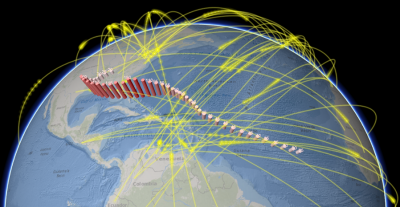
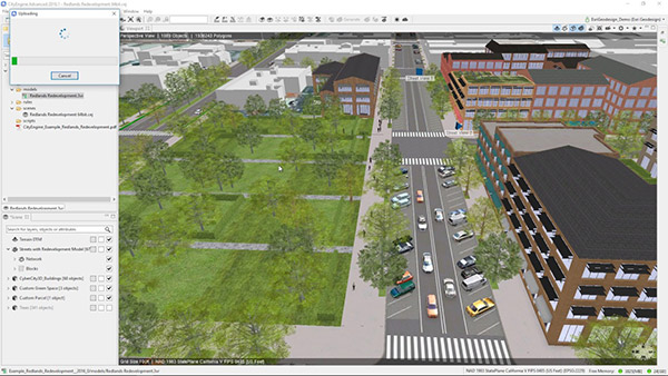
Insights gained from GIS technology take on a new perspective when visualised in 3D. The technology is being used in town planning, giving a ‘fly-through’ 3D view of proposed developments and their impact on the surrounding area, and in communications infrastructure, or calculating signal strength for new mobile phone or broadcast transmission towers. Add the dimension of time to the 3D data and you can build powerful 4D predictive models.
Using laser beams fired from a plane or drone, LiDAR (light detection and ranging) creates images that reveal complex 3D details of structures and elevation, down to intricate ground-level detail. LiDAR 3D imaging is being used to map resources such as commercial forests, facilitating sustainable and renewable operation by monitoring tree health, growth patterns, terrain and drainage aspects.
Forward-thinking industry leaders are already applying 3D, VR and AR to their core business GIS capabilities.
This includes VR mapping of natural and built environments to provide 360° access from anywhere in the world, 3D mapping to show locations, assets, terrain, utilities and energy resources and AR bringing data to life through immersive visualisation.
AR works like a data X-ray, presenting the hidden underlying infrastructure of objects or locations which can be used in subsurface modelling applications. For example, maintenance crews could simply point a smartphone or tablet at the ground to see the location of underground pipes and cables.
While traditional 2D mapping images often demanded high-level technical training to decipher, 3D, VR and AR views allow non-technical users to gain understanding of maps and data by transforming complicated raw data into recognisable visual representations.
The massive processing capacity required to apply 3D, VR and AR to maps was once a barrier to implementation. Today, ArcGIS Enterprise users can tap into the collective power of multi-CPU parallel processing to make short work of large datasets, creating seamless multidimensional imagery.
In later posts we’ll look at examples of how 3D, AR and VR technologies are being used in GIS in Australia, and the results they’re delivering over and above the traditional 2D data landscape.
To find out more about the latest trends in GIS, call a specialist consultant on 1800 870 750 or send us an email.