You are here News & Events Blogs Esri Australia blog Esri Australia blog AllEsri techData-driven decisionsDigital transformationDisruptive innovationGIS in Education Mapping the future: How location intelligence can accelerate Queensland's critical minerals mission Queensland’s critical minerals sector is entering a pivotal phase. The opportunity is not only to supply the minerals needed for modern infrastructure, defence, advanced manufacturing and the energy transition, it is to build a more coordinated, resilient and globally competitive critical minerals industry. Learn more Data-driven decisions From complex data to better decisions. How Goodman transformed its global portfolio with Managed Services for GIS Goodman, in collaboration with Esri Australia’s Managed Services for GIS, has redefined customer and investor experiences with an innovative online tool showcasing their Global Property Portfolio. Learn more In retail, location is an organisational problem Whether you are running a fast-food chain, fitness centres, or supermarkets, decisions about where things happen, stores, customers, inventory, deliveries, and incidents, shape performance every day. Yet, in most retail organisations, location intelligence is still primarily associated with one function: Site selection. Learn more The 2026-27 Federal Budget: Why delivery complexity is becoming a national challenge The Federal Budget outlines significant investment across housing, infrastructure, healthcare, energy, defence, and regional development. A spatial approach brings data together – giving delivery teams a connected view of how priorities play out on the ground. Learn more GIS in Education Building the next generation of sustainability problem solvers with GIS Ormiston College took out the 2025 SDG GIS Challenge award with their project, When Strangers Take Root: Invasive Species on Coochiemudlo Island. The project exemplified what students can achieve when STEM learning is grounded in real issues and supported by the right geospatial tools. Learn more Data-driven decisions A digital twin for Cross River Rail: Inside Brisbane's virtual railway Discover how a digital twin powered by GIS and BIM is transforming Cross River Rail in Brisbane, enabling immersive planning, better coordination, and smarter infrastructure delivery. Learn more Digital transformation Building the networks of the future: Why integration, not isolation, will define modern infrastructure Explore how networks of the future are transforming infrastructure through integration, geospatial intelligence, and more informed, real-time decision-making. Learn more Data-driven decisions What is spatial intelligence and why it matters for Australia's critical networks Spatial intelligence combines location‑based data and GIS to reveal patterns, risks and opportunities, enabling smarter, faster, more confident decision‑making. Learn more Digital transformation How digital twins, BIM-GIS integration, and geospatial AI are transforming Australian infrastructure Digital twins, GIS and AI are converging to help infrastructure owners plan, build and operate assets more safely, efficiently and resiliently across their lifecycle. Learn more Esri tech A digital plan of buildings and people guides Adelaide’s future growth South Australia’s cosmopolitan coastal capital and the fifth most populous city made a bold decision to grow rapidly but delicately. In its recently released comprehensive plan, Adelaide opted to double the population in its downtown core to 50,000 people by 2036, adding housing density near its green spaces and historic neighbourhoods. Learn more Esri tech What’s new across ArcGIS: Smarter workflows, better collaboration, deeper insight ArcGIS continues to evolve at pace, introducing capabilities that make it easier to work smarter, collaborate more effectively, and gain deeper insight from your spatial data. Across ArcGIS Online, Hub, Experience Builder, Dashboards, Instant Apps, Field Maps, Survey123, and Web Maps, Esri is delivering updates that enhance productivity, modernise workflows, and strengthen decision-making. Learn more Esri tech What's leaving in ArcGIS Enterprise 12.0? Learn which legacy apps are being retired and how moving to Experience Builder and Instant Apps can streamline your GIS workflows. Learn more Esri tech ArcGIS Desktop retirement: Next gen mapping now ArcGIS Desktop will retire on 1 March 2026, so now’s the time to move to ArcGIS Pro and modern licensing to keep your work connected and supported. Learn more Data-driven decisions How organisations can benefit from remote sensing and AI From precision agriculture and sustainable mining to smarter cities and faster disaster response, remote sensing and AI provide accurate, real-time insights that help organisations boost efficiency, enhance safety, and make informed, data-driven decisions. Learn more Data-driven decisions How remote sensing is transforming geospatial decision-making Remote sensing technologies have emerged as game-changers in the realm of geospatial decision-making. Through the capture and provision of satellite imagery, aerial data and drone data, then leveraging AI for deeper insights, organisations can now monitor, analyse, and respond to changes on the Earth’s surface with unprecedented precision and speed. Learn more Building confident GIS teams: Training for better ArcGIS outcomes Equip your team with practical ArcGIS skills to boost workflows and drive measurable results. Learn more Esri tech ArcGIS Enterprise 11.5: Prepare for version 12 Stay ahead by learning what's new in ArcGIS Enterprise 11.5 and prepare your upgrade with ease. Learn more Digital transformation Solving the water sector’s toughest challenges with spatial intelligence Australia’s water utilities are juggling ageing infrastructure and growing customer expectations. Discover how location intelligence is bringing people, systems, and data together to help them adapt and thrive. Build smarter, more resilient networks with the power of spatial thinking. Learn more Esri tech Building a smarter future with location-driven planning See how one council simplified system upgrades, improved planning efficiency, and reduced manual work. Learn more GIS in Education A journey from scholar to GIS consultant Follow the career path of 2024 Esri Young Scholar Award winner, Glenn Kong, from the University of Queensland to Esri Australia. Learn more Disruptive innovation APA’s game-changing GIS imagery workflows Leveraging imagery management services for greater operational efficiency. Learn more Digital transformation Lessons learned from the CrowdStrike outage The CrowdStrike global outage demonstrated the critical importance of robust response plans and security measures for all business systems, including GIS. Learn more Disruptive innovation Driving through roadblocks with GIS innovation Asset managers are using GIS technology to share data and collaborate on public works, leading to less disruption and reduced costs. Learn more Esri tech ArcGIS user types: What you need to know The June 2024 ArcGIS Online update introduced several new features and capabilities, most importantly, the new user type licencing model that streamlines administration workflows and expands current user roles. Learn more Digital transformation Overcoming Australia’s geospatial skills deficit: Charting the future of GIS Australia is grappling with an emerging skills gap in geospatial technology that is costing businesses an estimated $3.1 billion annually and could reach 1,400 professionals. Learn more Data-driven decisions Tracking sustainability with smart maps Committed to reducing the impact of its mining activities in Senegal, France's Eramet leverages geospatial technology to make decisions across its mineral sand's operation. Learn more Digital transformation Cloud transformation: Powering tomorrow’s success As GIS systems continues to grow in complexity and importance, how can organisations keep up? The answer may lie in the cloud. Learn more GIS in Education Maintaining the balance of Heron Island’s diverse ecosystem Heron Island’s transparent waters and breathtaking reefs are home to several marine creatures — from the lemon, black tip and epaulette sharks to the eagle rays and guitar sharks — but most importantly, it’s a significant turtle nesting area. Learn more GIS in Education The way forward: Single sign-on for academia SSO makes it easier to track ArcGIS Online usage across campus to be able to connect information between ArcGIS Online and authoritative campus systems. Learn more Esri tech Digitising exploration practices towards sustainability Read how DigiSHEC digitally transformed OZ Minerals' (now BHP) exploration project lifecycle management, winning three awards in 2023. Learn more
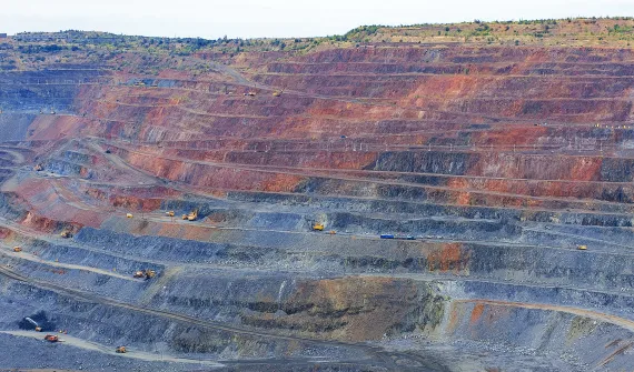
Mapping the future: How location intelligence can accelerate Queensland's critical minerals mission Queensland’s critical minerals sector is entering a pivotal phase. The opportunity is not only to supply the minerals needed for modern infrastructure, defence, advanced manufacturing and the energy transition, it is to build a more coordinated, resilient and globally competitive critical minerals industry. Learn more
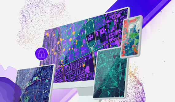
Data-driven decisions From complex data to better decisions. How Goodman transformed its global portfolio with Managed Services for GIS Goodman, in collaboration with Esri Australia’s Managed Services for GIS, has redefined customer and investor experiences with an innovative online tool showcasing their Global Property Portfolio. Learn more
In retail, location is an organisational problem Whether you are running a fast-food chain, fitness centres, or supermarkets, decisions about where things happen, stores, customers, inventory, deliveries, and incidents, shape performance every day. Yet, in most retail organisations, location intelligence is still primarily associated with one function: Site selection. Learn more
The 2026-27 Federal Budget: Why delivery complexity is becoming a national challenge The Federal Budget outlines significant investment across housing, infrastructure, healthcare, energy, defence, and regional development. A spatial approach brings data together – giving delivery teams a connected view of how priorities play out on the ground. Learn more
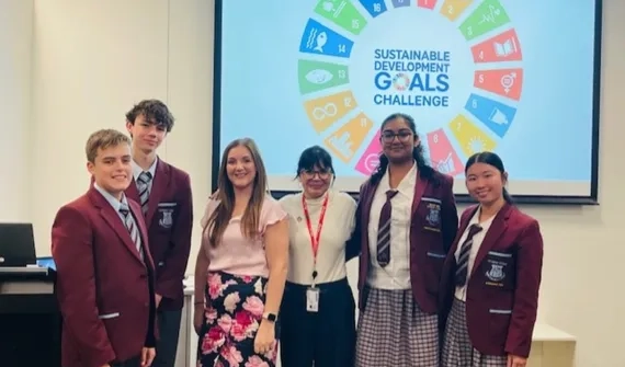
GIS in Education Building the next generation of sustainability problem solvers with GIS Ormiston College took out the 2025 SDG GIS Challenge award with their project, When Strangers Take Root: Invasive Species on Coochiemudlo Island. The project exemplified what students can achieve when STEM learning is grounded in real issues and supported by the right geospatial tools. Learn more
Data-driven decisions A digital twin for Cross River Rail: Inside Brisbane's virtual railway Discover how a digital twin powered by GIS and BIM is transforming Cross River Rail in Brisbane, enabling immersive planning, better coordination, and smarter infrastructure delivery. Learn more
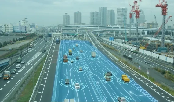
Digital transformation Building the networks of the future: Why integration, not isolation, will define modern infrastructure Explore how networks of the future are transforming infrastructure through integration, geospatial intelligence, and more informed, real-time decision-making. Learn more
Data-driven decisions What is spatial intelligence and why it matters for Australia's critical networks Spatial intelligence combines location‑based data and GIS to reveal patterns, risks and opportunities, enabling smarter, faster, more confident decision‑making. Learn more
Digital transformation How digital twins, BIM-GIS integration, and geospatial AI are transforming Australian infrastructure Digital twins, GIS and AI are converging to help infrastructure owners plan, build and operate assets more safely, efficiently and resiliently across their lifecycle. Learn more
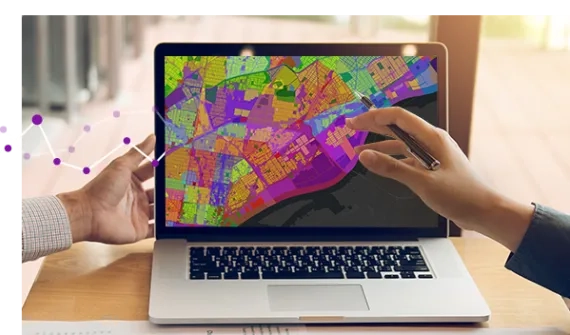
Esri tech A digital plan of buildings and people guides Adelaide’s future growth South Australia’s cosmopolitan coastal capital and the fifth most populous city made a bold decision to grow rapidly but delicately. In its recently released comprehensive plan, Adelaide opted to double the population in its downtown core to 50,000 people by 2036, adding housing density near its green spaces and historic neighbourhoods. Learn more
Esri tech What’s new across ArcGIS: Smarter workflows, better collaboration, deeper insight ArcGIS continues to evolve at pace, introducing capabilities that make it easier to work smarter, collaborate more effectively, and gain deeper insight from your spatial data. Across ArcGIS Online, Hub, Experience Builder, Dashboards, Instant Apps, Field Maps, Survey123, and Web Maps, Esri is delivering updates that enhance productivity, modernise workflows, and strengthen decision-making. Learn more
Esri tech What's leaving in ArcGIS Enterprise 12.0? Learn which legacy apps are being retired and how moving to Experience Builder and Instant Apps can streamline your GIS workflows. Learn more
Esri tech ArcGIS Desktop retirement: Next gen mapping now ArcGIS Desktop will retire on 1 March 2026, so now’s the time to move to ArcGIS Pro and modern licensing to keep your work connected and supported. Learn more
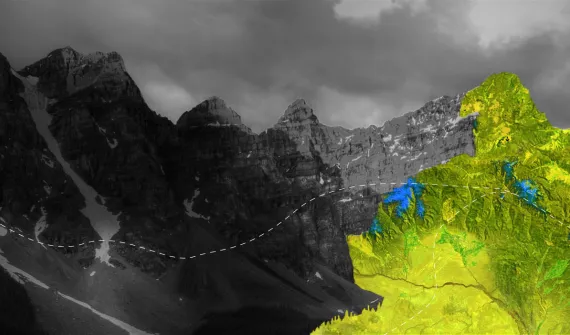
Data-driven decisions How organisations can benefit from remote sensing and AI From precision agriculture and sustainable mining to smarter cities and faster disaster response, remote sensing and AI provide accurate, real-time insights that help organisations boost efficiency, enhance safety, and make informed, data-driven decisions. Learn more
Data-driven decisions How remote sensing is transforming geospatial decision-making Remote sensing technologies have emerged as game-changers in the realm of geospatial decision-making. Through the capture and provision of satellite imagery, aerial data and drone data, then leveraging AI for deeper insights, organisations can now monitor, analyse, and respond to changes on the Earth’s surface with unprecedented precision and speed. Learn more
Building confident GIS teams: Training for better ArcGIS outcomes Equip your team with practical ArcGIS skills to boost workflows and drive measurable results. Learn more
Esri tech ArcGIS Enterprise 11.5: Prepare for version 12 Stay ahead by learning what's new in ArcGIS Enterprise 11.5 and prepare your upgrade with ease. Learn more
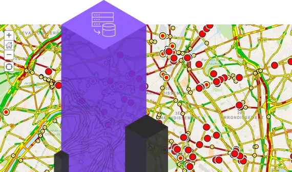
Digital transformation Solving the water sector’s toughest challenges with spatial intelligence Australia’s water utilities are juggling ageing infrastructure and growing customer expectations. Discover how location intelligence is bringing people, systems, and data together to help them adapt and thrive. Build smarter, more resilient networks with the power of spatial thinking. Learn more
Esri tech Building a smarter future with location-driven planning See how one council simplified system upgrades, improved planning efficiency, and reduced manual work. Learn more
GIS in Education A journey from scholar to GIS consultant Follow the career path of 2024 Esri Young Scholar Award winner, Glenn Kong, from the University of Queensland to Esri Australia. Learn more
Disruptive innovation APA’s game-changing GIS imagery workflows Leveraging imagery management services for greater operational efficiency. Learn more
Digital transformation Lessons learned from the CrowdStrike outage The CrowdStrike global outage demonstrated the critical importance of robust response plans and security measures for all business systems, including GIS. Learn more
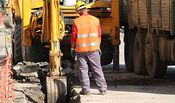
Disruptive innovation Driving through roadblocks with GIS innovation Asset managers are using GIS technology to share data and collaborate on public works, leading to less disruption and reduced costs. Learn more
Esri tech ArcGIS user types: What you need to know The June 2024 ArcGIS Online update introduced several new features and capabilities, most importantly, the new user type licencing model that streamlines administration workflows and expands current user roles. Learn more
Digital transformation Overcoming Australia’s geospatial skills deficit: Charting the future of GIS Australia is grappling with an emerging skills gap in geospatial technology that is costing businesses an estimated $3.1 billion annually and could reach 1,400 professionals. Learn more
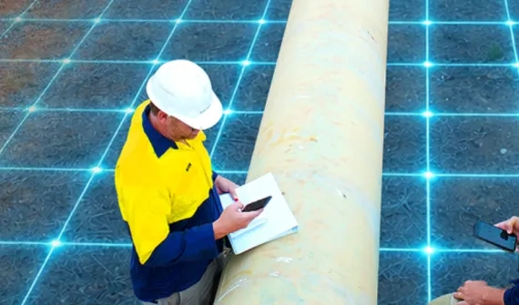
Data-driven decisions Tracking sustainability with smart maps Committed to reducing the impact of its mining activities in Senegal, France's Eramet leverages geospatial technology to make decisions across its mineral sand's operation. Learn more
Digital transformation Cloud transformation: Powering tomorrow’s success As GIS systems continues to grow in complexity and importance, how can organisations keep up? The answer may lie in the cloud. Learn more
GIS in Education Maintaining the balance of Heron Island’s diverse ecosystem Heron Island’s transparent waters and breathtaking reefs are home to several marine creatures — from the lemon, black tip and epaulette sharks to the eagle rays and guitar sharks — but most importantly, it’s a significant turtle nesting area. Learn more
GIS in Education The way forward: Single sign-on for academia SSO makes it easier to track ArcGIS Online usage across campus to be able to connect information between ArcGIS Online and authoritative campus systems. Learn more
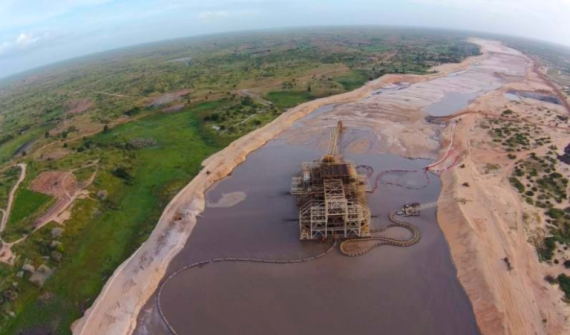
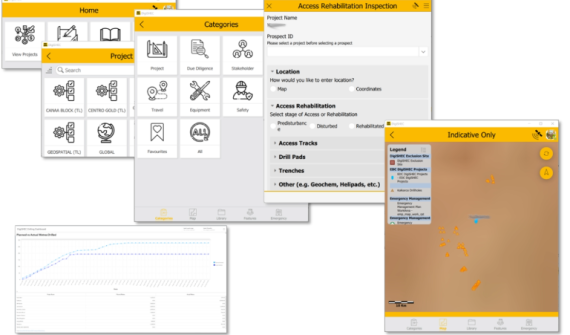
Esri tech Digitising exploration practices towards sustainability Read how DigiSHEC digitally transformed OZ Minerals' (now BHP) exploration project lifecycle management, winning three awards in 2023. Learn more