You are here News & Events Blogs Esri Australia blog Esri Australia blog AllEsri techData-driven decisionsDigital transformationDisruptive innovationGIS in Education Digital transformation Field operations just got smarter Introducing the revolutionary smart technology propelling small-cap miners to new heights and enabling a digitally transformation and optimisation of operations. Learn more Data-driven decisions How mapping technology can help catch killers Mike King outlines how investigators can use Geographic Information System (GIS) technology to combine location-based data, public information and suspect profiling data, to help catch killers. Learn more Data-driven decisions Combatting drug-related deaths with GIS US authorities are using location intelligence to report drug activity, educate the community, promote treatment options and understand the effectiveness of response activities. Learn more Data-driven decisions How mapping technology is helping solve crimes Emergency services expert Mike King shares how one US law enforcement agency used real-time GIS applications to manage the search of a large-scale crime scene in a missing persons case. Learn more Data-driven decisions Drones in agriculture - how to get started Getting the best results from drones on a farm depends on the desired outcomes and the type of sensors mounted on the drone. Before starting, it pays to find answers to the most common questions about using drones and satellite imagery in agriculture. Learn more Digital transformation Top 5 mining geospatial tech trends A new wave of automation is improving worker safety, raising productivity, and reducing operational costs in Australia's mining operations. See how advanced geospatial technology is helping organisations improve efficiencies at all levels organisation-wide. Learn more
Digital transformation Field operations just got smarter Introducing the revolutionary smart technology propelling small-cap miners to new heights and enabling a digitally transformation and optimisation of operations. Learn more
Data-driven decisions How mapping technology can help catch killers Mike King outlines how investigators can use Geographic Information System (GIS) technology to combine location-based data, public information and suspect profiling data, to help catch killers. Learn more
Data-driven decisions Combatting drug-related deaths with GIS US authorities are using location intelligence to report drug activity, educate the community, promote treatment options and understand the effectiveness of response activities. Learn more
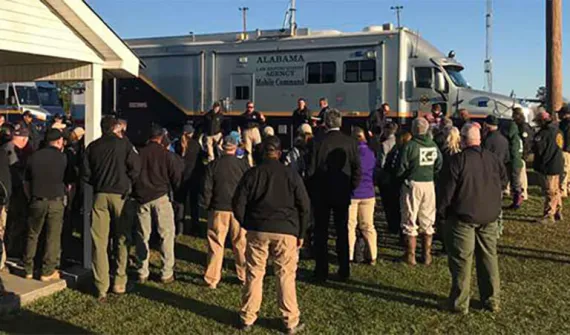
Data-driven decisions How mapping technology is helping solve crimes Emergency services expert Mike King shares how one US law enforcement agency used real-time GIS applications to manage the search of a large-scale crime scene in a missing persons case. Learn more
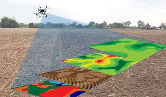
Data-driven decisions Drones in agriculture - how to get started Getting the best results from drones on a farm depends on the desired outcomes and the type of sensors mounted on the drone. Before starting, it pays to find answers to the most common questions about using drones and satellite imagery in agriculture. Learn more
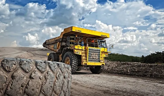
Digital transformation Top 5 mining geospatial tech trends A new wave of automation is improving worker safety, raising productivity, and reducing operational costs in Australia's mining operations. See how advanced geospatial technology is helping organisations improve efficiencies at all levels organisation-wide. Learn more