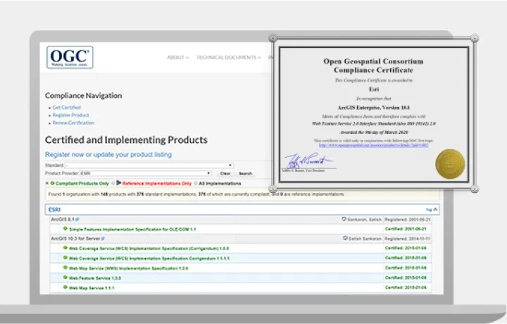
Esri has a long-standing commitment to open standards and interoperability, and actively contributes to international standards development processes, with a history of open-sourcing its format specifications.

Geospatial technology
ArcGIS supports reading and writing standard and data file types using industry and international standard data formats, and through OGC web services.

Security and privacy
Esri complies with international GIS standards as well as industry best practices for IT security and privacy.

Accessibility
Esri's goal is to design and implement accessible GIS and give people access regardless of their abilities.
To find out how our open vision can help you achieve your goals, contact us or call 1800 870 750.
Supported open geospatial standards
ArcGIS is the leading system in its support for OGC and ISO standards. Search for all OGC standards supported by Esri products and different versions of our software.