What is Big Data?
Big Data is defined by volume, velocity and variety — large amounts of data coming in quickly in a number of formats.
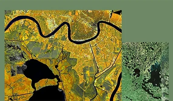
Geospatial data is a crucial component of big data, adding context that allows for better, multidimensional insights that facilitate smarter decisions, improved business operations and innovation to deliver a strong competitive advantage.
Tap into your Big Data
ArcGIS allows you to bring together layers of data from various sources — including existing business intelligence (BI) tools — and analyse it to deliver insights.

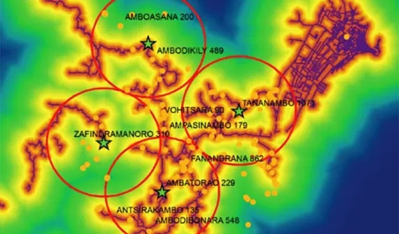
FIND HOTSPOTS
Sift through massive data sets to identify clusters of recurring incidences

ANALYSE PATTERNS
Reduce and summarise your data in ways that let you explore patterns

Aggregate data
Aggregate millions of data records into a digestible form for easy understanding

VISUALISE RESULTS
Visualise your data and use spatio-temporal analysis to see change over time
How can GIS and Big Data solve problems?
Every organisation grapples with the challenge of how to best refine raw data into a meaningful asset — one with measurable business value.
Location being a fundamental aspect of data, makes spatial analysis a valuable tool.
Using location intelligence, organisations can derive insights, uncover hidden patterns and support an informed decision-making process.