
Forward-thinking local governments prioritise strategies, policies, and workflows, enabling them to make data-driven decisions, maintain awareness of community activities, and stay better connected.
Call 1800 870 750 or email a specialist to find out more about GIS in local government.
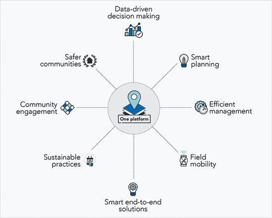
One platform for local government
The Esri Geographic Information System (GIS) platform provides local governments with the tools to develop smarter cities and deliver better services to the community.
As a collaborative platform, it enables government agencies to share spatial data to break through traditional data silos and build a more transparent organisation.
The Esri platform can be scaled to provide the tools for enterprise-wide data-driven decision making that improves management efficiency. Its mobility capabilities allow staff to access data any time, on any device, from anywhere to ensure enterprise data is always accurate and up-to-date.
With empowered collaboration and timely information sharing, your city can deliver smarter end-to-end solutions that create a more inclusive, sustainable and prosperous place to live.