You are here News & Events Blogs Esri Australia blog Esri Australia blog AllEsri techData-driven decisionsDigital transformationDisruptive innovationGIS in Education Data-driven decisions Virtual Reality for smart cities and urban planning Virtual Reality (VR) is transforming the way citizens and city administrators interact with new developments, through the unique perspective of 3D models that show what the eye cannot see. Learn more Data-driven decisions Geoscience Australia releases MH370 search data Story Map The search for Malaysia Airlines flight MH370 mapped more than 700,000 square kilometres of seafloor. Data from phase one of the search is now available to the public through an interactive Story Map. Learn more Disruptive innovation Enterprise GIS data meets Augmented Reality Augmented Reality (AR) adds even more detailed visualisation to maps and data. Find out how to bring your Enterprise GIS data into AR apps to supplement real-world views. Learn more
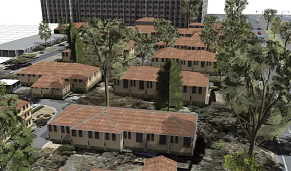
Data-driven decisions Virtual Reality for smart cities and urban planning Virtual Reality (VR) is transforming the way citizens and city administrators interact with new developments, through the unique perspective of 3D models that show what the eye cannot see. Learn more
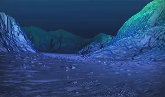
Data-driven decisions Geoscience Australia releases MH370 search data Story Map The search for Malaysia Airlines flight MH370 mapped more than 700,000 square kilometres of seafloor. Data from phase one of the search is now available to the public through an interactive Story Map. Learn more
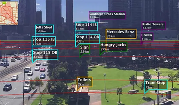
Disruptive innovation Enterprise GIS data meets Augmented Reality Augmented Reality (AR) adds even more detailed visualisation to maps and data. Find out how to bring your Enterprise GIS data into AR apps to supplement real-world views. Learn more