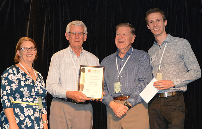
Winner of the Spatial Enablement Award at the 2017 Asia Pacific Spatial Excellence Awards South Australia, the Friends of Sturt Gorge web map is transforming the way the volunteer group collects, analyses and shares data to help create a better environmental future.
The Friends of Sturt Gorge (FOSG) is a volunteer group – one of many ‘Friends of Parks’ (FOP) groups that care for parks around South Australia – that work to remove invasive plants, revegetate native plants, maintain trails, and generally maintain and promote the Sturt Gorge in Southern Adelaide.

During his volunteer work removing invasive plants and keeping records using handheld GPS, cameras, pen-and-paper and Microsoft Word documents, David Phillips realised that a computer-based mapping system prioritising areas to be cleared would be a huge benefit.
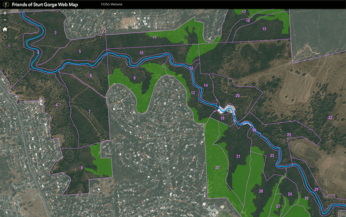
Built in ArcGIS Online using Web App Builder, the FOSG web map is a cutting-edge conservation mapping and decision-making tool that enables the group to collect conservation data spatially using a mobile device. This data can be viewed and edited in a web browser, alongside other useful layers and imagery. The web map took around six months from project concept to operational status with the group’s field mapping expert Rick Coyte collecting data in the field using an iPad and iPhone.
Rick has spent years mapping endangered plants in the Sturt Gorge, building up a wealth of useful information.
The web map has provided a solution that can capture information, and allow it to be accessed by anyone, so that it can contribute to the bigger picture of environmental management in South Australia – David Phillips, FOSG volunteer.
To kick off the project, David started with an ArcGIS personal use licence to build a prototype. Using South Australian government open data websites, he obtained spatial layers of trails, vehicle tracks, park boundaries, elevation contours, drainage lines, park signage and gates.
Some park signage data wasn’t available, so David photographed the signs, georeferenced the photographs and digitised the trails manually. He optimised the data attributes and geometry, published the data as web feature layers, and symbolised them in a web map within a web app interface.
This volunteer-led project has received strong feedback on its efficiency from the FOSG’s field mapping expert, Rick Coyte.
Web map users can pan and zoom around aerial imagery of the gorge, with the capacity to turn on and off different map layers depending on what’s relevant to their location and activity. The map can show the location of:
-
Working bees
-
Cleared areas
-
‘To do’ jobs
-
Plants of conservation significance
-
Animal sightings

The Department of Environment, Water and Natural Resources (DEWNR) were very supportive in getting the project up and running, and provided advice on the development of the map. They saw the potential for the web map to solve a long-standing problem: the mapping data they receive from conservation organisations is often submitted in inconsistent and difficult-to-use formats.
David acknowledged that a big challenge for conservationists is to gather the knowledge of local volunteers and experts, and to put that knowledge in a form that is useable by governments, researchers, and other organisations.
By deploying the web map to multiple conservation organisations, DEWNR could provide a standardised, best-practice data collection method. Data collected from these disparate organisations could be fed into the Biological Databases of South Australia (BDBSA).
The web map allows GPS and attribute data for rare and endangered plants and animals to be submitted to the Biological Databases of South Australia (BDBSA). This means that the vast body of knowledge within the FOSG can be accessed by anyone.
Volunteer Coordinator at DEWNR, Andrew Raymond said the tool will enable a move from paper-based records to geospatial record keeping. “It will also make the data more accessible for other members, easier to interrogate, and to export and transfer to the Biological Databases of South Australia (BDBSA) where it can be widely viewed, better utilised and stored in perpetuity,” he said.
Information can be used by DEWNR staff when reviewing park and vegetation management and when planning or evaluating prescribed burning. The data can also help geospatially plan priority works such as overlaying weed distribution layers with rare plants.
The Esri Nonprofit Organisation Program was a great enabler for us getting the project up and running on a small budget – David Phillips, FOSG volunteer.
The outcome of this initiative is a powerful, interactive web map that puts the FOSG at the forefront of conservation mapping. It shows the importance and value of spatial record keeping, and the high uptake, acceptance and implementation even within a group of users who previously knew nothing about GIS technology.

