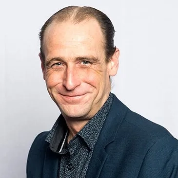
ANZLIC Chair and Land Use Victoria’s Chief Executive Officer, Melissa Harris, answers questions about how the Department of Environment, Land, Water and Planning (DELWP) is harnessing the global digital revolution to develop smarter communities and places through location-based intelligence and innovation.
Here's her recent discussion with GIS Directions podcast host, Wayne Lee-Archer.
Wayne Lee-Archer: Hi Melissa, thanks for joining us. DELWP has a reputation in the spatial sector for leading the way in smart government initiatives. Can you tell us about some of the transformative projects that you've been working on recently?
Melissa Harris: At Land Use Victoria, we could foresee the benefits of harnessing digital innovation early on so that spurred on our earlier smart government initiatives. As we approach a future of rapid urbanisation and population growth, we knew we needed to think long-term to create sustainable, resilient places and spaces that the communities we serve can thrive in.
I've always had a passion for doing things better and faster, and I'm drawn to projects that help improve efficiency through smarter digital processes.
An early example of that was in the early 2000s with the development of the SPEAR system in Victoria. It’s incredible to see how SPEAR has evolved to support the entire subdivision approval process in Victoria and has been pivotal in that industry’s transformation.
This can also be said about the work Victoria has led in the electronic conveyancing space. It's a journey that has achieved an almost complete transformation as we're now seeing 97% electronic lodgement for all land transactions in Victoria, and a staggering 94.5% are fully processed through electronic examination – that's world-leading capability by any measure.
Another example is the digital cadastre modernisation program, which is one of those once-in-a-generation projects. It's extremely complex and involves digitising all 3.3 million property parcels in Victoria. Property parcels are growing at a rate of about 80,000 parcels a year so we're working while it's still growing and changing – almost on a daily basis – and we’ve just hit a major milestone of two million land parcels being digitised.
This involves converting PDF plans of subdivision, some dating back to the beginning of Victoria to a XML format. It's a four-stage process with different partners, which only a few years ago would have been unachievable and unaffordable.
Now, with cloud computing and an enhanced digital capability, we have the ability to deliver this highly accurate digital map base for the state, which is going to be the foundation for so much land and property-based innovation in Victoria in years to come.
Then we have Vicmap, which recently celebrated its 45th anniversary – it is a treasure to Victoria. It's come a long way since the early days, and we're evolving it to be an interoperable, standards-based, data-driven, 3D and 4D data set, to ensure it meets the needs of our community into the future.
This year, we’ve also launched two exciting digital innovation programs that will radically change how we plan and model cities and communities of the future: Digital Twin Victoria and eComply.
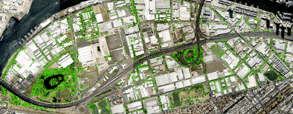
Our vision for Digital Twin Victoria is to recreate the State online so that government, industry and the community can collaborate through shared open data, technology and algorithms, to enhance real world outcomes. The program brings together rich 3D and 4D spatial data, artificial intelligence and sensor data from across the State to visualise and model places virtually, before investments hit the ground.
eComply is a pilot project – part of Digital Twin Victoria – to explore how to make the historically complex task of housing approvals faster, easier and cheaper. It uses digital twin technology, spatial intelligence and machine learning to assess digital building designs’ compliance with the Small Lot Housing Code. It’s already demonstrating the value that digital twin technology can deliver to unlock regulatory red tape by knocking up to seven weeks off the process.
Wayne: With so many more end-users out there – and we all know that end users have an expectation of extremely high-resolution data – do you think we can keep up with the expectations of the public versus what is achievable with remotely sensed data?
Melissa: It's definitely a challenge. Two years ago, we realised that our “business as usual” was not going to service the needs of our customers in the future, and we needed to future-proof our services. There’s rivers of innovation, data and opportunity heading our way. We need to be good at looking forward, seizing opportunities, assessing them and incorporating them into what we do, so we are future-ready and continue to evolve to meet the needs of our community. These needs will demand high accuracy, high resolution data, and an increasing number of data sets and applications.
We frequently hear that designers, for example, want digital data sets with two or three-centimetre accuracy, and research projects are showing incredible productivity and efficiency gains using artificial intelligence – all of that relies on good quality data input. But of course, we need to source and fund these services in a sustainable way. Through Digital Twin Victoria, we will be enabling much greater sharing of data and collaboration around data which we see as the fuel of our digital future.
Wayne: There’s a lot of talk out there about digital twins and smart city tools. A few years ago, it seemed like a pipe dream or a community engagement tool, but now we're seeing digital twins being used in some really incredible ways for scenario planning analysis. I'm interested to hear your thoughts about the stickiness of digital twins. Do you think they'll be superseded by something new or are they here to stay?
Melissa: I know how hard it is to make important decisions about location with historical toolsets – which usually entail white boards, rulers and paper. There’s a lot of guesswork that goes into planning our future, despite the incredible care and effort people put into it.
That's the magic of emerging technology, particularly in the digital twin space. We've got so much interest and support from stakeholders about our Digital Twin Victoria program, particularly the rich 3D visualisation components and the potential for automation.
Digital twins are also very valuable in supporting community engagement, but over the coming years they're going to be much more than that. They're the ultimate connector of different data sets – supporting rich data sharing above ground, below ground, 3D and 4D, sensors – all in a single environment.
That combined, powerful capability is what governments need. I think we're shifting the dial and hoping for a major transformation in the use and adoption of 3D digital twin capability in Victoria and also across Australia, which is why it's featured so prominently in the ANZLIC strategy – and why our Digital Twin Victoria program has just secured a record $35.2 million investment!


Wayne: Have you got any tips on where to start when creating digital twins and digital cities?
Melissa: I think it's really incumbent on government to take a leadership role and help industry groups to work together, to set the agenda and to stimulate the discussion around things that are really important and are worth the effort. This is what we’ve done in Victoria through Digital Twin Victoria, with New South Wales and Queensland also harnessing the digital revolution for the built and natural environment to build twins.
In addition, ANZLIC plays a pivotal role in enabling connections across the digital ecosystem with supporting entities and peak industry groups. In Victoria and across Australia, we have foundation data that's well-managed and is already being distributed through open data channels. I think you’ll continue to see more capability, which will make it easier for local councils and other organisations to grow their skills and expertise in this area.
Increasingly, we're trying to break down barriers. We’re trying to build ubiquitous tools that really democratise the geospatial capability and deliver high impact, broad scale benefits to just about every section of the community.
Wayne: If you are a GIS user or a manager in an organisation, and you wanted to get buy-in from someone at the executive level, how would you start that conversation about creating a digital twin or even just collecting the data?
Melissa: This is one of the big opportunities and obligations for geospatial experts everywhere – get out of the IT department or the back room and step up to the executive table. This opportunity isn't as much about technology, as it is about the future of business. Geospatial professionals have an incredibly important role to play in this future – but they need the tools to do the job well.
For local governments or people investing in technology, access to data and quality tools will only get cheaper and easier but, they need to be able to build the case for investment. I think one of the things about digital twins is they're just so visually rich and easy to use that you don't have to have deep technical skills to appreciate their immense value.
If I look at the capability we have now compared to only 12 months and two years ago, it's exponentially increasing. So, I think everyone will be on the journey one way or the other – and sooner, rather than later!
Connect with Melissa Harris on LinkedIn
Find out more about Digital Twin Victoria at Land.Vic
Keep up to date with ANZLIC’s news on LinkedIn
See DELWP's 3D data in action in this immersive fly-through of Bendigo from Esri's 2021 UC
To learn more about how geospatial technology can drive smarter government practices, call 1800 870 750 or submit an enquiry.


