Over a thousand delegates gathered across three cities – Melbourne, Sydney and Brisbane – plus international guest speakers, local GIS experts and users, all exploring the latest in spatial technology and sharing user stories.
After a busy morning networking in the Tech Hub, everyone took their seats for the main event, our plenary session showcasing new technology, and international and local user stories.
Esri Australia and Boustead Geospatial Technology Group Managing Director Brett Bundock kicked off proceedings. Brett took the opportunity to share news of the group’s $15-million commitment to build new programs driven by innovation through GIS. This is the biggest single investment of any kind made by the group in its 40-year history.
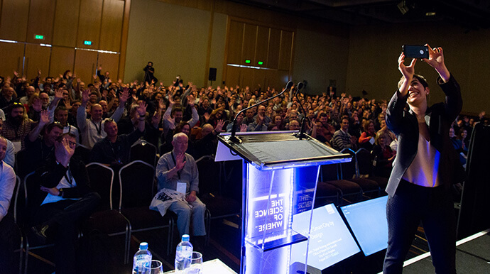
Sari Ladin, Analytics and Digital Strategy Lead at the City of Los Angeles, joined us for her first international speaking engagement. Sari told the story of the GeoHub, LA’s open data portal that makes data accessible, interoperable and actionable, creating a smarter Los Angeles.
18 months since the launch of GeoHub, Sari shared how the city’s approach to decision making had changed, a more data driven approach was seen in applications like Street Wize, the app that coordinates construction projects and minimise disruption, to Clean Streets LA, a Story Map that lets citizens report real-time updates at street level, resulting in more efficient clean-up planning and tidier neighbourhoods. We were especially grateful that Sari, who’d been married just six days before Ozri, was spending what should have been her honeymoon with the Australian Esri User community. (Sari’s social media ‘honeymoon’ selfies from the Ozri stage were a highlight of the day!)
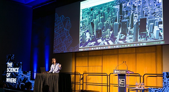
Is there anyone in the world who knows more about 3D GIS than Esri’s Gert van Maren? (Let me know if you’re out there!) Gert conveyed his passion and knowledge for 3D GIS through presentations that showed the scope of applications like City Engine and ArcGIS 3D – useful for tasks such as viewing potential developments in their surroundings, seeing potential shadow cast of proposed buildings and even anticipating the scope of views from windows at different levels in a building. Gert showed organisations how easy it is to get 3D-ready: if your data has a z axis, you’re ready to go 3D.
Gert van Maren is a living example of how a geospatial career can take you anywhere in the world: he was born in the Netherlands, worked in the United States and Switzerland and now lives in New Zealand, where he can pursue his passion for outdoor adventure sports.
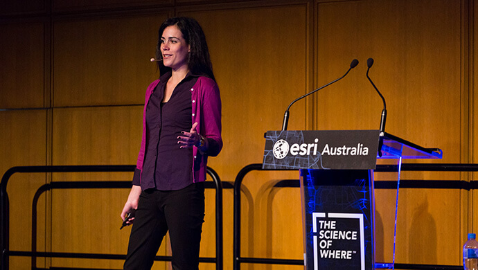
Also from Esri, Product Engineer Flora Vale shared how Esri’s new branding, The Science of Where, has always been at the heart of what we do – from building smarter cities, preparing for natural disasters, optimising retail location strategies, mitigating crime, utility planning, asset management and even environmental protection and wildlife conservation.
At a time when the world is undergoing a massive digital transformation, it’s spatial thinkers like you who are pushing the limits of GIS to transform how we understand and communicate in our new digital world. Flora shared her excitement about GeoAnalytics server, which uses the power of distributed computing to process large volumes of data in minutes or hours instead of weeks or days. For an analyst, the enhancements at ArcGIS 10.5 meant she has access to large quantities of data that can be used for more complex and in-depth analysis in both space and time.
With the Australian cyclone season fast approaching, it was timely to see Matthew Piper and Thorsten Hohenstrater’s presentation about how Ergon Energy were able to quickly prepare, respond and coordinate the aftermath of Tropical Cyclone Debbie earlier this year. With 22 staff in the field collecting data, 876 forms returned and 1,807 photos taken, Ergon Energy could effectively prioritise recovery and restoration efforts using a series of maps and apps including their major event dashboard. With ArcGIS Online an integral part of their plan, it was no surprise that Matt and Thorsten used an Esri Story Map to show their presentation – nice touch!
We were privileged to hear from Global Vice President SAP Database and Data Management, Matt Zenus, who shared his insights about data: “the new digital currency”. Matt reinforced the point that breaking down silos to combine and process data delivers smarter, geo-driven, real-time insights. The partnership between Esri and SAP is working towards connecting GIS and Enterprise systems to transform data into insight.
Simon Jackson and Selin Ozdemir proved in their ‘master vs. apprentice’ shootout that ArcGIS Pro is packed with features for all types of users. It was neck-and-neck for a while there, until Simon cracked his geospatial dad joke: “What map element plays in a band? The Symbol” *crash*. I think I heard as many groans as I did laughs! Jokes aside, it was great to see the Esri Australia team sharing their knowledge from different perspectives, showing the versatility of the ArcGIS platform.
The afternoon technical sessions were all enthusiastically received, with great turnouts across all streams: Enterprise Science, Analytic Science and Design Science. There were 18 sessions (including nine user stories) in total during the afternoon, all of which are now available to view online. You’ll find plenty of handy tips from users and experts – be sure to catch up on the topics that interest you most so you can take notes for future reference.
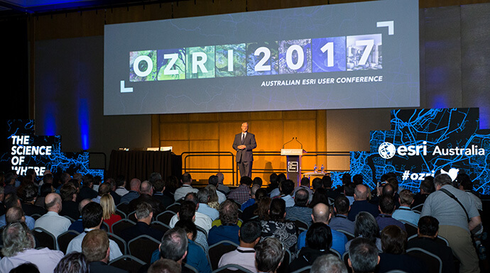
Thanks to all of you who attended and made Ozri 2017 such a great day – it was brilliant to see so many women presenters and delegates, too. I trust that you gained valuable insights from the day, made a few new geospatial contacts and learned how other organisations are leveraging Esri technology to get the most out of spatial data.
I’m already looking forward to next year’s event – see you there!
If you’d like to be part of Ozri 2018 as a sponsor, exhibitor, presenter or simply to attend as a delegate, send us an email for more information.

