Exploring the emerging trends transforming the industry

In part one, Mary, Wayne, and Esri Natural Resources Director, Dal Hunter discuss the emerging trends fundamentally changing industries such as mining, oil and gas, agriculture and forestry – and their digital journeys. From sustainable business operations to advanced analytics, find out the tech you need to edge closer towards a smarter, better future.

“Geospatial excellence is about establishing a portal inside of your organisation so that information is captured – and people are making decisions with it... and collaboration is leveraged.”

Dal Hunter

  SUBSCRIBE:

Apple podcast badgeSpotify podcast badgePodbean badgeGoogle podcast badge

transcript iconVIEW TRANSCRIPT

Never miss an episode of GIS Directions - subscribe now.

Subscribe for more short, sharp and immediately usable tips and insights. 

Got a burning question or a hot topic?

Connect with the hosts

Mary Murphy - GIS Directions 2
Mary Murphy
Consultant
Esri Australia, Perth
Experienced GIS and remote sensing specialist
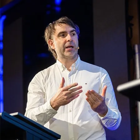
Wayne Lee Archer - GIS Directions 1
Wayne Lee Archer
Sector Principal Consultant
Esri Australia, Brisbane
One of Australia's leading curators of spatial information and modern technology.
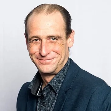
Dal Hunter.jpg
Dal Hunter
Director, Global Business Development, Natural Resources
Esri, San Antonio, Texas
Dal is the sector director for natural resources at Esri, responsible for petroleum, pipeline, mining, agriculture, forestry and renewable energies.

Stay in the know

Be notified when new episodes go live and submit your topic ideas below.

  • Click to view the episode transcript

    Disclaimer: This podcast is brought to you by the team at Boustead Geospatial Productions, in conjunction with our affiliates – Esri Australia, Esri Singapore,
    Esri Malaysia, and Esri Indonesia.

    To get your hands on more short, sharp and immediately usable resources, head to the GIS Directions Podcast website, and check out the show notes.

    Dal: Being able to know where people are and where everything is during an incident, things are happening in real-time. And being able to use that information to make the decisions, make sure that people are safe, really relevant today and applicable to all the natural resources industries.

    Wayne: Welcome to GIS Directions. I'm Wayne Lee-Archer.

    Mary: And I'm Mary Murphy.

    Wayne: And today we are lucky enough to be joined by Dal Hunter. He is the Sector Director for Natural Resources Esri Inc. Dal has been in the industry for over 25 years with responsibilities across the petroleum, pipeline, mining, agriculture, forestry, and renewable energies industries.

    He manages the direction and focus of Esri Technologies to help companies leverage location-based information to improve their businesses.
    Welcome along today, Dal.

    Dal: Well, thank you Wayne. Thanks for the great introduction and thanks for having me. As you mentioned, I spent my whole career in the natural resources industry. My main focus has been on spatial, so I'm really looking forward to our conversation.

    Mary: Thanks for joining us Dal, and we’re looking forward to it too Dal. And I should mention at this point that because we have so much to discuss today about all things ArcGIS and the world of natural resources, that we’ve decided to split this discussion into two episodes – so this will be the first of two episodes with Dal – so make sure you subscribe to the podcast, so you don’t miss the second part of this conversation.

    Now with that said, let’s get into it…

    So, Wayne, you wanna kick us off with some ideas around mapping common ground?

    Wayne: Well, this is exactly one of the things that I'm very interested in, in this space. I know the, the natural resources space is one of our, our busiest sectors here in Australia.

    So, Dal, can you tell us a little bit about the differences or maybe some of the similarities in managing natural resources between our great lands?

    Dal: It's one of the busiest sectors across the world, to be honest, natural resources come into play in everything we do in our lives. And as you mentioned, Wayne, I would offer, there's more in common than there are differences and it's not really so much about what's going on in the US versus the rest of the world. An asset's an asset and working with customers across the industries, especially in natural resources, they're trying to solve similar problems and they have similar challenges.

    So while the workflows might be slightly different, spatial really to me is, it's a language and it cuts across all geographies in all industries. And I wanna hit on an example with that.

    We had an energy event and we highlighted four themes. Sustainable business operations, instrumenting the planet, advanced analytics and geospatial excellence, all which are applicable for resources companies, no matter where they're located in the world.

    Wayne: One of the big ones there that really piques my interest is that instrumenting the planet notion. We've talked a lot on, on the podcast series about digital twins in particular, and it really starts at that instrumenting the planet level. Can you tell us a little bit more about what's going on in the space there, Dal?

    Dal: Yeah. It's one of the most exciting spaces with the instrumentation, and I guess there's different ways to look at it. One is just from an imagery perspective, it's really exciting to me. As you mentioned, I've been in the industry for over 26 years, and I think about the role of imagery and satellite imagery, particularly in the past.

    Now many more satellites are being launched every single day. So, the modality, the types of sensors being put on the satellites, the access to that information in a short timeframe, and then you think about being able to capture it at aerial and drones. Bringing all that information in from an imagery standpoint, really exciting cuz it lets you recognise and see patterns that you couldn't see before.

    I think going along with that though is the sensors, you know, whether it's on a satellite or whether it's on a ship, an AIS vessel, or if it's, looking at ESG and looking at emissions off of an asset. All those things are allowing us much more access to information and really being able to drive our business and make better decisions.

    Mary: Absolutely. And it's one of my favorite areas is that sensor side of things, coming from that GIS and remote sensing background, I'm always keen to see good imagery, good sensor data come through, but the amount of it, the sheer amount of it coming through, and then the sheer knowledge that's required to take that data and push it into information. So, the techniques used around the analytics as well.

    So, there's a lot more in the way of opportunity there for learning something new if it's something you haven't actually dabbled in before as well.

    Dal: Absolutely. No doubt. There's just so much available and it comes down to what you're looking for in your business. And the sensors, again, whether it's on a stationary asset, you're monitoring an asset in the field, or if it's on an asset that's mobile, it could be your staff and you think about emergency preparedness and emergency response.

    We always have to be prepared, especially in the natural resources industry, being able to know where people are and where everything is during an incident, things are happening in real-time. And being able to use that information to make the decisions, make sure that people are safe, really relevant today and applicable to all the natural resources industries.

    Mary: I suppose building on what you've just said there, talking about geospatial workflows, can you dive into a little bit more on the specifics on where you see that common GIS ground across the different parts of natural resources?

    Dal: Whether you're in oil and gas and you're mapping an oil and gas lease, or you're in mining and you're mapping your tenements, at the end of the day, those assets need to be mapped and you need to have a system of record really, that you can then leverage to build upon, perform analytics, improve efficiencies, and leverage the technology to build out that system of record.

    And I think across the industry, whether it's agriculture and you're looking at crops and pests and disease and stress, or if you're looking at mine sites and how your operations are performing, it ties back to the asset. And this is where I think GIS, it's the system of record for that asset.

    And this is where it becomes really applicable. It's like step one, what's the first thing you need to do? Map your assets. And you would think that everybody has them mapped across the world, but it's not always the case. So, tons of use cases for once you get your assets mapped. And that's like the foundational piece of it.

    Wayne: And you know, in this particular case, in the case of natural resources, those assets just so happen to be the really important things that we want to keep track of in life. I think this is one of those key industries where we really have an opportunity to make a big difference with the technology available to us.

    I'd like to sort of pick up the thread that it's not just those big mining companies, those big organisations that are really leveraging GIS technology anymore is it Dal, can you tell us a little bit about how this is moving into a smaller space and how smaller players are even able to, to access this technology and leverage it to, to map the things they have those natural resources?

    Dal: Absolutely, and it's a great topic, you know, perception might be that it is just available to the large organisations, the large multinational mining companies. But in reality, you think about the juniors and where you start. It can scale from the smallest, a mum and pop shop, you know, one, two, three-person organisation leveraged all the way up by the largest organisations in the world.

    And the great thing about GIS today is the accessibility. So, you think about the desktop, you need to map your assets. You know, that can be as simple as using as simple desktop application in ArcGIS Pro in the case of Esri.

    You want to be able to use that information. You know whether it's with five or 10 people in your organisation. And the beauty of it today is SaaS, having ArcGIS Online. That really lets you advance to an area to collaborate and share across an organisation that you couldn't do 25 years ago.

    We went into web mapping, but now what that really means is it's accessible again to the smallest firms. To the largest. And it's just a scale.

    Mary: What other things are you seeing people use the GIS for?

    Dal: I think one of the largest growth areas that we've seen in the recent years is the use of mobile technology. And you think about, from an operational standpoint, so you have the mines that are operating every day, and you need information collected in that field. Whether it's an inspection or a survey, you wanna be able to bring that back into your GIS and be able to monitor it and make decisions. It's across all the industries.

    If you're in oil and gas, they're going out and inspecting the equipment on the oil pad. If they're in agriculture, right, they're going out and looking at the crops, looking for stress and disease, capturing that information. Mobile has really expanded our capabilities into capturing data and getting it back from the field and back into a system of record.

    Mary: Have you seen any people have any big shining examples of increased efficiency and effectiveness because they've implemented some good geospatial infrastructure?

    Dal: Absolutely across the board, I think one of the ones that stands out for me is efficiencies gained and how you think about your asset. So, if you need to go out and visit 10 assets today, which order do you go? Which one is your high priority asset? And if you don't think about it spatially, you may be going to a far-off location where it's not your most important asset.

    Work has to be done there, but you really need to prioritise that, and GIS allows you to look at those assets, prioritise your workflows, and really get the ones that are the most important back up and running in an efficient manner.And that's where some efficiency gains really start to come through.

    Mary: So, do you have any specific examples that you've seen people on a particular project where just some very simple tweaks to their geospatial workflows have inspired you, when you've been floating around the world on your travels Dal?

    Dal: I'm always inspired when I go to a customer site and see the work that they're doing. So, when I think about the things that inspire me, and I'm gonna pick one of recent memory, and it's an example again, highest and best use and when you think about highest and best use of our resources, thinking about land. Cuz land is, is our precious asset, right? Lands and water.

    Where is the best location for wind, solar? Should we be doing carbon offsets? We've always used GIS to do this. When you think about it at a local scale, we've always been able to do it. We've done it very well.

    But being able to take that and do it at scale, if you think about Australia, for example, if you wanted to run some models and analytics across the whole country to look at every parcel, every piece of land, and say, what is the highest and best use? You can do that today and you can do it fast.

    And there's technology and in the ArcGIS stack, something called GeoAnalytics Engine that allows you to really access and analyse massive amounts of data in a very short time. And we've had a customer doing this in the US and started to do it around the globe as they're looking at the real estate portfolio and trying to determine what is the best use for this property.

    And so, to me, that’s really inspiring because when it gets into this real estate portfolio, we're leveraging GIS in parts of an organisation that we really never leveraged it before. And that's what always inspires me is when I see these workflows where they're reaching the masses, and they don't even know to a degree that they're using GIS.

    Mary: And I love that, that you're bringing it to the masses, you're bringing it to those non-traditional GIS people, right? I'm all for that. I'm all for smashing down those gates and bringing everyone in and having a play.

    And Wayne, you're gonna love this one. One of the things that I think has been innovative and just something that's been very inspirational, I suppose for me, is the idea that it's really important to collaborate.

    For example, going out and collecting the same data set that a team may be next door collected last year and it would've done and saved us money and whatever it may be. And that's the use of digital twins.

    Wayne: I actually think this is probably one of the driving industries for digital twin technology. We've done some episodes of the podcast about digital twins, and we've talked about, you know, the different pillars of building up digital twins.

    And one of those key pillars is that initial pillar of data, getting data into your system and the fidelity of that data, increasing the fidelity of that data so it, it's closer to the real world so to speak.

    And, when we're talking about resources such as, land, water, forestry, agriculture, these are, are pretty much the base layers, for want of a better word, of anything that evolves towards a digital twin. So, I think this is really where the rubber hits the road as far as GIS technology is concerned.

    And collecting data about natural resources is key, not just to the industries and to the businesses that immediately use and manage those natural resources. But this is the kind of core data that then gets reused and reused across other industries and across other sectors and silos.

    Dal: You know, Wayne, I guess one comment that I wanna make from what you and Mary have said is, I do agree GIS, it's the foundation of a digital twin. It really is. You have to map the asset and give it context. And as we transition in the world to a more visual way of working, this is where digital twins really become applicable.

    And yeah, you can think about it in mining, being able to truly map and have that whole mine site in a digital form so that you can really see and understand what's going on with the mine site. And that's bringing in, as we mentioned earlier, sensors and real-time information.

    In refineries, for example, want to know every aspect of that refinery and not have to send people out every time, right? Seeing a real representation of it. Get down to look at the threads on the bolts and everything that's within that refinery, and get to the right valve and really have greater context before you send people out to the field. So there are, across all industries, I would say, everyone is striving to build out that digital twin.

    And GIS, again, as I mentioned at the beginning, is foundational for that. So it's a really exciting time and exciting place for us to be at, because again, we're not a digital twin alone. Information's gonna come from a variety of systems.But what GIS does and what we do really well, which is exciting, is we are really good about bringing all that information together and surfacing it through a map or through a visual way for individuals to view.

    Mary: Organising, managing, and then letting people fly through it in 2D and 3D.

    Dal: When you think of digital twin, everybody thinks of 3D specifically. And it's a really important aspect, but it doesn't always have to be 3D, but it does help us visualise things when we see it in 3D. It's the natural environment. We get context. And it's bringing in all these sensors information, cuz it's not just visualising that, but it's seeing the real-time information streaming through that environment.

    Let's take mining or oil and gas, it's taken specialist applications, to do this type of work in the past, they've done it for years. Looking at strata or looking at surfaces and oil and gas subsurface.  There's specialist packages that have allowed them to do it, and they're still applicable today for the geologists and the geoscientists.

    But being able now to take that information, being able to share it and collaborate with others in an easy-to-use manner and that 3D space and visualise it that way, that's where we've made the advancements. You can take that from a specialist package, push it out into a web service that can be consumed then by a web application, and now it's accessible to everybody across your organisation.

    Mary: We've talked about a lot there in mapping common ground and identifying that, even if you are in different parts of the natural resources world, the odds are your neighbours in forestry if you're in fishery or mining, etc., energy, are probably doing things you can benefit from. So, if I'm starting to collect data, what parts of the tech, the world of ArcGIS, if I'm someone who works in, say, for example, environmental compliance, maybe improving safety and performance.

    Tracking field personnel and assets, emergency management. One I've learned about recently tailing storage facilities management, TSF I think I'm getting there. ESG, I think you brought it up earlier, etc., right? I'm getting there. All these resources, people around me are cracking the whip.

    So, if I'm going out and I'm collecting data, what parts of the tech can they leverage to do this?

    Dal: I think it goes back to what we talked about earlier, is the technology for the big multinational companies, or is it accessible to everyone? And I think your question lends to that. It's available to everyone. you know, there's, massive amounts of data that's already out there available for you to use. Especially think about at Esri we have something called the Living Atlas of the World, massive amounts of data that's readily available to you.

    Biodiversity, ecosystems, all these different layers that you can bring in and start to leverage today. Now, of course, the next step is, well I need to collect information about my assets. So, this is where the mobile technology comes into play. I think using things like Field Maps is a great example.

    Being able to go out and map and capture that asset. You're building up that system of record. Those are some of the things that are really easy to do. Do you need a full-on ArcGIS implementation?  In some cases you might, but you also might be leveraging contractors and you're using ArcGIS Online and SaaS.

    Very simple and easy to get going. So you can really start to build up that system of record with the technology in it and using some of the mobile technology. So I think that's one thing that people sometimes overlook. It’s like, well where do I start? There's one, there's a lot of information there.

    And then two, it's not as complicated as you might think. There are things you need to think and consider about data governance, access, you know all sorts of things you need to consider, those are some things that, and you mentioned the tailings, that's a mining example, right? Think you're coming into your own for the mining industry here.

    Mary: I'm getting there.

    Dal: You're getting there. You know, when you think about a tailing facility, in GIS, well, you need to map the tailings pond, right? You'll have a boundary around that.

    They have piezometers that are sensors that are bringing in real-time information, being able to map those, collect those locations, put them into an operations dashboard where you can view and monitor that asset, and then analyse, you know, how is the metrics and the KPIs with the sensors that are coming in, how are they holding up?

    And if something needs to be investigated, this is where you can leverage that mobile technology to go out and, you know, you've had an alert, you need to go out and inspect it, and you go out and use something like Survey123 and you think about digital transformation. Survey123 is a great example of that.

    All these paper forms and inspections. You as an individual and your organisation can easily convert those into digital forms, and that gets you down the runway of using GIS and collecting information in a very short amount of time.

    Mary: Yeah, there's a really good example that you reminded me of, and that's the Chevron Australia crew, they built this wellhead inspection tool using a Survey123, I'm pretty sure for Barrow Island. That's a really good example of just digital transformation, from doing it manually into using Survey123.

    Dal: Exactly, and when people think about digital transformation, sometimes gets perceived as this huge undertaking, but you can take paper forms and transform those into digital, collect that information, and it's really an easy process that any organisation can take on, no matter their size. And the efficiencies gained from that and the information now that you have access to, to make decisions, it's unparalleled.

    Mary: Start small, build big. You know, it doesn't have to be this monster from day one.

    Dal: Absolutely. When I think about natural resources, operations is one of the key areas for growth and part of that, or growth, I would say growth adoption maybe of GIS. And the reason for that is every organisation you hear, I mean you have for years talking about digital transformation, well, there's just those field workflows. Every asset needs to be either inspected or surveyed. And GIS has the tools to allow you to do that in a really efficient manner.

    Mary: So, let's just say we've listened to all of this amazing advice, and we actually have some data now, we wanna analyse it. Lots of us are asking where is something, where were things, where are things, where should we put something? Where should we not put something?

    What are the trends I'm seeing in my data? What type of tech can they leverage for the analytics side of things?

    Dal: Oh, this is a great question and you know, when I think about GIS and even why I got into the field, it's the analytics side. Of course, visualise mapping and visualisation is fantastic. But I guess my area that I always like is the analytics piece. And so, what tech can be used?

    Well, of course you have the GIS Analyst that can do it using ArcGIS Pro, things like that, there's tool's – so much built into those tools, right. You mentioned the key questions, Mary, of where, where should this be located? What are the parameters?

    So, Pro did the desktop analyst tools, no doubt is an area, but more and more as we get into advanced analytics, there's other systems that we need to tie into, whether it’s a statistical package like ‘R’ or SaaS and be able to leverage statistics from there.

    Tools that we have today available to us are available to the different personas across these organisations. Almost any mining company you go into, at least the larger ones, they'll have a data scientist. They're doing things that are spatial and we have the platform and the tools available to them.

    Do they want to leverage Python and execute against a big data cluster to perform massive analytics? ArcGIS has the tools. And now it gets into the enterprise thing and that's a different type of persona. So, if you wanna do something at a smaller scale and you wanna do it on desktop use Pro, if you want to go to a large area and do deeper analytics, leveraging multiple systems, maybe that's where you're using enterprise and GeoAnalytics Engine. So, numerous capabilities today.

    Mary: Yeah, and I'm a big fan of ArcGIS Pro. My desktop GIS will have to be pried from my cold dead hands. but also then things like working with Map Viewer are now in ArcGIS Online. Now we have some spatial analytic capabilities in there as well.

    And you don't have to be someone who is, you know, has a background or an education in the GIS analytics side of things. You can bring in some data, test run it, have a look at it, because the buttons and the actual, the GUI itself is quite easy to use.

    Dal: Oh, absolutely. The latest release in our SaaS solution, the analytical capabilities that are available there, you don't have to be using ArcGIS Pro and know those tools inside and out. You can do it through the map viewer inside of ArcGIS Online. And another area of analytics that I think is advancing, and we're seeing this across natural resources, is the concept of raster analytics.

    Mary: Yes.

    Dal: Being able to take raster data and analyse that and being able to take that information and then enrich other data. If you're taking satellite data right, and you want to understand the piece of land, you get values back from doing that analytics and you want to tie that, let's say, to a unit of land, where then you start understanding the different land units that you have across an area and enriching that data.

    And that comes from the underlying capability of analytics. And again, raster analytics is just one that's growing. And we talked about it early on, the sensors that are available. And this again, I think of carbon offsets, carbon capture and storage. All these things that companies are looking at today. That is done with sensors, capturing information and then doing analytics on it and it's science based.

    And then being able to take that information, put it into land units and be able to analyse, inquiry it, and look for things that are of interest to you as an organisation. Really powerful.

    Mary: Really, really powerful. And I, I suppose alongside 3D, the use of raster and imagery data and that analytics side of things is another one where it was, oh, I don't really dabble in that, or I don't think I can dabble in that.

    Now I have found that conversation has changed as well, it’s like, oh, we see the value in analysing the imagery and we're keen to get started, but we're a little bit afraid because it looks like there's a very steep learning curve. And I think the gates for that are coming down as well with things like the SaaS offering with ArcGIS Online, the fact that we can work with imagery in there as well.

    Dal: Absolutely. you know one of the things that sometimes gets overlooked is the capabilities for raster. And you think about ArcGIS, it really has from the end to end the full spectrum of capturing information, raster information, being able to process that information, store it, analyse it. Be able to share it out.

    We really have a complete imagery management and analytical system today, which we didn't have, you know, years back, you didn't have all those capabilities. They were in disparate systems, and they were siloed, and organisations would end up with multiple, you know, satellite images of one location and maybe they even purchased those.

    Mary: It is fantastic now, and if you do wanna do your image analytics or you want to test run your workflows, you have the raster function templates, for example, love them.

    So I mean, jump in there and have a play in either the desktop GIS or even just SaaS in ArcGIS Online.

    Dal: Absolutely.

    Mary: So, our last little piece of the puzzle then is we've done all the hard work, which is, you know, usually collecting the data, making the data clean. We'll skip data engineering for today, but analysing the data and then sharing it with relevant stakeholders.

    So, we often have to, and again, in natural resources, this is a huge thing, effectively report and communicate, data, information, results. Or you could be, like you've alluded to earlier, monitoring in real-time or near real-time, those critical resources or situations on the ground. So people, again, who might be in things like compliance to plan, live tracking, safety performance, social and cultural.

    We have responsibilities to our environment, to the people who live in particular areas, ESG, we're looking at restoration, re-vegetation. What can we do with the tech stack to share and collaborate?

    Dal: Well, I think this is a testament to the platform or the ArcGIS system today, is that the ease to be able to share this information and allow others access to it. This is where Enterprise and Portal, ArcGIS Online, it really has opened the doors. I touched on one of the themes earlier, geospatial excellence, that's really about establishing a portal inside of your organisation so that this information is, it's captured and people are making decisions upon it, that it can be shared out and collaboration can be leveraged.

    And the portal is key to that. It's really opening the doors of the spatial information to your organisation. And, some organisations, at a recent event, ConocoPhillips talked about it and the journey that they've, it is a journey and there's milestones along the way where people start to understand that, oh, I have this portal in my organisation.

    I can have access to information. I can see what's going on in real-time. They shared their journey of where they're at, and it's just opened doors to new workflows that I would say they probably never dreamed of.

    Wayne: Super excited about this conversation, you know, and it just makes me hungry to sort of wonder about the next step here. So, we've got all of the data, we've collected it, we're crunching the numbers, we've lit up our organisation with a portal and everybody's doing web GIS, just the way it was supposed to be, it's an exciting new world.

    But natural resources drives us to go a little bit further because there's another conversation that needs to be had. We're not just talking internally; we're talking externally and we're talking and collaborating with the rest of the world. And, you know, this is that sort of, social conscience side of things that we, that we need to touch on with natural resources. We've seen cases of, of large organisations having problems with culturally significant sites.

    Having come from Tasmania, there's the Mount Lyle mine, in, in Queenstown, down in Tasmania, wasn't it? An old copper mine where the land really has been ravaged by mining.

    And it's only been through the use of GIS in this kind of collect and report and evaluate process that we've been able to start to rejuvenate such a critical part of our natural resources down there in Tasmania.

    I'd really love to know how we then taking this and using maybe tools like Hub to or, you know maybe even ArcGIS Urban to some extent, to collaborate and work with our communities on those important things that really affect natural resources and affect all of those other areas that I've just touched on you know social responsibility, environmental responsibility, and sustainability.

    Dal: You know, Wayne, I think, natural resources is one of those sectors and all the industries within it that people understand, they know about, they understand agriculture. We grow crops, they understand forestry and that we log and create timber and wood to build and use it for different things.

    They understand oil and gas and mining than the resources that are needed. And I think there is more of an environmental lens today than there ever has been. And we would all agree it's a good thing, right? We want to have the least amount of impact on our planet,

    And I think everybody in GIS appreciates that and being able to share the good, the restoration, the efforts that are being made. You mentioned Hub and there's StoryMaps. There's so much that's being shared because I think we're looking at it through that ESG, the environmental and social governance piece, you know, what does that mean?

    And this is like at the forefront for a lot of natural resources organisations, whether it's mining, whether it's oil and gas, and I would say we have the technology for them to share the stories, share the good work that they're actually doing to improve their operations with the environment in front of them and how they operate.

    We hear about sustainability and reducing emissions, decarbonization. All of us would agree that's a fantastic thing and the public want to know about this right and wants to know what organisations are doing.

    Wayne: I love that you've brought up StoryMaps because it seems to be the unsung hero. We always talk about, you know, Hub, we always talk about Portal and all of these other cool techs, but gosh, how good are StoryMaps for getting a story across?

    Dal: Yeah. It's one of those things that get forgotten about, when you want to tell a story to the outside world, StoryMaps are awesome. It really allows you to take that information and share it out to the public.

    Mary: I'm gonna throw one more example in just because I know there's a really good one if the listeners want to see how to do that from start to finish. And that's with, I think it was Newmont and how they tackled this problem. So again, I'll jump into tailings management the little bit I know, and I know there's a thing called the Standard.

    But what they did was they used ArcGIS to tackle the standard. And there's a great quote at the top of this blog and we'll put it into the resources at the end of this. And it says that ArcGIS enables operators to align with the standard by providing capabilities to monitor tailing facilities, prepare for emergency response, and like we were just talking about, publicly disclose information pertaining to tailings management.

    Dal: And anybody in the mining space, I would encourage them, Mary, to go out and read that blog. Cause it is a really great story from beginning to end and how you can engage and adhere to standards as well.

    Wayne: One of the stories that piqued my interest, I was talking the other day Dal, we were talking, and you mentioned a guitar maker in the forestry industry, how they're actually using this. So, something passionate to my heart, being a musician myself, tell us a story about a guitar maker.

    Dal: Ah, you would wonder what's a guitar maker have to do with natural resources? So, it's one of my favorite stories because if you think about it, a guitar maker needs wood. Right? It needs a natural resource. 

    And so, we were working with the guitar maker. And the idea was they were really interested in how they sustain their business for the future. Like, how do they really make sure that they're around and have the wood needed in a hundred years, on a guitar, and I'm not the guitar enthusiast, you are Wayne, so maybe you’ll have more insight here, but Ebony is one of the woods that is used.

    Wayne: Absolutely.

    Dal: It's only grown in specific areas around the world. And historically they wanted specific characteristics of that ebony. And so, this guitar maker looked at it and said, you know, how can I make sure that there's enough Ebony in the world to sustain my business?

    And cuz these trees are long growing, you know, it takes many, many, many years for those trees to develop. So, they looked at it and said, okay, we need to manage the Ebony Forest, the stands of trees, grow those and manage those in order to sustain our business. Now that's really interesting to me because they're looking at it and using GIS of how they can do forest management so that they can still operate as a business, but there's also another really positive impact there.

    We know that trees capture carbon. So when they're doing this work here from the sustainability of their business, they're also looking at it from an environmental standpoint and looking at how that will offset carbon. So, it's just a really interesting example and, and GIS was core to that, where to locate and manage those tree stands and how to monitor their growth just like with any other crop. So, GIS is at the core of it, it's an awesome example.

    Wayne: I think that's amazing that us musos are driving other aspects to, you know, environmental responsibility and sustainability. Cuz we want to have our guitars in, in 10, 20, 50 years’ time.

    Mary: You found your niche, Wayne.

    Wayne: I found my niche. I think I might have found my calling.

    Mary: That’s it!

    Wayne: Well, thank you so much for your time, Dal, and thanks for joining us on the episode today. There’s certainly been some short, sharp and immediately useable tips and tricks sprinkled throughout our conversation.

    Dal: Alright – thank you.

    Mary: Yep, cheers Dal, thanks for joining us – we look forward to picking your brains again next time.

    For today, we’ve added all the resources we’ve mentioned to the show notes at GIS Directions Podcast.com.au. And please remember to connect with us through LinkedIn – we love to hear from you. And with that…

    Wayne: Stay spatial.

    Mary: And until next time – stay curious.

    Disclaimer: The views and opinions expressed in this podcast are solely those of the hosts and guests and do not necessarily represent the views or opinions of the Boustead Geospatial Group of companies.

Subscribe to
Esri Australia news