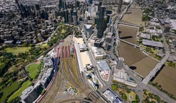
The real-time record of the world around us

We've all heard of the term digital twin, but what does it really mean and how can it be used to represent the world outside your window? Wayne,Ta and Mary discuss the four pillars to realise the ‘digital twin effect’ and list out the tech to get you started.    

 SUBSCRIBE:

Apple podcast badgeSpotify podcast badgePodbean badgeGoogle podcast badge

Subscribe for more short, sharp and immediately usable tips and insights. 

Got a burning question or a hot topic?

Connect with the hosts

Ta Taneka profile image
Tariro Taneka
Program Manager, User Journeys
Esri Australia, Brisbane
Ta is the designer of the trailblazing ArcMap to ArcGIS Pro Migration and Web GIS enablement programs leading a new breed of GIS adoption specialists.   
Wayne Lee Archer - GIS Directions 1
Wayne Lee Archer
Sector Principal Consultant
Esri Australia, Brisbane
One of Australia's leading curators of spatial information and modern technology.
Mary Murphy - GIS Directions 2
Mary Murphy
Consultant
Esri Australia, Perth
Experienced GIS and remote sensing specialist

Stay in the know

Be notified when new episodes go live and submit your topic ideas below.

  • Click to view the episode transcript

    [00:00:00] Wayne: Welcome to GIS Directions. I'm Wayne Lee Archer.  

    [00:00:03] Ta: I'm Ta Taneka.  

    [00:00:04] Mary: And I'm Mary Murphy.  

    [00:00:06] Wayne: And today as father of real-world twins, we're gonna be talking about something very, very dear to my heart. We're gonna be talking about digital twins and trying to define what that thing is.  

    [00:00:18] Ta: Uh, should we still be using the term digital twin or would it be more accurate to refer to these digital simulations of real life as living digital twins? 

    [00:00:28] Ta: That's my big question for today.  

    [00:00:30] Wayne: I do like the addition of the word living in there because a lot of this is about real time. And you know, you've heard me wax lyrical about it already Ta, you know, I actually have a bit of a problem with this whole idea of the term digital twin, um, because from, from my perspective, uh, what we've been doing for, you know, the better part of, of, you know, 50 years, uh, in, in digital GIS is creating a representation of the world outside our window. 

    [00:00:58] Wayne: Um, but you know, I would, I'd lay there in the argument that, you know, whenever we are trying to make a representation of the real world is that not creating a twin.  

    [00:01:09] Mary: I suppose then that harps back to, maybe we should define or give a definition of what we think a digital twin is. I've been asked a number of times, what is a digital twin? 

    [00:01:19] Mary: Um, you very much have your idea of what a digital twin is. And I suppose if I'm thinking of it or if I have to answer that type of question, I usually think of it from the perspective of whoever that end user is, right? Because that's who I end up in front of, is that end user. So I usually think of it as some form of interactive or. 

    [00:01:38] Mary: Queryable digital representation of the real world. Right? Which, like you said, I think we've been doing that for a long time anyway. Um, and that real world in my mind could be at any scale. So I could do that from a piece of street furniture to a building, to a street itself to a city or whatever it wants. 

    [00:01:55] Mary: But I, as the end user, I want to be able to see the features, understand the relationships between them, and have them behave as I would expect them to behave, those relationships to behave under certain conditions. And they could be real time conditions or me entering parameters or modelling scenarios and seeing those results. 

    [00:02:13] Mary: So, You know, it's a high bar that I have as an end user what my expectation of a digital twin is. So conceptually for me, it's almost metaverse-esque kind of thing. That's what I'm getting into, right?  

    [00:02:25] Ta: Ooh, okay. Okay. I like that. So I need to point out that, uh, firstly, it's essential that we look backwards to look forward. 

    [00:02:32] Ta: And by that I mean, you know, we have a rich history of map, paper-based maps, digital maps, as well as schematics for infrastructure and building information models. So we already have a digital record of our world, but you know, what we should be focusing on is a living record of our world. What's here and now? How has it changed? 

    [00:02:51] Ta: What have we done better? What can we improve? We talk about sustainable practices and the future, and they're all fair points, absolutely. But we need to have access to our current state if we want to promote and engage the smart city framework. Living twins, they enable us to undertake, you know, simulations, integrations, testing, monitoring, maintenance of everything from infrastructure to buildings to what our future can be. 

    [00:03:15] Ta: So that's, that's really where I fall into. The living twins, digital twins? Yes, living twins. That, that's where I'm going with this. 

    [00:03:22] Wayne: I love the, the use of the word simulation there, Ta, because I mean, if we actually have a look at the, you know, the, the dictionary or the Wikipedia definition of what a digital twin is, um, it, it says that it's a virtual representation of a real world physical system or process. 

    [00:03:38] Wayne: But if you have a look into it deeper, it actually was born out of NASA in an attempt to improve the way they model their spacecraft within the physical world. And what we're seeing now is the culmination of technologies reaching such a point in GIS that the fidelity, the accuracy at which we can represent what's outside the window is so much higher. 

    [00:04:05] Wayne: And we understand that because of the fidelity of the data in the world around us, we get to see, you know, the traffic, uh, you know, flowing by us. We get to see the river flowing under the road or over the road. We get to see the surface of the road. And that I think is the real key to this notion of twins. 

    [00:04:24] Wayne: It's bringing in all of these various different data sources, all of this, this data at different levels of granularity, uh, and, and, and different levels of real timeliness, uh, so that it becomes more and more like the experience we have in our head as we are walking around in the 3D world.  

    [00:04:43] Ta: I love what you've just said there, that um, it's smart city thinking. 

    [00:04:46] Ta: It's smart cities and where a lot of our local and state governments are heading to or they're at. Um, and speaking of smart cities, you know, Singapore created the first country scaled digital twin and they brought in imagery data and building information models and transport information data, and used it to redesign major sections of Singapore's rail infrastructure and that right there. 

    [00:05:08] Ta: To me that represents a beacon for digital twins and smart city thinking. You know, let's note that as an island nation being able to represent true buildings and infrastructure represents a huge benefit for this side of the world, structurally, culturally. So that really speaks into, you know, the fidelity of that data, how it, creating a true representation at such a large scale. 

    [00:05:29] Ta: And we are really moving towards those smart cities as a member of a community that, that's where I'm trying to go, that's where I'm trying to be.  

    [00:05:35] Mary: Yeah. And, and I'm gonna bring it back to my kind of end user experience here, right? And exactly what you've said as well, Wayne. Um, in combination, what you've said there Ta is this idea of where that level is. 

    [00:05:48] Mary: Right? Where is that threshold? Once we cross a particular threshold? Are we now in digital twin territory? Um, from what you are seeing, Wayne? No, we're always in digital twin territory

    [00:06:20] Wayne: It's not the level of, you know what, what Tara was just talking about with Singapore, how they've done a whole countrywide representation of their data. It's a small slice. It may be a representation of your building on campus, and it's, as you get more and more information lay it in there. As you build up that bulk of information, it becomes closer and closer and closer to the real world, and you get those real world like insights into what's going on, and that's the power of digital twins. 

    [00:06:50] Wayne: Once we actually get the data fidelity up that high, you get to see stuff just the way you get to see it outside your window and through your eyes in real life. And those are when the best in insights really come to play.  

    [00:07:02] Ta: So Mary, we have defined it and I think that's always the best way to start any kind of topic. 

    [00:07:06] Ta: We've defined it. Um, Wayne, from where you're going with this, what are the pillars that underpin digital twins?  

    [00:07:13] Mary: Yeah, let's help people get started.  

    [00:07:15] Wayne: I, I'm so glad you asked because there is a process to this. You know, when we talk about digital twins, we've got. Four key pillars to build in digital twins. 

    [00:07:24] Wayne: Well, these are the four elements of a digital twin, and so listen carefully. We'll be coming back to them over this conversation. We start off with data capture and integration.  

    [00:07:34] Mary: So that's our first place? Is that where we begin or is that just one of the pillars?  

    [00:07:38] Wayne: Well, this is one of the pillars, but I mean it it comes always, always, always comes back to the data. 

    [00:07:43] Ta: Yeah.  

    [00:07:44] Mary: Agreed.  

    [00:07:44] Wayne: Right? Yep. Uh, and so, you know, data capture and integrating data is super important. That's, that's one of the key parts of this. Modelling the real world is what Twining is about. And you can't model it unless you've got data. And the more data you get, the higher that fidelity the representation becomes. 

    [00:08:01] Wayne: And that's what we're talking about with Twining. The second pillar or the second element is, and this is I think what really sets aside what we've been doing for decades versus this actual notion of a, a living digital twin or a living twin. And this is real time and visualisation. It's about the real time. 

    [00:08:23] Wayne: This is about the culmination of technology has brought us to a point where we can actually see things like they are in the real world. That's our definition of a twin. So this is real time traffic data. This is IOT sensors, uh, you know, all of this coming in together in real time so that we can see those insights with all of that information overlaid on each other. 

    [00:08:46] Wayne: So we've got data capture, we've got real time and visualisation now. And now we're talking about that third pillar, the third element of digital twins, and then digital twin design. And this is super important. I think this is one of the most, if not the key part of the actual pillars of, of the digital twin. 

    [00:09:03] Wayne: This is sharing and collaboration. Uh, you know, this is about bringing together different viewpoints on the world. You can't all have all of the data, all of the time. But there are people out there, other people that aren't you, that do have the data and do have their own little view on their own world, their own mini twin. 

    [00:09:23] Wayne: And so when you start to share and when you start to collaborate between organisations and between departments, you can bring all of this data together into a single place. And that's when you get to, you know, really get down and see some insights. You can have your traffic data on top of your weather data, on top of your road data, and actually really start to see things all together. 

    [00:09:45] Ta: Now, you said four pillars, what's that last pillar?  

    [00:09:49] Wayne: Well, I, I don't necessarily think that this is a pillar in terms of it doesn't actually drive building the twin. This is the why we do it, right? So what it is, I know, you know what I'm about to say, Mary. It's analysing and predicting. This is the, why do we build a twin? 

    [00:10:09] Wayne: It answers that.  

    [00:10:10] Mary: Yeah, leveraging the twin,  

    [00:10:12] Wayne: Absolutely realising the, the twin effect, the digital twin effect.  

    [00:10:17] Ta: Focusing on those first three pillars then, I guess where do we, where do we land? What are we doing? Like how are we getting that data? How are we capturing it? How are we visualising and collaborating? 

    [00:10:27] Ta: What's the tech behind it? That's what I'm here for.  

    [00:10:29] Mary: Yeah. So how do we like start from the beginning, Because we've said, you know, we have data capture and integration as probably that first step there at the very, very beginning. So how do we actually build it? How do we do this brick by brick, pixel by pixel? 

    [00:10:41] Mary: How do we jump in and actually start doing this? How do we build this digital world, this living digital world? So we're starting with that particular category, I assume, as our kind of, that's where we start that data capture and integration, 

    [00:10:54] Wayne: The data capture and integration, uh, steps. So, you know, once you've got your data, then you can can build out the twin.  

    [00:11:00] Mary: Yeah. So what tech do we need? I might direct this first to ArcGIS Pro. That's your kind of starting point, right? Your desktop GIS application has to be, so that will allow you to do things like your visualisation, your analysis, your data maintenance, integration with maybe your enterprise system and so on,  

    [00:11:18] Mary: So that's a, like your starting point. And as you said Wayne, earlier on, if you have this hierarchy or scale or sliding scale of digital twins, um, everyone starts with those, you know, points, lines, polygons, and a few bits of raster, and that's what you're doing. So that's your, your desktop GIS, and then maybe, um, your ArcGIS online slash your enterprise portal would be kind of where you would go next and your enterprise deployment. 

    [00:11:44] Mary: What else though, do we need? Because I wanna help these people get up and running.  

    [00:11:48] Wayne: Uh, I, I would say some of the next tools that we can talk about, uh, things like Survey 123 and Field Maps. So, you know, this is where we are almost getting into the, you know, the reality capture side of things, which is another thing that we can talk about. 

    [00:12:01] Wayne: Uh, but you know, first and foremost you've got field workers out there looking at light poles, looking at defects, uh, and, you know, vegetation encroachment and capturing that data using tools like Field Maps and Survey 123. So there's the next layer on top of that foundational stuff that you get through ArcGIS Online, through Enterprise. 

    [00:12:22] Mary: Any other data capture and integration, um, pieces of kit that we need. What do you reckon Ta?  

    [00:12:27] Ta: Planner in me says ArcGIS Urban. ArcGIS Urban, from my perspective. So, so, so dope right? It's a web-based 3D application that supports scenario planning and impact assessment. So that predictive element, the why of, of you know what we wanna do, and then that impact assessment. 

    [00:12:42] Ta: I really wanna, you know, put something out there that will be for the greater good, how is everyone gonna be affected? And then how can we start future planning? So ArcGIS Urban for the win for me.  

    [00:12:51] Mary: Yeah. 

    [00:12:52] Wayne: And so that includes like building information model as well, doesn't it? Uh, so like this is representing the as-built world, so it's exactly what we're talking about with digital twins. 

    [00:13:01] Wayne: I think that's a great call.  

    [00:13:02] Mary: Mm-hmm, anything else, Wayne, that we might throw in there for our data capture?  

    [00:13:06] Wayne: Uh, data capture, you know, so again, we are going further and further down the, the fidelity, you know, scale, uh, you know, obvious, obvious, uh, call out here would be, uh, Drone, Drone to Map, uh, would be Site Scan. 

    [00:13:21] Wayne: Uh, you know, this is where you're actually getting that point data, those point clouds out of LIDAR scans. Is that not like super uber twining? Like when you actually got, you know, millimetre perfect and millimetre accurate representations of the real world. How do you catch that? Well, you catch it with, you know, reality capture tools. 

    [00:13:42] Wayne: Uh, and for, for me, reality capture is the, the best in breeds. This is the layers of tools that you would work through and build up through to capture the data that you need to put your twin together.  

    [00:13:54] Mary: All right, so that's lots of lovely information around the products and we can use in this particular part of the, um, process for our data capture and integration. 

    [00:14:03] Mary: But have we got any examples, any examples of some amazing digital twins out there that we can drive people to, to have some, uh, a nosy around the place? Any ideas?  

    [00:14:14] Ta: Yeah. Yeah. I wanna jump in and say Snowy Hydro for the win for sure.  

    [00:14:18] Mary: Fabulous. Yeah. Well, I'll say Fremantle Ports. They've done some fantastic ones. 

    [00:14:23] Mary: Any other ones? 

    [00:14:24] Wayne: Uh, I'm, I'm gonna say head overseas. I know we have the grand masters overseas in this, uh, so Singapore, you know, Geospace C is a great example.  

    [00:14:34] Ta: Oh, Malaysia MRTC. 

    [00:14:36] Mary: Yes. Fantastic. MRTC Malaysia. Yeah, absolutely. Excellent. I mean, so people are doing some fantastic things and there's lots of examples and we'll definitely throw some links down into those show notes for everyone. 

    [00:14:49] Ta: How do we get people started? Like where do they go? How can they find in information? Am I getting a trial? Am I getting like a course? What am I doing?  

    [00:14:57] Mary: So you might wanna start with some introductory, say, pro courses to get hands on, because we are talking about the um, data capture and integration. So we need to get hands on with our data. 

    [00:15:06] Mary: So that could be things like your introduction courses like introduction to GIS, ArcGIS Pro, Central Workflows, ArcGIS Online Essential Workflows, maybe even an introduction to how you're gonna integrate with your enterprise stack, right? So that might be your enterprise configuring your based deployment or administration workflows. 

    [00:15:24] Mary: So those are those kind of core things that you might wanna look at. And then if you do wanna look at your data management, and capture in the field side of things, that field data course that we have is very, very good as well. So they would be that, you know, real core starting point and then build out from there and then learn ArcGIS is excellent if you have a particular industry in there that you're interested in, like there's lots of AEC and BIM things in there in particular because a lot of people, that's where they come in. 

    [00:15:51] Mary: That's where you dive into. But I suppose my top tip would be planning is key. Jump in, get a look around, get a feel for it all, but it comes down to you and your need. Sit down, plan it out.  

    [00:16:03] Wayne: Great tip. My tip is start with what you know. Uh, remember that we've talked about the, the different types of twins, you know, little twins and big twins. 

    [00:16:12] Wayne: Uh, if, if what you are modelling is a utility network, then start with the utility network modelling. Get into those training courses. Get utility network certified. But start with what you know, and then start to bring in those other forms of data, and you might find that you're stepping into those other pillars and collaborating with people in doing so. 

    [00:16:33] Ta: To help you get started with these tips we've had at all the resources we've spoken about to our website, so that's gisdirectionspodcast.com.au, including all the information you'll need to get started with the four pillars of digital twins. I said four there Wayne, and I know you say three, but it's definitely four pillars. 

    [00:16:49] Ta: We'd also love to hear any tips from you guys, the ArcGIS user community, so jump onto the website to send them through or connect with us through LinkedIn or Twitter, and hopefully we can feature some of those tips as part of our resources and ongoing program.  

    [00:17:03] Wayne: So yeah, hit us up on the socials and keep on the conversation about digital twins. 

    [00:17:07] Wayne: But for now, that's us. Keep on twining.  

    [00:17:10] Ta: Happy mapping.  

    [00:17:11] Mary: Catch you next time. 


Subscribe to
Esri Australia news