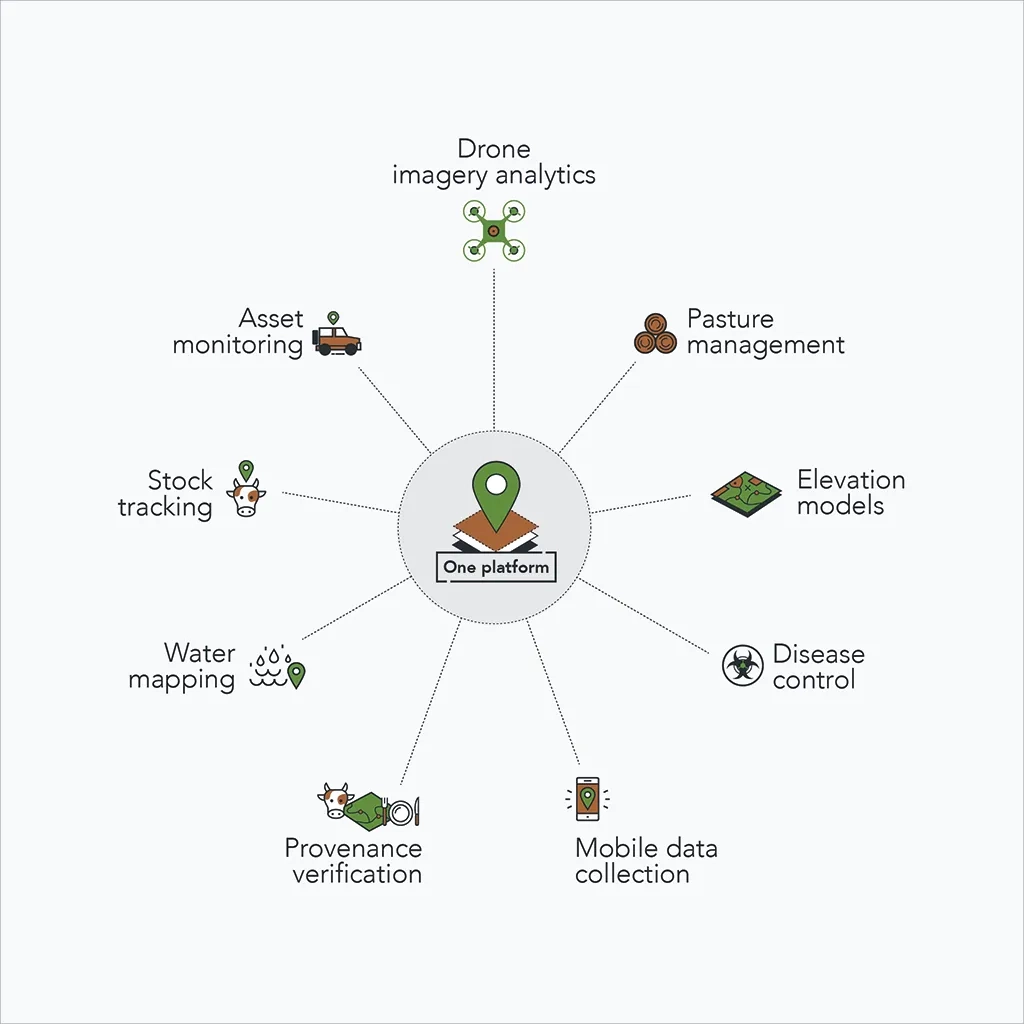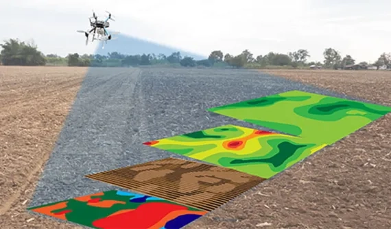
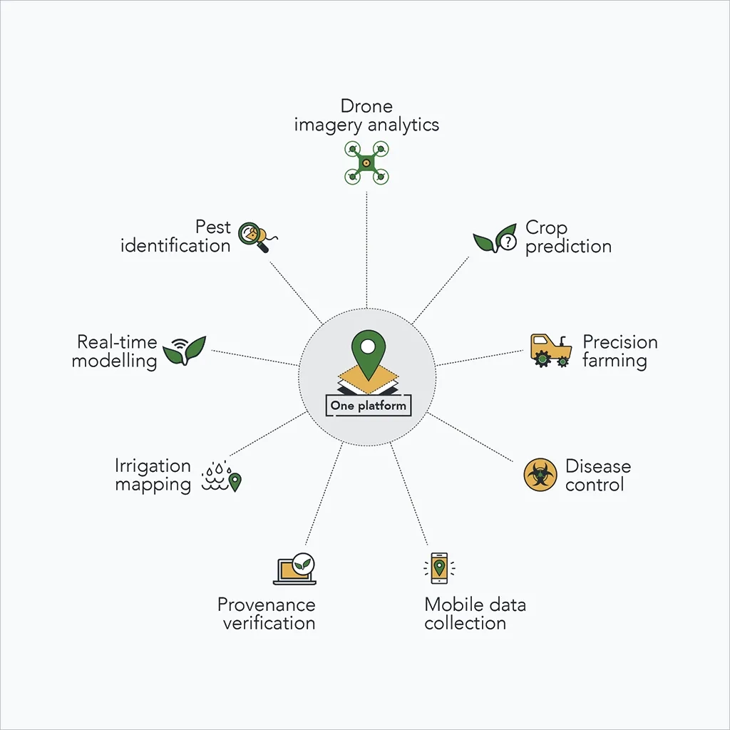
Integrate high-resolution imagery, field observations, and real-time data feeds to understand how to make the most of your limited resources. Esri technology allows you to collect, maintain, and analyse all your agriculture field data in one centralised system.

Call 1800 870 750 or email a specialist to find out more about GIS in agribusiness.
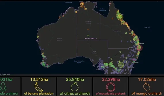
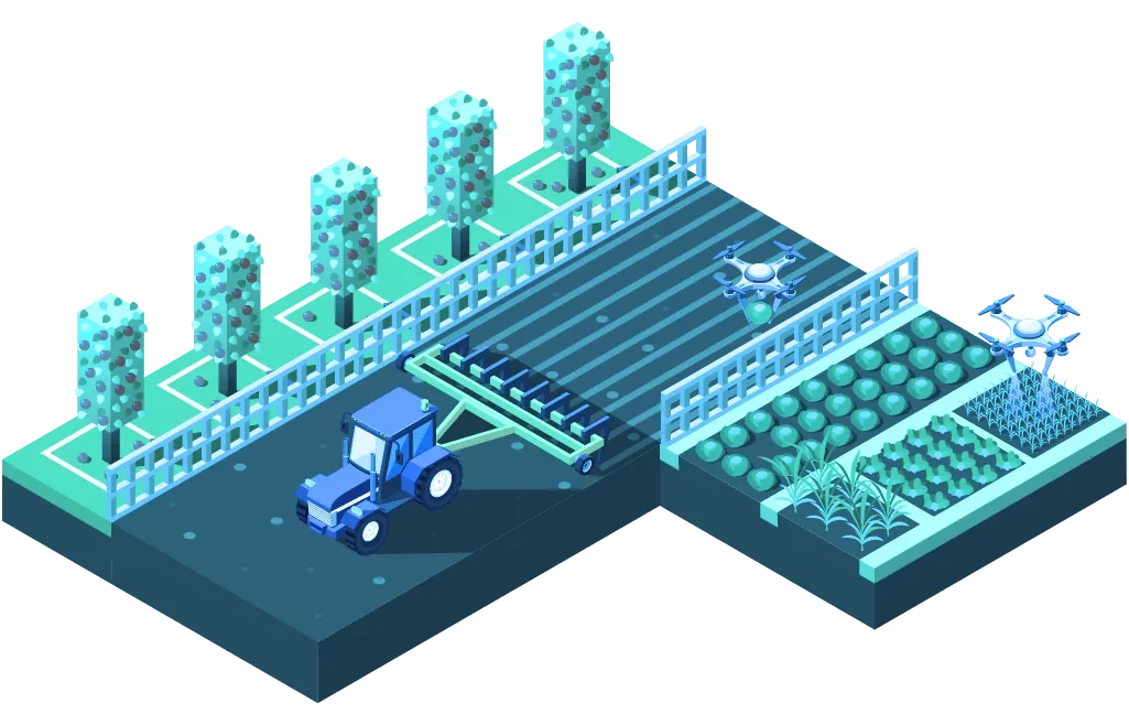
Mapping and analytics for agriculture
The Esri ArcGIS platform provides agricultural operations with a single-point-of-truth for all geospatial information.
The platform enables users to create and share spatial data to generate information and insights capable of improving workflows and maximising efficiencies.
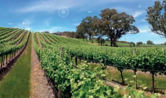
The capabilities of real-time mapping, reporting and analytics can be adapted to suit multiple agricultural applications from tree plantations to cropping and livestock.
Users can access a wide variety of relevant map data layers such as imagery, infrastructure, surveillance, weather and more – any time, through any device.
Mapping and analytics for livestock
Esri’s ArcGIS platform provides agribusiness users with a single-point-of-truth for all geospatial information.
Create and share spatial data to generate information and insights capable of radically transforming workflows and maximising efficiencies.
Real-time mapping, reporting and analytics can be adapted to suit multiple operations, including monitoring moving assets over wide areas, such as stock and herds, or managing localised housed livestock and small flocks.
Farm users can access a wide variety of relevant, ready-to-use map data layers such as imagery, infrastructure, surveillance, weather and more – any time, through any device.