You are here News & Events Blogs Esri Australia blog Esri Australia blog AllEsri techData-driven decisionsDigital transformationDisruptive innovationGIS in Education Data-driven decisions How Deloitte and Esri Australia are transforming road maintenance with Asset AI Knowing where road defects are emerging can help councils make faster, more informed maintenance decisions. Through Asset AI ®, Deloitte and Esri Australia are bringing artificial intelligence and location intelligence together to help turn road condition data into actionable insight. Learn more Digital transformation Building future-ready networks through spatial intelligence and Microsoft's enterprise platform See how Esri and Microsoft connect enterprise data with spatial intelligence to improve operational efficiency and support faster, data-driven decisions. Learn more Digital transformation AI in Government: How spatial intelligence enables better decisions Explore how government agencies can connect trusted enterprise and spatial data with AI to strengthen operational decisions, coordination and community outcomes. Learn more Digital transformation Connected by design: How spatial intelligence helps commercial organisations unlock more value from enterprise data See how geospatial data integration connects enterprise data and workflows to help commercial organisations unlock greater value and make confident decisions. Learn more Digital transformation Building resilient telecommunications networks with real-time spatial intelligence See how real-time spatial intelligence helps telecommunications providers respond faster, strengthen resilience and make confident network decisions. Learn more Digital transformation Beyond the model: How living digital twins are transforming infrastructure See how living digital twins connect infrastructure data and workflows to improve planning, asset performance, resilience and decision-making. Learn more Esri tech From big data to actionable business insights: JAKALA's Success with ArcGIS GeoAnalytics Engine Discover how a MarTech company transformed big data into actionable insights, reduced their analytics processing time, and expanded their service offerings. Learn more Data-driven decisions Vodafone creates country-scale digital twins to engineer better networks The Vodafone country-scale digital twin captures environmental and network attributes to deliver a more robust and performant network. Learn more Esri tech From insight to action: What we learnt at Esri UC 2026 Explore five key lessons from Esri UC 2026 – from AI and operational intelligence to digital twins, trusted adoption and practical ArcGIS improvements. Learn more Esri tech From ambition to action: Sustainability insights from Esri UC 2026 Explore five sustainability insights from Esri UC 2026, from observing environmental change and strengthening resilience to using living digital twins and trusted AI. Learn more Esri tech AI in GIS: 5 takeaways from Esri UC 2026 Here are five takeaways from Esri UC 2026 for organisations exploring AI in GIS. Learn more Honda Australia Case Study Honda Australia and Esri Australia brought motorcycle division data into one dashboard giving leaders a clearer view of performance to spot trends and make faster decisions. Learn more Geospatial vs physics-enabled digital twins: Rethinking infrastructure decision-making Energy demand is shifting. Climate pressure is intensifying. Networks are becoming more interconnected and more fragile. And in the middle of it all, one concept keeps surfacing: the digital twin. But as the conversation matures, a more important question is emerging: What kind of digital twin do you actually need? Learn more 5 questions to ask before scaling AI in geospatial operations Use this checklist to assess whether AI is ready to scale across ArcGIS-enabled workflows, with the geospatial context, transparency and accountability needed to support real-world decisions. Learn more How Managed Services for GIS supports business critical systems In this Managed Services Insider, Irina Rakhimova, Team Lead, Application Services, explains how Managed Services for GIS helps organisations move from reactive system management to a more confident, strategic approach. Learn more Mapping the future: How location intelligence can accelerate Queensland's critical minerals mission Queensland’s critical minerals sector is entering a pivotal phase. The opportunity is not only to supply the minerals needed for modern infrastructure, defence, advanced manufacturing and the energy transition, it is to build a more coordinated, resilient and globally competitive critical minerals industry. Learn more Digital transformation How Managed Services for GIS scales to meet your organisation’s strategic needs Shane Miles, Head of Managed Services at Esri Australia, explains what sets GIS-specific support apart and how organisations can choose a model that fits their current needs and future ambitions. Learn more Data-driven decisions Case Study: How Managed Services for GIS is turning complex spatial data into business value. The Department of Natural Resources and Mines, Manufacturing and Regional and Rural Development has enhanced Queensland’s spatial data accessibility and economic resource business development prospects. Learn more Data-driven decisions From complex data to better decisions. How Goodman transformed its global portfolio with Managed Services for GIS Goodman, in collaboration with Esri Australia’s Managed Services for GIS, has redefined customer and investor experiences with an innovative online tool showcasing their Global Property Portfolio. Learn more In retail, location is an organisational problem Whether you are running a fast-food chain, fitness centres, or supermarkets, decisions about where things happen, stores, customers, inventory, deliveries, and incidents, shape performance every day. Yet, in most retail organisations, location intelligence is still primarily associated with one function: Site selection. Learn more The 2026-27 Federal Budget: Why delivery complexity is becoming a national challenge The Federal Budget outlines significant investment across housing, infrastructure, healthcare, energy, defence, and regional development. A spatial approach brings data together – giving delivery teams a connected view of how priorities play out on the ground. Learn more GIS in Education Building the next generation of sustainability problem solvers with GIS Ormiston College took out the 2025 SDG GIS Challenge award with their project, When Strangers Take Root: Invasive Species on Coochiemudlo Island. The project exemplified what students can achieve when STEM learning is grounded in real issues and supported by the right geospatial tools. Learn more Data-driven decisions A digital twin for Cross River Rail: Inside Brisbane's virtual railway Discover how a digital twin powered by GIS and BIM is transforming Cross River Rail in Brisbane, enabling immersive planning, better coordination, and smarter infrastructure delivery. Learn more Digital transformation Building the networks of the future: Why integration, not isolation, will define modern infrastructure Explore how networks of the future are transforming infrastructure through integration, geospatial intelligence, and more informed, real-time decision-making. Learn more Data-driven decisions What is spatial intelligence and why it matters for Australia's critical networks Spatial intelligence combines location‑based data and GIS to reveal patterns, risks and opportunities, enabling smarter, faster, more confident decision‑making. Learn more Digital transformation How digital twins, BIM-GIS integration, and geospatial AI are transforming Australian infrastructure Digital twins, GIS and AI are converging to help infrastructure owners plan, build and operate assets more safely, efficiently and resiliently across their lifecycle. Learn more Esri tech A digital plan of buildings and people guides Adelaide’s future growth South Australia’s cosmopolitan coastal capital and the fifth most populous city made a bold decision to grow rapidly but delicately. In its recently released comprehensive plan, Adelaide opted to double the population in its downtown core to 50,000 people by 2036, adding housing density near its green spaces and historic neighbourhoods. Learn more Esri tech What’s new across ArcGIS: Smarter workflows, better collaboration, deeper insight ArcGIS continues to evolve at pace, introducing capabilities that make it easier to work smarter, collaborate more effectively, and gain deeper insight from your spatial data. Across ArcGIS Online, Hub, Experience Builder, Dashboards, Instant Apps, Field Maps, Survey123, and Web Maps, Esri is delivering updates that enhance productivity, modernise workflows, and strengthen decision-making. Learn more Esri tech What's leaving in ArcGIS Enterprise 12.0? Learn which legacy apps are being retired and how moving to Experience Builder and Instant Apps can streamline your GIS workflows. Learn more Esri tech ArcGIS Desktop retirement: Next gen mapping now ArcGIS Desktop will retire on 1 March 2026, so now’s the time to move to ArcGIS Pro and modern licensing to keep your work connected and supported. Learn more
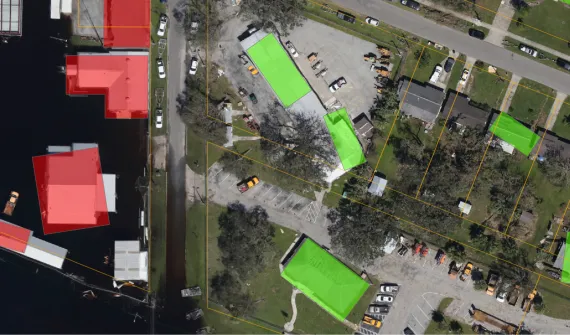
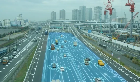
Data-driven decisions How Deloitte and Esri Australia are transforming road maintenance with Asset AI Knowing where road defects are emerging can help councils make faster, more informed maintenance decisions. Through Asset AI ®, Deloitte and Esri Australia are bringing artificial intelligence and location intelligence together to help turn road condition data into actionable insight. Learn more
Digital transformation Building future-ready networks through spatial intelligence and Microsoft's enterprise platform See how Esri and Microsoft connect enterprise data with spatial intelligence to improve operational efficiency and support faster, data-driven decisions. Learn more
Digital transformation AI in Government: How spatial intelligence enables better decisions Explore how government agencies can connect trusted enterprise and spatial data with AI to strengthen operational decisions, coordination and community outcomes. Learn more
Digital transformation Connected by design: How spatial intelligence helps commercial organisations unlock more value from enterprise data See how geospatial data integration connects enterprise data and workflows to help commercial organisations unlock greater value and make confident decisions. Learn more
Digital transformation Building resilient telecommunications networks with real-time spatial intelligence See how real-time spatial intelligence helps telecommunications providers respond faster, strengthen resilience and make confident network decisions. Learn more
Digital transformation Beyond the model: How living digital twins are transforming infrastructure See how living digital twins connect infrastructure data and workflows to improve planning, asset performance, resilience and decision-making. Learn more
Esri tech From big data to actionable business insights: JAKALA's Success with ArcGIS GeoAnalytics Engine Discover how a MarTech company transformed big data into actionable insights, reduced their analytics processing time, and expanded their service offerings. Learn more
Data-driven decisions Vodafone creates country-scale digital twins to engineer better networks The Vodafone country-scale digital twin captures environmental and network attributes to deliver a more robust and performant network. Learn more
Esri tech From insight to action: What we learnt at Esri UC 2026 Explore five key lessons from Esri UC 2026 – from AI and operational intelligence to digital twins, trusted adoption and practical ArcGIS improvements. Learn more
Esri tech From ambition to action: Sustainability insights from Esri UC 2026 Explore five sustainability insights from Esri UC 2026, from observing environmental change and strengthening resilience to using living digital twins and trusted AI. Learn more
Esri tech AI in GIS: 5 takeaways from Esri UC 2026 Here are five takeaways from Esri UC 2026 for organisations exploring AI in GIS. Learn more
Honda Australia Case Study Honda Australia and Esri Australia brought motorcycle division data into one dashboard giving leaders a clearer view of performance to spot trends and make faster decisions. Learn more
Geospatial vs physics-enabled digital twins: Rethinking infrastructure decision-making Energy demand is shifting. Climate pressure is intensifying. Networks are becoming more interconnected and more fragile. And in the middle of it all, one concept keeps surfacing: the digital twin. But as the conversation matures, a more important question is emerging: What kind of digital twin do you actually need? Learn more
5 questions to ask before scaling AI in geospatial operations Use this checklist to assess whether AI is ready to scale across ArcGIS-enabled workflows, with the geospatial context, transparency and accountability needed to support real-world decisions. Learn more
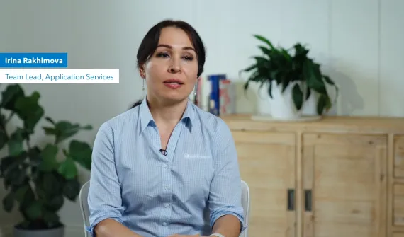
How Managed Services for GIS supports business critical systems In this Managed Services Insider, Irina Rakhimova, Team Lead, Application Services, explains how Managed Services for GIS helps organisations move from reactive system management to a more confident, strategic approach. Learn more
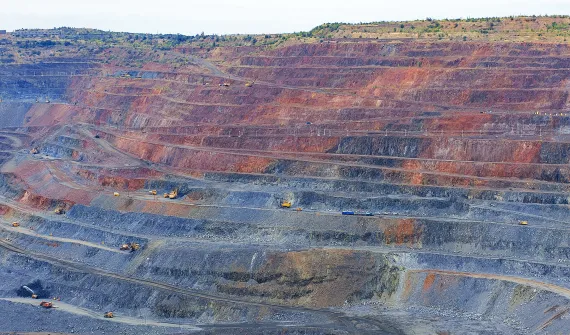
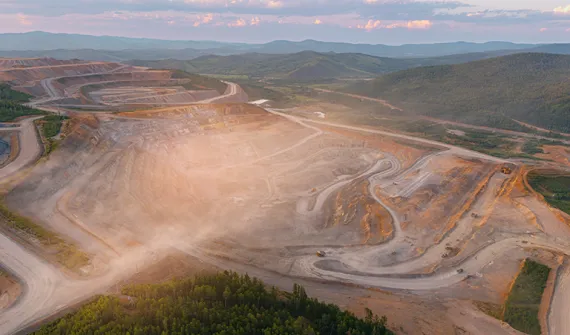
Mapping the future: How location intelligence can accelerate Queensland's critical minerals mission Queensland’s critical minerals sector is entering a pivotal phase. The opportunity is not only to supply the minerals needed for modern infrastructure, defence, advanced manufacturing and the energy transition, it is to build a more coordinated, resilient and globally competitive critical minerals industry. Learn more
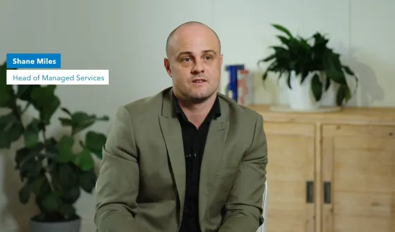
Digital transformation How Managed Services for GIS scales to meet your organisation’s strategic needs Shane Miles, Head of Managed Services at Esri Australia, explains what sets GIS-specific support apart and how organisations can choose a model that fits their current needs and future ambitions. Learn more
Data-driven decisions Case Study: How Managed Services for GIS is turning complex spatial data into business value. The Department of Natural Resources and Mines, Manufacturing and Regional and Rural Development has enhanced Queensland’s spatial data accessibility and economic resource business development prospects. Learn more
Data-driven decisions From complex data to better decisions. How Goodman transformed its global portfolio with Managed Services for GIS Goodman, in collaboration with Esri Australia’s Managed Services for GIS, has redefined customer and investor experiences with an innovative online tool showcasing their Global Property Portfolio. Learn more
In retail, location is an organisational problem Whether you are running a fast-food chain, fitness centres, or supermarkets, decisions about where things happen, stores, customers, inventory, deliveries, and incidents, shape performance every day. Yet, in most retail organisations, location intelligence is still primarily associated with one function: Site selection. Learn more
The 2026-27 Federal Budget: Why delivery complexity is becoming a national challenge The Federal Budget outlines significant investment across housing, infrastructure, healthcare, energy, defence, and regional development. A spatial approach brings data together – giving delivery teams a connected view of how priorities play out on the ground. Learn more
GIS in Education Building the next generation of sustainability problem solvers with GIS Ormiston College took out the 2025 SDG GIS Challenge award with their project, When Strangers Take Root: Invasive Species on Coochiemudlo Island. The project exemplified what students can achieve when STEM learning is grounded in real issues and supported by the right geospatial tools. Learn more
Data-driven decisions A digital twin for Cross River Rail: Inside Brisbane's virtual railway Discover how a digital twin powered by GIS and BIM is transforming Cross River Rail in Brisbane, enabling immersive planning, better coordination, and smarter infrastructure delivery. Learn more
Digital transformation Building the networks of the future: Why integration, not isolation, will define modern infrastructure Explore how networks of the future are transforming infrastructure through integration, geospatial intelligence, and more informed, real-time decision-making. Learn more
Data-driven decisions What is spatial intelligence and why it matters for Australia's critical networks Spatial intelligence combines location‑based data and GIS to reveal patterns, risks and opportunities, enabling smarter, faster, more confident decision‑making. Learn more
Digital transformation How digital twins, BIM-GIS integration, and geospatial AI are transforming Australian infrastructure Digital twins, GIS and AI are converging to help infrastructure owners plan, build and operate assets more safely, efficiently and resiliently across their lifecycle. Learn more
Esri tech A digital plan of buildings and people guides Adelaide’s future growth South Australia’s cosmopolitan coastal capital and the fifth most populous city made a bold decision to grow rapidly but delicately. In its recently released comprehensive plan, Adelaide opted to double the population in its downtown core to 50,000 people by 2036, adding housing density near its green spaces and historic neighbourhoods. Learn more
Esri tech What’s new across ArcGIS: Smarter workflows, better collaboration, deeper insight ArcGIS continues to evolve at pace, introducing capabilities that make it easier to work smarter, collaborate more effectively, and gain deeper insight from your spatial data. Across ArcGIS Online, Hub, Experience Builder, Dashboards, Instant Apps, Field Maps, Survey123, and Web Maps, Esri is delivering updates that enhance productivity, modernise workflows, and strengthen decision-making. Learn more
Esri tech What's leaving in ArcGIS Enterprise 12.0? Learn which legacy apps are being retired and how moving to Experience Builder and Instant Apps can streamline your GIS workflows. Learn more
Esri tech ArcGIS Desktop retirement: Next gen mapping now ArcGIS Desktop will retire on 1 March 2026, so now’s the time to move to ArcGIS Pro and modern licensing to keep your work connected and supported. Learn more