Esri Australia | Home

Main navigation Australia

  • Industries
    • Business
      • Agribusiness
      • Architecture, engineering and construction (AEC)
      • Banking
      • Commercial real estate
      • Electricity
      • Gas
      • Insurance
      • Logistics and freight
      • Mining
      • Petroleum and pipeline
      • Ports and maritime
      • Retail
      • Telecommunications
      • Water
    • Government
      • Climate action
      • Defence and intelligence
      • Emergency services
      • Federal government
      • Health
      • Land administration
      • Law enforcement
      • Local government
      • National security
      • State government
      • Transport
      • Waste management
    • Community
      • Schools
      • Higher education
      • Esri Young Scholar Award
      • StoryMaps Challenge 2026
      • Environmental management
      • Nonprofit organisations
      • Safe communities
      • Smart communities
  • Products
    • Capabilities
      • Digital twins
      • Geospatial AI
      • Field operations
      • Integrated Geospatial Infrastructure
      • Spatial analytics
      • Spatial intelligence
      • Imagery and remote sensing
    • About ArcGIS
      • ArcGIS Online
      • ArcGIS Pro
      • ArcGIS Enterprise
      • ArcGIS Developer
      • ArcGIS for Personal Use
      • ArcGIS Online credits
      • ArcGIS Online free trial
      • ArcGIS Pro free trial
      • See other Esri products
    • Applications
      • Apps for the Office
      • Apps for Field Operations
      • App Builders
      • Connect for ArcGIS
      • SmarterWX
    • GIS data
      • GIS datasets
      • Esri’s Open Vision
      • Open Data
  • Services & Support
    • Services
      • Advisory services
      • Managed services
      • Professional services
      • Enterprise advantage program
      • Configuration engineering
      • ArcGIS Enterprise upgrade
      • GDA2020 service packages
      • User Experience for GIS
      • Disaster Response Program
      • Learning and Services Units
    • Technical support
      • Esri Support App
      • Support programs
      • Support resources
      • ArcGIS Personal Use support
    • Training
      • Book your course
      • Course calendar
      • Learning Pathways
      • Capability Matrix
      • Submit a training enquiry
    • ArcGIS resources
      • A quick-start guide to ArcGIS Pro
      • Get started with Web GIS
      • ArcGIS user types
      • ArcGIS product licensing
      • ArcGIS Enterprise Web GIS
      • Customer Care Plan
  • News & Events
    • News
      • In the media
      • Australian maps
    • Events Calendar
      • Esri Australia Live
    • Blogs
      • Esri Australia blog
      • Technical blog
      • Subscribe to Esri Australia blog
    • Podcasts
      • GIS Directions podcast
      • Esri Podcast Network
      • Mapping Evil with Mike King
      • Subscribe to podcast alerts
  • About
    • About Esri Australia
      • Our people
      • Our partners
      • Our relationship with Esri
      • Our relationship with Boustead
      • Our GIS experts
      • Policies
    • About GIS technology
      • A history of GIS
      • Location intelligence
      • Location analytics
      • Big Data and GIS
    • Careers
      • Our values
      • Our people
      • Browse jobs
      • Join talent community
    • Contact us
      • Sales and services
      • Technical support
      • Training
      • Other questions
      • Digital subscriptions
  • Store

You are here

  • News & Events
  • Blogs
  • Esri Australia blog

Esri Australia blog

  • All
  • Esri tech
  • Data-driven decisions
  • Digital transformation
  • Disruptive innovation
  • GIS in Education
Esri UC blog banner
Esri tech From insight to action: What we learnt at Esri UC 2026 Explore five key lessons from Esri UC 2026 – from AI and operational intelligence to digital twins, trusted adoption and practical ArcGIS improvements. Learn more
sustainability web card.png
Esri tech From ambition to action: Sustainability insights from Esri UC 2026 Explore five sustainability insights from Esri UC 2026, from observing environmental change and strengthening resilience to using living digital twins and trusted AI. Learn more
2026 Esri User Conference wrap up
Esri tech AI in GIS: 5 takeaways from Esri UC 2026 Here are five takeaways from Esri UC 2026 for organisations exploring AI in GIS. Learn more
Adelaide
Esri tech A digital plan of buildings and people guides Adelaide’s future growth South Australia’s cosmopolitan coastal capital and the fifth most populous city made a bold decision to grow rapidly but delicately. In its recently released comprehensive plan, Adelaide opted to double the population in its downtown core to 50,000 people by 2036, adding housing density near its green spaces and historic neighbourhoods. Learn more
Data
Esri tech What’s new across ArcGIS: Smarter workflows, better collaboration, deeper insight ArcGIS continues to evolve at pace, introducing capabilities that make it easier to work smarter, collaborate more effectively, and gain deeper insight from your spatial data. Across ArcGIS Online, Hub, Experience Builder, Dashboards, Instant Apps, Field Maps, Survey123, and Web Maps, Esri is delivering updates that enhance productivity, modernise workflows, and strengthen decision-making.  Learn more

Webcard - Upgrading to ArcGIS Enterprise 11
Esri tech What's leaving in ArcGIS Enterprise 12.0? Learn which legacy apps are being retired and how moving to Experience Builder and Instant Apps can streamline your GIS workflows. Learn more
ArcGIS Map to Pro homepage banner
Esri tech ArcGIS Desktop retirement: Next gen mapping now ArcGIS Desktop will retire on 1 March 2026, so now’s the time to move to ArcGIS Pro and modern licensing to keep your work connected and supported. Learn more
ArcGIS-Enterprise_2_Webcard_standard_768x451.png
Esri tech ArcGIS Enterprise 11.5: Prepare for version 12 Stay ahead by learning what's new in ArcGIS Enterprise 11.5 and prepare your upgrade with ease. Learn more
Wodonga housing.jpg
Esri tech Building a smarter future with location-driven planning See how one council simplified system upgrades, improved planning efficiency, and reduced manual work. Learn more
ArcGIS UserTypes
Esri tech ArcGIS user types: What you need to know The June 2024 ArcGIS Online update introduced several new features and capabilities, most importantly, the new user type licencing model that streamlines administration workflows and expands current user roles. Learn more
DigiSHEC
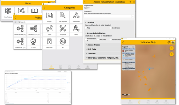
Esri tech Digitising exploration practices towards sustainability Read how DigiSHEC digitally transformed OZ Minerals' (now BHP) exploration project lifecycle management, winning three awards in 2023. Learn more
Esri Australia | Home

Footer menu

  • Privacy
  • Sitemap
  • Website Terms and Conditions
  • Purchase Order terms
© 2026 Esri Australia All rights reserved. ABN 16 008 852 775