You are here News & Events Blogs Esri Australia blog Esri Australia blog AllEsri techData-driven decisionsDigital transformationDisruptive innovationGIS in Education Digital transformation Digital Twin Technology Drives Nottingham's City Center Renewal Like most urban centers, the city of Nottingham, England, has a rich history and strong cultural heritage, but it has been hampered for more than a decade by remnants of past retail and industrial patterns. The city’s Broadmarsh Centre shopping mall stood mostly vacant. Several former manufacturing sites needed to be cleaned up and repurposed. Train and bus transport hubs looked drab and required costly maintenance. Nottingham City Council met these challenges with an ambitious revitalisation plan that included new parks, office space, and housing. Nottingham planners created and shared their vision for what the city center could become, using a 3D digital twin built with ArcGIS Urban and other geographic information system (GIS) technology. The digital twin combines a 3D object model, real-world scans of buildings, and location-specific planning data to guide planning decisions. Learn more Digital transformation Building future-ready networks through spatial intelligence and Microsoft's enterprise platform See how Esri and Microsoft connect enterprise data with spatial intelligence to improve operational efficiency and support faster, data-driven decisions. Learn more Digital transformation AI in Government: How spatial intelligence enables better decisions Explore how government agencies can connect trusted enterprise and spatial data with AI to strengthen operational decisions, coordination and community outcomes. Learn more Digital transformation Connected by design: How spatial intelligence helps commercial organisations unlock more value from enterprise data See how geospatial data integration connects enterprise data and workflows to help commercial organisations unlock greater value and make confident decisions. Learn more Digital transformation Building resilient telecommunications networks with real-time spatial intelligence See how real-time spatial intelligence helps telecommunications providers respond faster, strengthen resilience and make confident network decisions. Learn more Digital transformation Beyond the model: How living digital twins are transforming infrastructure See how living digital twins connect infrastructure data and workflows to improve planning, asset performance, resilience and decision-making. Learn more Digital transformation How Managed Services for GIS scales to meet your organisation’s strategic needs Shane Miles, Head of Managed Services at Esri Australia, explains what sets GIS-specific support apart and how organisations can choose a model that fits their current needs and future ambitions. Learn more Digital transformation Building the networks of the future: Why integration, not isolation, will define modern infrastructure Explore how networks of the future are transforming infrastructure through integration, geospatial intelligence, and more informed, real-time decision-making. Learn more Digital transformation How digital twins, BIM-GIS integration, and geospatial AI are transforming Australian infrastructure Digital twins, GIS and AI are converging to help infrastructure owners plan, build and operate assets more safely, efficiently and resiliently across their lifecycle. Learn more Digital transformation Solving the water sector’s toughest challenges with spatial intelligence Australia’s water utilities are juggling ageing infrastructure and growing customer expectations. Discover how location intelligence is bringing people, systems, and data together to help them adapt and thrive. Build smarter, more resilient networks with the power of spatial thinking. Learn more Digital transformation Lessons learned from the CrowdStrike outage The CrowdStrike global outage demonstrated the critical importance of robust response plans and security measures for all business systems, including GIS. Learn more Digital transformation Overcoming Australia’s geospatial skills deficit: Charting the future of GIS Australia is grappling with an emerging skills gap in geospatial technology that is costing businesses an estimated $3.1 billion annually and could reach 1,400 professionals. Learn more Digital transformation Cloud transformation: Powering tomorrow’s success As GIS systems continues to grow in complexity and importance, how can organisations keep up? The answer may lie in the cloud. Learn more Digital transformation Field operations just got smarter Introducing the revolutionary smart technology propelling small-cap miners to new heights and enabling a digitally transformation and optimisation of operations. Learn more Digital transformation Digital Twin & GIS underpins Cross River Rail In Brisbane, Australia's fastest-growing city, a digital twin and a virtual reality program guide the design and construction of the Cross River Rail. Learn more Digital transformation WaterNSW streamlines asset monitoring with unique application WaterNSW is using ArcGIS to capture and analyse critical field data to enhance asset performance and maintain reliable service delivery to its customers. Learn more Digital transformation 6 essentials for your next GIS implementation Learn about and avoid common mistakes that slow down or derail the implementation of a new GIS. Learn more Digital transformation APA's playbook for pipeline and gas utilities Discover how APA Group rapidly designed and deployed a whole-of-organisation geospatial platform creating instant access to data and insights - and for the first time, a consistent cloud-based approach. Learn more Digital transformation How to transition your GIS team to work remotely COVID-19 has catalysed a global transition to remote work. Find out how your GIS team can make the transition to remote work a success in part one of the blog series. Learn more Digital transformation How small councils achieve great things with GIS Small LGAs face challenges that their larger, usually urban counterparts do not. Yet, many are achieving outstanding results with their GIS capability through intelligent application of modern web GIS. Learn more Digital transformation The essentials of managed cloud services Esri Australia's managed cloud services offers various packages for the deployment of your ArcGIS stack in the cloud. Learn more Digital transformation The modern land parcel solution future-proofing South Australia's cadastre South Australia's Land Boundaries Group shares how an out-of-the-box technology solution has boosted their land parcel management productivity by up to 80%. Learn more Digital transformation Top 5 mining geospatial tech trends A new wave of automation is improving worker safety, raising productivity, and reducing operational costs in Australia's mining operations. See how advanced geospatial technology is helping organisations improve efficiencies at all levels organisation-wide. Learn more Digital transformation Next-generation emergency response Public safety team lead, Patrick Bell explains why getting resources out into the field is key to greater cost-savings and reducing response times. Learn more
Digital transformation Digital Twin Technology Drives Nottingham's City Center Renewal Like most urban centers, the city of Nottingham, England, has a rich history and strong cultural heritage, but it has been hampered for more than a decade by remnants of past retail and industrial patterns. The city’s Broadmarsh Centre shopping mall stood mostly vacant. Several former manufacturing sites needed to be cleaned up and repurposed. Train and bus transport hubs looked drab and required costly maintenance. Nottingham City Council met these challenges with an ambitious revitalisation plan that included new parks, office space, and housing. Nottingham planners created and shared their vision for what the city center could become, using a 3D digital twin built with ArcGIS Urban and other geographic information system (GIS) technology. The digital twin combines a 3D object model, real-world scans of buildings, and location-specific planning data to guide planning decisions. Learn more
Digital transformation Building future-ready networks through spatial intelligence and Microsoft's enterprise platform See how Esri and Microsoft connect enterprise data with spatial intelligence to improve operational efficiency and support faster, data-driven decisions. Learn more
Digital transformation AI in Government: How spatial intelligence enables better decisions Explore how government agencies can connect trusted enterprise and spatial data with AI to strengthen operational decisions, coordination and community outcomes. Learn more
Digital transformation Connected by design: How spatial intelligence helps commercial organisations unlock more value from enterprise data See how geospatial data integration connects enterprise data and workflows to help commercial organisations unlock greater value and make confident decisions. Learn more
Digital transformation Building resilient telecommunications networks with real-time spatial intelligence See how real-time spatial intelligence helps telecommunications providers respond faster, strengthen resilience and make confident network decisions. Learn more
Digital transformation Beyond the model: How living digital twins are transforming infrastructure See how living digital twins connect infrastructure data and workflows to improve planning, asset performance, resilience and decision-making. Learn more
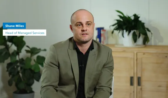
Digital transformation How Managed Services for GIS scales to meet your organisation’s strategic needs Shane Miles, Head of Managed Services at Esri Australia, explains what sets GIS-specific support apart and how organisations can choose a model that fits their current needs and future ambitions. Learn more
Digital transformation Building the networks of the future: Why integration, not isolation, will define modern infrastructure Explore how networks of the future are transforming infrastructure through integration, geospatial intelligence, and more informed, real-time decision-making. Learn more
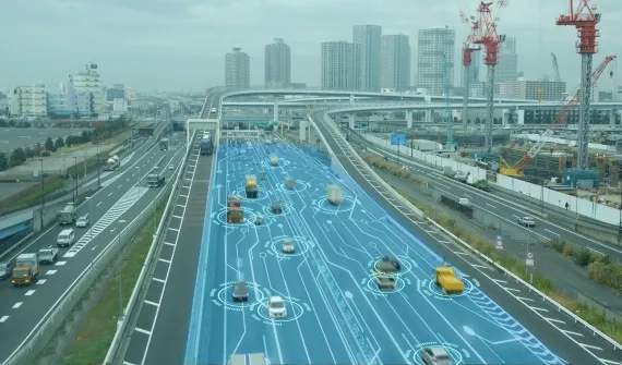
Digital transformation How digital twins, BIM-GIS integration, and geospatial AI are transforming Australian infrastructure Digital twins, GIS and AI are converging to help infrastructure owners plan, build and operate assets more safely, efficiently and resiliently across their lifecycle. Learn more
Digital transformation Solving the water sector’s toughest challenges with spatial intelligence Australia’s water utilities are juggling ageing infrastructure and growing customer expectations. Discover how location intelligence is bringing people, systems, and data together to help them adapt and thrive. Build smarter, more resilient networks with the power of spatial thinking. Learn more
Digital transformation Lessons learned from the CrowdStrike outage The CrowdStrike global outage demonstrated the critical importance of robust response plans and security measures for all business systems, including GIS. Learn more
Digital transformation Overcoming Australia’s geospatial skills deficit: Charting the future of GIS Australia is grappling with an emerging skills gap in geospatial technology that is costing businesses an estimated $3.1 billion annually and could reach 1,400 professionals. Learn more
Digital transformation Cloud transformation: Powering tomorrow’s success As GIS systems continues to grow in complexity and importance, how can organisations keep up? The answer may lie in the cloud. Learn more
Digital transformation Field operations just got smarter Introducing the revolutionary smart technology propelling small-cap miners to new heights and enabling a digitally transformation and optimisation of operations. Learn more
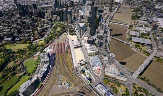
Digital transformation Digital Twin & GIS underpins Cross River Rail In Brisbane, Australia's fastest-growing city, a digital twin and a virtual reality program guide the design and construction of the Cross River Rail. Learn more
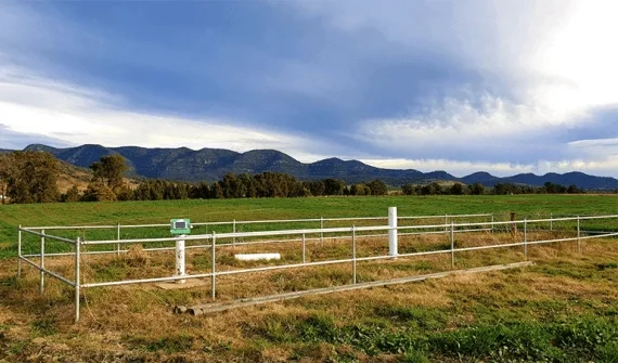
Digital transformation WaterNSW streamlines asset monitoring with unique application WaterNSW is using ArcGIS to capture and analyse critical field data to enhance asset performance and maintain reliable service delivery to its customers. Learn more
Digital transformation 6 essentials for your next GIS implementation Learn about and avoid common mistakes that slow down or derail the implementation of a new GIS. Learn more
Digital transformation APA's playbook for pipeline and gas utilities Discover how APA Group rapidly designed and deployed a whole-of-organisation geospatial platform creating instant access to data and insights - and for the first time, a consistent cloud-based approach. Learn more
Digital transformation How to transition your GIS team to work remotely COVID-19 has catalysed a global transition to remote work. Find out how your GIS team can make the transition to remote work a success in part one of the blog series. Learn more
Digital transformation How small councils achieve great things with GIS Small LGAs face challenges that their larger, usually urban counterparts do not. Yet, many are achieving outstanding results with their GIS capability through intelligent application of modern web GIS. Learn more
Digital transformation The essentials of managed cloud services Esri Australia's managed cloud services offers various packages for the deployment of your ArcGIS stack in the cloud. Learn more
Digital transformation The modern land parcel solution future-proofing South Australia's cadastre South Australia's Land Boundaries Group shares how an out-of-the-box technology solution has boosted their land parcel management productivity by up to 80%. Learn more
Digital transformation Top 5 mining geospatial tech trends A new wave of automation is improving worker safety, raising productivity, and reducing operational costs in Australia's mining operations. See how advanced geospatial technology is helping organisations improve efficiencies at all levels organisation-wide. Learn more
Digital transformation Next-generation emergency response Public safety team lead, Patrick Bell explains why getting resources out into the field is key to greater cost-savings and reducing response times. Learn more