
Across Australia, infrastructure leaders are being asked to solve a new kind of problem. They must maintain assets, but they also need to anticipate risk, scale networks, and make faster decisions in increasingly complex environments.
Energy demand is shifting. Climate pressure is intensifying. Networks are becoming more interconnected and more fragile. And in the middle of it all, one concept keeps surfacing: the digital twin.
But as the conversation matures, a more important question is emerging: What kind of digital twin do you actually need?
The digital twin conversation is evolving
For many organisations, digital twins began as a way to model individual assets, assess performance, predict failures, and improve engineering outcomes. That capability still matters. But today’s challenge is bigger. Leaders aren’t just asking: “Will this asset fail?”
They’re asking:
- “Where should we invest next?”
- “What risks are emerging across our entire network?”
- “How do we make decisions faster, with more confidence?”
This is where the distinction between physics-enabled digital twins and geospatial digital twins becomes critical.
Two lenses on the same network
The engineering lens: Physics-enabled digital twins
Physics-enabled digital twins go deep. They model how assets behave under real-world conditions, accounting for stress, load, weather, and structural dynamics.
They’re incredibly powerful for:
- Understanding failure risk
- Testing “what-if” scenarios
- Improving asset-level performance
Put simply, they answer the question: “What will happen to this asset?”
The systems lens: Geospatial digital twins
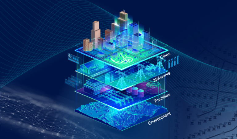
Geospatial digital twins step back and look across the entire network. They connect assets, environments, and systems through location, bringing together data that is often fragmented across organisations.
With platforms like ArcGIS from Esri, organisations can:
- See how assets relate to each other in real time
- Understand risk across regions and communities
- Align operational insight with strategic decision-making
They answer a different question: “What should we do next, and where?"
This network-wide visibility is powered by spatial intelligence, helping organisations understand how assets, people, places, and risks interact so they can make more informed infrastructure decisions.
Why this distinction matters now
Individually, both approaches are valuable. But across infrastructure, the real shift is that the challenge is no longer just understanding assets - it is understanding systems.
A single asset failure is rarely isolated. It has cascading impacts across networks, customers, and entire regions. This is what makes infrastructure decisions increasingly systemic, not localised.
That’s why organisations are moving toward geospatial digital twins as a foundation. Not because they replace engineering models, but because they provide the context those models depend on.
From insight to action: Why integration wins
Framing this as a choice between approaches misses the point. The most advanced organisations are doing both, but in different ways.
They are:
- Using physics-based models to generate deep, technical insight
- Using geospatial platforms to connect, interpret, and act on that insight
In practice, it looks like this:
- A risk is identified across the network
- Detailed modelling is applied where needed
- The results are fed back into a broader operational view
This creates something far more powerful than a model: a decision-making system.
What this means for infrastructure leaders
For executives and infrastructure leaders, this isn’t just a technology decision. It’s a mindset shift.
From modelling assets to orchestrating systems. From isolated insights to connected intelligence. From reactive decisions to proactive, data-driven strategy.
This is where platforms like ArcGIS play a critical role - not as another tool, but as the environment where decisions come together.
What this means for the future of infrastructure
The organisations that lead in the next decade won’t necessarily have the most detailed models. They’ll have the best understanding of how everything connects.
They’ll be able to:
- See risk before it escalates
- Prioritise investment with confidence
- Respond to change in real time
In other words, they’ll move from knowing more to deciding better.
The digital twin conversation is no longer about accuracy alone. It’s about context, connection, and consequence.
Physics-enabled models will continue to deepen understanding. But it’s geospatial digital twins that bring everything together, turning insight into coordinated, enterprise-wide action.
That’s what defines the true networks of the future.
To explore the full insights, sector case studies and practical guidelines, download the Get future-ready with spatial intelligence paper.