
The next phase of AI in government will not be measured by the number of demonstrations or pilots. It will be measured by whether agencies can use geospatial AI securely and responsibly to improve real operational decisions, grounding AI in trusted enterprise and spatial data and creating a clear path from insight to action. For government leaders facing constrained workforce capacity, the opportunity is to give skilled employees better evidence and more time to focus on the decisions where their expertise matters most.
Government is being asked to do more – with less room for error
Government leaders face a difficult combination of pressures. Budgets and workforce capacity are constrained. Infrastructure is ageing. Citizen expectations continue to rise. Climate impacts and emergency events are increasing operational complexity. At the same time, agencies must strengthen security, transparency and public trust.
Government does not lack expertise. It often lacks capacity. Skilled employees spend significant time finding information, reconciling different sources and repeating analysis before they can act. AI can create leverage by reducing this manual effort, making institutional knowledge easier and to access and giving public servants more time to focus on complex, higher-value work.
But the challenge is moving from an impressive pilot to a capability that can be trusted inside day-to-day government operations. Moving from an AI pilot to operational capability is not primarily a model problem. It is a data, context, governance and workflow problem.
Doing so is rarely about the AI model alone. Important information is often distributed across planning, asset, works, customer, environmental, emergency management and spatial systems. Different teams may hold different versions of the same asset, location or community. When the underlying information is fragmented, AI can produce faster answers without producing a more complete or reliable understanding.
This is why Australia’s policy for the responsible use of AI in government places emphasis on coordinated, accountable and transparent adoption, not experimentation detached from governance and public purpose.
AI needs trusted spatial context

AI can process information at unprecedented speed and scale, but its outputs are only as reliable as the data and context it receives. For government, much of that context is spatial.
People, assets, infrastructure, services, hazards and communities are connected by location. A road closure affects access to nearby services. A development application changes demand on surrounding infrastructure. A flood warning becomes operationally meaningful when agencies can identify which homes, roads, facilities and vulnerable communities may be affected.
Spatial context connects these relationships. It helps AI understand what is happening, where it is happening, what surrounds it, who may be affected and how conditions are changing. Without this context, AI may produce an answer that is technically plausible but operationally incomplete.
Spatial intelligence brings trusted enterprise and location-based information together, helping agencies move from isolated data and generic AI outputs towards a clearer understanding of real conditions and consequences. Geospatial AI applies AI and machine learning within this spatial context to detect patterns, analyse change, predict outcomes and support decisions about real places, assets and communities.
AI can accelerate the analysis, while spatial intelligence grounds that analysis in authoritative real-world context. AI-ready government is therefore not simply model-ready. It is data-ready, context-ready, governance-ready and action-ready.
Trusted decisions require responsible AI
For government, speed cannot come at the expense of accountability. Decisions may affect access to services, infrastructure investment, emergency response and outcomes for vulnerable communities. Agencies need to understand what informed an AI-assisted output, where its limitations lie and who remains accountable for the final decision.
Responsible AI must therefore be designed into the operating model from the beginning, not added after a pilot has already been selected or built. That includes authoritative data, transparent methods, appropriate security and privacy controls, clear human oversight and ongoing monitoring proportionate to the risk of the decision.
Esri and Microsoft both place human judgement at the centre of their responsible AI approaches. Esri’s commitments span security, privacy, transparency, fairness, reliability and accountability, while Microsoft’s principles include fairness, reliability and safety, privacy and security, transparency, accountability and inclusiveness. For agencies, these principles provide a foundation for adopting AI in a way that supports innovation while protecting public trust.
From fragmented information to a common operating picture
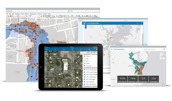
Government agencies already hold vast amounts of enterprise and spatial information. The problem is that it is often distributed across planning, infrastructure, asset, works, customer service and emergency management systems. Different teams may be looking at different information about the same asset, location, community or event.
The goal is not to create another specialist platform or AI silo. ArcGIS can extend authoritative spatial information into the analytics, collaboration and workflow environments government employees already use, including established Microsoft environments. This allows executives, analysts, operational teams and field workers to draw on consistent spatial context without requiring every user to become a GIS specialist.
A common operating picture gives agencies a shared understanding of what is happening, where conditions are changing, which people and assets may be affected and where action is required. It is not necessarily one enormous dashboard. It is a connected information environment in which different teams can work from authoritative data, understand dependencies and coordinate their response.
This becomes particularly valuable when issues cross organisational boundaries. Shared maps, operational views and workflows can help agencies and partners exchange trusted information, understand the same incident or location in context and coordinate action without requiring every participant to use the same specialist system.
The City of Raleigh demonstrates the operational value of this approach. By connecting live traffic-camera feeds with Microsoft Azure, NVIDIA AI and Esri technology, the city created real-time digital twins that give transportation engineers continuous visibility across busy intersections. The city estimates that improved traffic-signal timing could save commuters US$9.7 million in time and travel costs. It also reports that two transportation engineers can now undertake work that previously required significantly greater capacity.
This is the shift from connected data to operational intelligence: trusted enterprise and spatial information brought together so agencies can understand conditions, make decisions and coordinate action more effectively.
Where AI and spatial intelligence can make a difference today
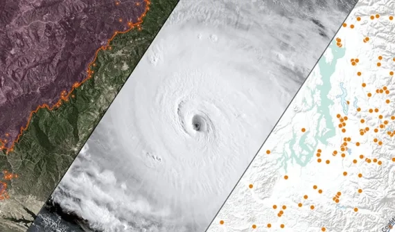
The opportunity is practical and already relevant across a wide range of government responsibilities.
Infrastructure and asset management
AI can help identify patterns in inspection records, imagery, sensor data and maintenance history. Spatial intelligence adds the asset’s location, surrounding conditions and network dependencies, helping agencies prioritise maintenance, direct field teams and assess the broader consequences of failure.
Planning and development assessment
Connected spatial data can help planning teams assess proposals against land use, transport, environment, infrastructure capacity and community context. AI may accelerate information discovery and routine analysis, while clear rules, authoritative data and human oversight remain central to defensible decisions.
Climate resilience and emergency management
Imagery, sensors, forecasts and historical information can help detect change and anticipate impacts. Spatial analysis connects those signals to communities, critical infrastructure and evacuation routes, giving emergency teams a clearer basis for prioritisation and coordination.
ALERT California demonstrates this in practice. Its network uses AI to identify smoke and other anomalies, while an ArcGIS Living Atlas layer provides access to more than 1,150 cameras and sensor arrays. Bringing this information into existing maps and applications can help emergency teams identify potential incidents earlier, understand unfolding conditions and make faster decisions when every minute matters.
Citizen services
Location can help agencies understand where demand is growing, where service access is uneven and how local conditions affect outcomes. AI can assist with triage, information retrieval and workload analysis; spatial intelligence helps ensure those decisions reflect the communities and places being served.
The strongest use cases begin with a real decision or workflow, not with a model looking for a problem.
How Esri and Microsoft support operational AI
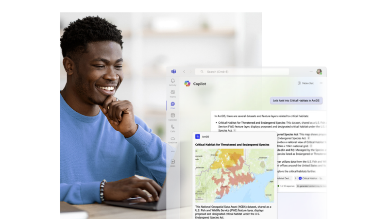
Turning connected information into operational decisions requires trusted technology, governance and workflows to work together.
Esri and Microsoft have collaborated for nearly four decades, with the partnership continuing to evolve across cloud, data, analytics, AI and productivity technologies. For government agencies, these complementary capabilities can help connect information, increase workforce capacity and move insight into the workflows where action occurs.
ArcGIS provides authoritative spatial information, geospatial AI and operational awareness across assets, infrastructure, services, communities and risk. Microsoft provides complementary enterprise capabilities for secure cloud, data, AI and collaboration. Together, they can connect enterprise information and AI with the real-world context needed to understand where conditions are changing, who may be affected and what action should follow.
The value of the partnership is not measured by the number of products or integrations. It lies in helping agencies build on existing investments and governance arrangements, extend trusted spatial intelligence into everyday workflows and move more efficiently from detecting change to understanding its implications, coordinating a response and measuring the outcome. For a broader executive perspective, explore how Esri and Microsoft are helping organisations build future-ready networks through connected enterprise data, spatial intelligence and AI.
These capabilities do not replace human judgement. In high-impact government decisions, accountability, explainability, data lineage, security, privacy and appropriate oversight remain essential. Technology should strengthen the evidence available to decision-makers while keeping people responsible for the decisions and outcomes that follow.
Five foundations of AI-ready government
Turning trusted information into operational decisions requires more than deploying an AI model. Five foundations help agencies move from isolated experimentation towards responsible and repeatable use:
- Trusted enterprise and spatial data: Establish authoritative enterprise and spatial data, clear ownership, appropriate access, traceable lineage and a shared understanding of what the information represents.
- Connected systems: Integrate information across business, operational and spatial environments so AI is not working from isolated datasets.
- A common operating picture: Combine current conditions with historical and spatial context so teams can understand what is changing, where attention is required and how an event may affect people, assets and services.
- Secure and responsible AI: Apply risk assessment, transparency, privacy, security, explainability, human oversight and ongoing monitoring in proportion to the decision being supported.
- Coordinated workflows that turn insight into action: Design how alerts, recommendations and analysis move into the tools, teams and cross-agency processes responsible for deciding and responding.
Agencies do not need to solve every foundation at enterprise scale before beginning. The appropriate starting point depends on the challenge. Some may begin with a focused innovation sprint to test how ArcGIS and Microsoft AI capabilities could improve one high-value workflow, with clear measures of success and a contained investment. Others may first need to assess whether their data, governance, security and operating environment are ready to support trusted Geospatial AI.
Both approaches can help agencies move forward with greater confidence: testing business value where the foundations are sufficient, or strengthening readiness where greater assurance is needed. A successful first engagement can then establish repeatable patterns for governance, integration, measurement and broader operational adoption.
From smarter technology to better community outcomes

The measure of AI-ready government is not how many pilots progress to production. It is whether operational capability improves outcomes for agencies and communities. That may mean faster access to services, better maintained infrastructure, more informed investment, earlier identification of risk, stronger emergency coordination or greater transparency around decisions. It may also mean giving public servants more time to apply expertise and judgement where they add the most value.
Spatial intelligence connects these outcomes to the places and people government serves. Microsoft technologies can connect enterprise data, AI and workflows, while ArcGIS connects those capabilities to authoritative information about real places and operational conditions. Together, they can help agencies move from isolated AI experiments to coordinated action, giving public servants clearer evidence, greater capacity and stronger coordination around the decisions that matter.
Confident decisions build future-ready networks. When agencies connect trusted data, spatial context and AI within secure enterprise workflows, they are better positioned to anticipate change, act with confidence and deliver better outcomes for communities.
Ready to explore what's possible? Book a 1:1 strategy session with Esri Australia and Microsoft experts to identify the right starting point for AI-ready government.