The next wave of workflow automation is creating greater efficiencies at the heart of mining enterprises.
A growing focus on using technology to improve worker safety, raise productivity, and reduce overall operational costs is seeing a surge in demand for advanced geospatial capabilities in mining operations.
Here are my top 5 geospatial technology trends for mining in 2018.
-
Automation for big time savings
Australia's mining industry has a long history of using automation technologies, such as autonomous vehicles and machinery as well as robotics, to extract minerals more efficiently and safely.
However, the new wave of automation is seeing GIS technology used to create efficiencies at the heart of the mining enterprise, by automating workflows.
Automation is possible across almost every geospatial process, from desktop scripting to enterprise server-based workflows. We’re also seeing image processing and analysis being automated – delivering significant productivity gains across organisations. For example, analysis and publication of drone imagery can be automated to ensure field data is in the hands of decision makers straight away.
-
Self-service data access for heightened productivity
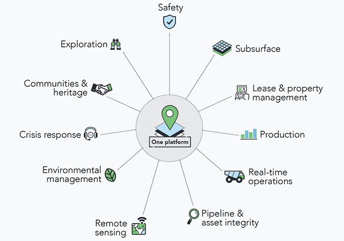
The new breed of enterprise GIS solution means resources companies are creating a ‘one-stop-shop’ for their geospatial information and services. Anyone can leverage and share spatial data and information using one platform – from any device, from anywhere in the world – drastically increasing adoption and transforming workflows.
-
Real-time GIS for real-time smarts
In the digital age, real-time analytics provides powerful competitive advantage. The consumption and visualisation of real-time data provides an essential view of what is currently occurring within the business, and assists with decision-making – whether it’s gauging the effectiveness of mine outputs, or assessing safety hazards based on temperature, pressure, flow rates and dust. GIS technology is taking this data from tables and visualising it on a map – providing added context.
GIS technology also has unique ‘geo-fencing’ functionality, which can assist with creating events and alerts that occur in real-time within specified locations, such as locating vehicles and staff as part of safety monitoring and reporting.
-
Spatial integration with asset management
While GIS technology may have earned its pedigree in asset management, a new spin on this traditional capability is shaking up the mining industry.
GIS now integrates with asset management programs like SAP Work Manager – which has exciting ramifications for areas like schedule optimisation and improved field mobility.
In terms of optimising workflows and maintenance schedules, GIS technology can reveal areas of clear efficiency gains within operations. For example, if a maintenance manager is travelling 100 kilometres along a train line to complete an unscheduled maintenance task they can quickly identify what other assets are due for maintenance nearby – while on the journey – to ensure they are completed at the same time. This reduces the need for multiple trips at different points in time. The manager gets to see how assets are connected spatially and how an activity on one asset may have an impact on another at nearby operations.
From the perspective of using GIS for predictive maintenance, there’s plenty of development around using machine learning to detect faults. Drones are a valuable tool to eliminate some health and safety issues while increasing operational efficiency, as they can perform rapid inspections in dangerous sites. Image analysis technology and machine learning can then be used to analyse the captured imagery and predict maintenance requirements. If you’d like to learn more about using drones, you may be interested in watching this pre-recorded webinar on how to transform your organisational productivity using drones.
-
Integrating information for richer insights
Integration is at the heart of many of these new technology trends, whether it’s connecting with asset management systems, business intelligence applications – or even simply integrating the presentation of data. For example, we worked with one client who was using Spot and Navman to track field staff. The manager had to log into each disparate system to get a view of their staff on top of a generic basemap. We worked with them to pull the feeds into a single application using their own basemap, and then enriched this with additional contextual information such as drill holes, weather feeds and vehicle tracking, to deliver the full picture.
Looking to find those small and large gains I have been working with many clients that are seeking to discover the same benefits through integrating their existing business applications – and without costly capital expenditure. In fact many clients have been exploring established application integration patterns from outside the mining industry for new ways of doing things. While others are applying the simplicity of using geography as an integrator.
So that’s my round-out of the top 5 trends underpinning the digital transformations of mining companies. While I’ve focused this blog on my observations in Australia, these trends have global relevance as mining companies worldwide seek new ways to innovate and drive efficiencies, in an environment where capital is increasingly constrained and human resources are scarce.
If you’d like to learn more about how new technology advancements can support your mining organisation, or further information on any of these topics, feel free to get in touch.