
Commercial organisations do not need another disconnected system. They need the systems they already rely on to work together, so decision-makers can see how customers, assets, operations, opportunity and risk connect in the real world.
Building future-ready networks requires more than connected technology. It requires organisations to connect data, people and decisions across the enterprise. As explored in building future-ready networks through spatial intelligence and Microsoft's enterprise platform, the opportunity is to use existing investments more effectively, extend trusted spatial intelligence into everyday workflows and move faster from enterprise data and insight to operational action.
The integration problem is no longer just technical
Commercial organisations have invested heavily in the platforms that run their businesses: enterprise resource planning, customer relationship management, property and asset management, operational technology, Internet of Things systems, analytics platforms and cloud data estates.
Each system may perform its own job well. The difficulty emerges when a decision crosses system boundaries, as commercial decisions increasingly do. A retailer assessing a store network may need customer, lease, sales, supply-chain and maintenance data. An insurer evaluating portfolio exposure may need to connect policy and claims information with property characteristics, hazards and changing environmental conditions. A mining operator may need operational, asset, workforce and environmental information from sites spread across vast distances.
When those datasets remain separated, teams spend time reconciling different views of the business. Analysis is duplicated. Important relationships are harder to detect. Decision-makers may receive multiple dashboards without gaining a shared understanding of what is happening, where it is happening and why it matters.
This is where location changes the integration conversation. Customers, stores, properties, mines, assets, supply routes, hazards and events all exist somewhere. Location provides a common reference point that can connect information organised in different ways across different systems.
What is geospatial data integration?
Geospatial data integration connects business and operational information through the shared context of location and spatial relationships. Rather than analysing spatial data separately, it brings information about customers, assets, risks, events and environments into the wider enterprise data ecosystem, helping teams understand where they are, how they relate and what is changing around them.
For commercial organisations, this can connect information held across ERP, CRM, property, asset management, IoT and analytics platforms through the common context of location.
Geospatial data integration for a connected enterprise
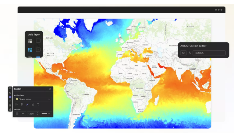
The aim is not to replace the enterprise platforms that already run the business. It is to make existing investments more valuable together.
ArcGIS provides a spatial intelligence layer across the technology environment, connecting business, operational and external information through location and spatial relationships. Microsoft provides complementary enterprise capabilities spanning cloud, data, analytics, AI and productivity. Together, these technologies can connect authoritative spatial information with the systems and workflows organisations already use.
This approach is already visible in practical workflows. ArcGIS for Microsoft 365 can bring mapping and spatial analysis into familiar environments such as Excel, SharePoint and Teams, while other ArcGIS integrations can connect spatial intelligence with enterprise data, analytics and automation workflows. This allows location-based insight to become part of the wider information environment rather than remaining within a specialist system.
The principle is more important than any one integration: spatial insight should be available in the systems and workflows where people already analyse, collaborate and act. This can help operational teams, analysts and executives work from a more consistent view of the organisation.
The goal is not to add another silo. It is to help the systems that run the business work better together. The next integration advantage will not come from forcing every dataset into a single system. It will come from creating enough shared context for people to make better decisions across the systems they already use.
One integration challenge, four commercial contexts

The information varies by industry, but the underlying problem is remarkably consistent.
Commercial real estate
Property leaders may hold lease, facilities, sustainability, occupancy and asset data in separate platforms. Connecting those sources through location can create a more authoritative portfolio view – supporting site and portfolio planning, facilities management, sustainability reporting and tenant experience without requiring every dataset to be rebuilt in a new system.
Insurance
Risk does not sit neatly within a policy or claims system. It changes by place and over time. Connecting customer, policy, claims, property and environmental information through location can help insurers understand geographic exposure and accumulation, identify emerging risk, prioritise response and make more informed underwriting, portfolio and claims decisions.
Mining
Mining operations span sites, pits, processing facilities, transport routes and surrounding environments. A shared spatial context can connect asset, operational, field and environmental information across that footprint – improving visibility, coordinating field activity and helping teams understand how changing conditions may affect safety, performance, compliance and risk.
Retail
Retail decisions draw on store, customer, property, supply-chain, maintenance and sustainability information. Adding spatial intelligence to this existing ecosystem can strengthen site selection and portfolio optimisation, reveal gaps in network coverage, improve supply-chain and field visibility, and help teams respond faster when local conditions affect stores or customers.
Different sectors, same decision challenge: understand what is happening, where it is happening and how it relates to everything else.
Moving beyond maps – from integration to intelligence

Many organisations have already taken the first step: they can display assets, customers or activity on a map. But visualisation alone does not create a connected enterprise. Greater value emerges as spatial capability matures across four stages:
- Foundations: Establish trusted location, customer and asset data, with clear ownership and governance.
- Integration: Connect spatial information with enterprise systems and make it accessible through everyday workflows.
- Insight: Analyse geographic relationships, patterns, risk and opportunity across previously separated datasets.
- Real-time intelligence and AI: Interpret changing conditions continuously, automate appropriate responses and support faster decisions with richer context.
This progression does not require a single, enterprise-wide transformation. It can begin with one decision or workflow where fragmented information is creating delay, duplication or avoidable risk. A focused integration can prove value, establish governance and create a repeatable pattern for other parts of the organisation.
A connected spatial environment also creates a stronger foundation for AI. AI becomes more useful for commercial decisions when it is grounded in trusted enterprise and spatial data. Authoritative ArcGIS content, combined with clear data ownership, enterprise governance and permission-aware access, can help AI understand where customers, assets, risks and events are located, how they relate and what is changing around them. Explore how spatial intelligence can help organisations move from AI pilots to AI-ready operations.
Turning existing investments into greater business value
For senior leaders, the case for integration is not about connecting technology for its own sake. It is about improving how the organisation operates and decides. Connected spatial intelligence can help commercial organisations:
- Reduce duplication by reusing information held across enterprise systems instead of repeatedly recreating analysis.
- Accelerate decisions by bringing business, operational and location information into a shared context.
- Identify growth opportunities by revealing geographic patterns in customer demand, market coverage, portfolio performance and emerging need.
- Improve asset and portfolio performance through clearer visibility of properties, stores, facilities, mines and distributed assets.
- Strengthen resilience by showing how hazards, incidents and changing conditions intersect with customers, assets and operations.
- Improve frontline execution by carrying enterprise insight into maps, applications and field workflows.
- Create a trusted foundation for AI and automation by connecting authoritative enterprise and spatial data with geographic relationships, governance and real-world context.
The result is not simply a better map or dashboard. It is a more connected operating picture, one that helps people across functions make decisions with greater speed, consistency and confidence.
Enterprise technology, with spatial context
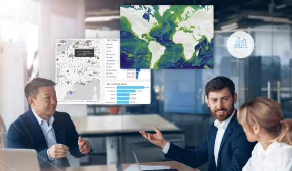
Esri and Microsoft have collaborated for nearly four decades, with the partnership continuing to evolve across cloud, data, analytics, AI and productivity technologies.
ArcGIS provides the spatial intelligence that connects customers, assets, operations, opportunities and risks through location. Microsoft provides complementary enterprise capabilities across cloud, data, analytics, AI and productivity. Together, these technologies can help commercial organisations build on established investments, extend trusted spatial insight into everyday workflows and create a stronger foundation for AI and automation.
One example is ArcGIS GeoAnalytics for Microsoft Fabric, which brings Esri's spatial analytics into Fabric data engineering and data science workloads. Other integrations support mapping and spatial analysis in Microsoft 365 and connect ArcGIS content with enterprise automation workflows. These are different expressions of the same principle: location should form part of the enterprise information flow, not be added as a specialist output at the end.
This matters because future-ready commercial organisations will not be defined by the number of systems they deploy. They will be defined by how effectively their data, systems and people work together.
Commercial networks are increasingly distributed, dynamic and interdependent. Customers move, risk changes, assets age, supply chains are disrupted and markets evolve differently from one location to the next. Spatial intelligence provides the connective context needed to understand these changes across customers, assets and operations.
By connecting ArcGIS with Microsoft and other enterprise technologies, organisations can use existing investments more effectively, extend trusted spatial intelligence into more workflows and move faster from enterprise data and AI insight to operational action. That is how fragmented information becomes a shared operating picture and reactive decisions become more confident, future-ready action.
Confident decisions build future-ready networks.
Ready to explore what's possible? Book a 1:1 strategy session with Esri Australia and Microsoft experts to identify where spatial intelligence can unlock greater value across your commercial operations.