
A network alarm can show that something has gone wrong. It cannot always show the full operational consequence: which assets and services are affected, which customers are at risk, what is happening around the incident or where response teams should act first. For telecommunications providers, that missing context can turn a local fault into a much wider operational challenge.
Real-time spatial intelligence closes that gap. By connecting live network events with authoritative information about assets, customers, field activity and surrounding conditions, it gives decision-makers a shared operational view of what is happening, where it is happening and what should happen next. The result is not simply greater visibility. It is a stronger ability to anticipate disruption, coordinate action and protect service continuity.
Resilience requires more than network visibility
Telecommunications networks are becoming more distributed, software-driven and operationally complex. At the same time, providers face rising expectations for availability, faster restoration and clearer customer communication. The network operations centre may have extensive monitoring data, yet the information required to interpret an incident can still sit across operational support systems, asset registers, customer platforms, field applications and external data sources.
Each system may provide part of the answer. An alarm identifies a change in performance. An asset record describes the infrastructure involved. Customer data indicates the potential service impact. Weather, fire, flood or transport information may reveal access constraints and emerging risk. When teams must assemble these elements manually, responses can slow at the point when a clear and coordinated decision matters most.
A spatial intelligence platform provides a connective layer across this environment. ArcGIS can relate network, operational, customer and environmental data through location, creating a common operational picture without requiring every source system to be replaced. This allows teams to move beyond seeing isolated alerts and understand an event in its real-world context.
As explored in the article about building future-ready networks through spatial intelligence and Microsoft's enterprise platform, future-ready organisations use their existing technology investments more effectively, extend trusted spatial intelligence into everyday workflows and move faster from enterprise data and insight to operational action. For telecommunications providers, that capability becomes especially important when conditions change by the minute and every delay can increase service, safety and reputational impacts.
Turn live network events into operational decisions
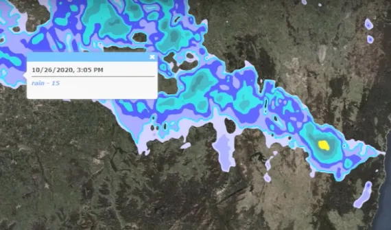
Real-time resilience begins with a reliable view of the current network state, but its value comes from the decisions that view enables. When live feeds are connected with authoritative network and spatial information, providers can establish a more consistent operational sequence: detect change, understand impact, prioritise action, coordinate response and learn from recovery.
For example, a map-based operational view can help teams locate faults and outages, identify the infrastructure and services connected to them, estimate which customers or communities may be affected and assess nearby hazards or access limitations. Incidents can then be prioritised according to likely consequence, rather than treated as a flat queue of technical alerts.
This matters during both widespread disruption and day-to-day operations. During a severe weather event, teams may need to understand which sites are exposed, which routes remain accessible and where backup capacity or field resources should be directed. During routine network degradation, the same approach can reveal clusters, dependencies and downstream impacts that are difficult to identify in tables alone.
The purpose is not to create another monitoring screen. It is to give network operations, field teams and decision-makers the same spatial record of the situation, so they can act from shared and governed information.
Connect the network operations centre with the field
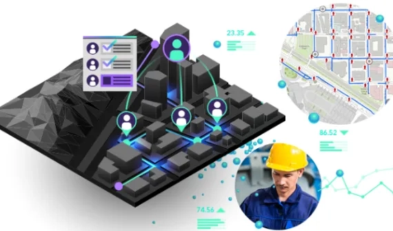
A resilient network is not restored by one control room. It depends on people across operations, engineering, asset management, customer service and the field working from a consistent understanding of conditions and priorities.
Location intelligence helps information move in both directions. Operational teams can provide crews with current network assignments, asset details, hazards and access information in a geographic view. Field teams can capture observations, damage assessments, photographs and work status at the point of activity, improving the currency of the operational picture for everyone else.
This connection reduces reliance on delayed handovers and fragmented updates. It can also support clearer customer and executive communication because service impacts and restoration progress are grounded in the same underlying view. Instead of different teams maintaining competing versions of the event, the organisation can coordinate around one shared picture of the network and the response.
Move from reacting to disruption to anticipating risk
Responding faster is important, but real-time intelligence creates greater strategic value when it is combined with historical spatial analysis. Patterns across previous incidents, maintenance records, network performance and external hazards can show where resilience is repeatedly being tested and where intervention may have the greatest effect.
Telecommunications providers can use this combined view to:
- Recurring vulnerabilities. Identify recurring faults and vulnerable assets or routes.
- Performance and demand. Understand geographic patterns in congestion, degradation and service demand.
- External risk. Assess exposure to bushfire, flood, heat and other hazards.
- Telecommunications asset management. Target preventive maintenance, inspections and field activity where they can reduce risk and disruption.
- Investment priorities. Direct capacity, redundancy and capital investment towards the greatest resilience gaps.
This shifts resilience from an incident response activity to a continuous management discipline. Live information helps the provider respond to what is changing now; historical and predictive analysis helps it decide what to strengthen next. Over time, each operational event becomes an opportunity to improve planning, asset strategy and network design.
Explore how location intelligence supports telecommunications network planning, operations and asset management across the network lifecycle.
Scale spatial intelligence across the enterprise with Esri and Microsoft
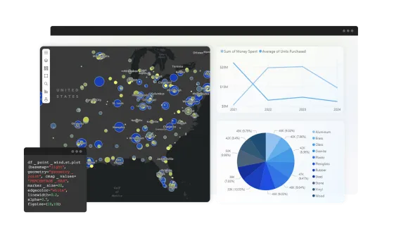
The operational picture becomes more valuable when it connects with the wider enterprise environment rather than operating as another specialist system.
Esri and Microsoft have collaborated for nearly four decades, with the partnership continuing to evolve across cloud, data, analytics, AI and productivity technologies. For telecommunications providers, these complementary capabilities can help connect real-time operational intelligence with the broader data and workflows used across the organisation.
ArcGIS provides the spatial intelligence that relates network, asset, customer, workforce and environmental information to place. Microsoft provides complementary enterprise capabilities across cloud, data, analytics, AI and productivity. Together, these technologies can bring authoritative network and location information into established analytics, collaboration and workflow environments.
This allows technology leaders to build on existing investments and governance arrangements rather than introduce another disconnected platform. It also helps operational leaders extend trusted spatial insight to more teams and move faster from a change in the network to coordinated action.
The value is not measured by the number of products or integrations involved. It lies in connecting the enterprise information and real-world operational context needed to make faster, more confident network decisions.
Vodafone: A connected view of network conditions
View the Esri UK video below to see how Vodafone’s digital twin guides decision making.
Vodafone offers a practical example of the value of seeing a telecommunications network in context. The provider created a high-resolution geospatial digital twin of its network across Britain, using GIS to bring infrastructure, the built environment and signal propagation into a shared view. Engineers can use the model to support virtual site visits, maintenance, upgrades and capacity planning, including assessing how new development may affect future demand and coverage.
The significance is not the 3D model alone. It is the ability to make network decisions using a connected understanding of infrastructure, signal conditions, demand and place. That same principle underpins real-time resilience: when teams can see network conditions in context, they can plan more effectively, identify potential impacts earlier and act with greater confidence.
Confident decisions build resilient networks
Telecommunications networks will only become more connected, complex and critical. Resilience will increasingly depend on how quickly providers can turn changing network conditions into shared understanding and coordinated action.
By connecting real-time network information with authoritative spatial context, providers can understand operational impacts sooner, direct people and resources more effectively, communicate from a common picture and use every incident to strengthen future performance.
ArcGIS and Microsoft technologies can support this shift by helping providers build on existing investments, extend trusted spatial intelligence into enterprise workflows and move faster from network insight to operational action.
Confident decisions build future-ready networks.
Ready to explore what's possible? Book a 1:1 strategy session with Esri Australia and Microsoft experts to identify opportunities to strengthen resilience across your telecommunications network.