You are here News & Events Blogs Esri Australia blog Esri Australia blog AllEsri techData-driven decisionsDigital transformationDisruptive innovationGIS in Education Data-driven decisions Satellite imagery and the search for MH370 debris When the Malaysian Airlines flight MH370 was determined by authorities to have crashed into the ocean the same question was asked repeatedly: could satellites help find the crash site? Learn more Data-driven decisions Drones in agriculture - how to get started Getting the best results from drones on a farm depends on the desired outcomes and the type of sensors mounted on the drone. Before starting, it pays to find answers to the most common questions about using drones and satellite imagery in agriculture. Learn more Data-driven decisions Geoscience Australia releases MH370 search data Story Map The search for Malaysia Airlines flight MH370 mapped more than 700,000 square kilometres of seafloor. Data from phase one of the search is now available to the public through an interactive Story Map. Learn more
Data-driven decisions Satellite imagery and the search for MH370 debris When the Malaysian Airlines flight MH370 was determined by authorities to have crashed into the ocean the same question was asked repeatedly: could satellites help find the crash site? Learn more
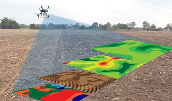
Data-driven decisions Drones in agriculture - how to get started Getting the best results from drones on a farm depends on the desired outcomes and the type of sensors mounted on the drone. Before starting, it pays to find answers to the most common questions about using drones and satellite imagery in agriculture. Learn more
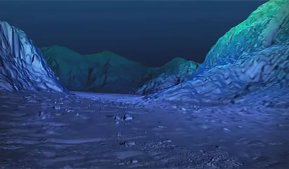
Data-driven decisions Geoscience Australia releases MH370 search data Story Map The search for Malaysia Airlines flight MH370 mapped more than 700,000 square kilometres of seafloor. Data from phase one of the search is now available to the public through an interactive Story Map. Learn more