You are here News & Events Blogs Esri Australia blog Esri Australia blog AllEsri techData-driven decisionsDigital transformationDisruptive innovationGIS in Education Digital transformation How small councils achieve great things with GIS Small LGAs face challenges that their larger, usually urban counterparts do not. Yet, many are achieving outstanding results with their GIS capability through intelligent application of modern web GIS. Learn more Data-driven decisions Where Australia imports its food from: world map Next time you look at your plate, you might ask "where does my food come from?" Thanks to location-based analytics, you can search this world map to find out where Australia imports food from. Learn more Data-driven decisions The role of 3D data in emergency response The use of three-dimensional (3D) data, combined with other spatial data may hold the key to the future of emergency calls - but are Australian authorities harnessing its full potential? Learn more Data-driven decisions How mapping technology can help catch killers Mike King outlines how investigators can use Geographic Information System (GIS) technology to combine location-based data, public information and suspect profiling data, to help catch killers. Learn more Data-driven decisions Combatting drug-related deaths with GIS US authorities are using location intelligence to report drug activity, educate the community, promote treatment options and understand the effectiveness of response activities. Learn more Data-driven decisions How mapping technology is helping solve crimes Emergency services expert Mike King shares how one US law enforcement agency used real-time GIS applications to manage the search of a large-scale crime scene in a missing persons case. Learn more Data-driven decisions GIS and data science: two sides of the same coin If data scientists analyse data to uncover insights that help improve bottom lines, then what have GIS professionals been doing for years? Learn more Data-driven decisions Geoscience Australia releases MH370 search data Story Map The search for Malaysia Airlines flight MH370 mapped more than 700,000 square kilometres of seafloor. Data from phase one of the search is now available to the public through an interactive Story Map. Learn more Data-driven decisions Find out where Australia imports its food from Does Australia get more meat from New Zealand or the Netherlands? This interactive map shows you where we import our food from, so you can make more informed decisions relating to what ends up on your plate. Learn more
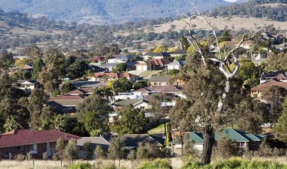
Digital transformation How small councils achieve great things with GIS Small LGAs face challenges that their larger, usually urban counterparts do not. Yet, many are achieving outstanding results with their GIS capability through intelligent application of modern web GIS. Learn more
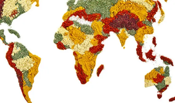
Data-driven decisions Where Australia imports its food from: world map Next time you look at your plate, you might ask "where does my food come from?" Thanks to location-based analytics, you can search this world map to find out where Australia imports food from. Learn more
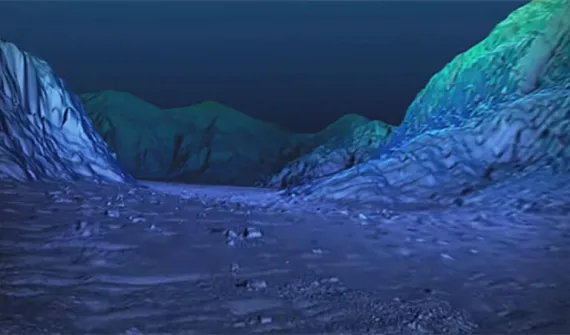
Data-driven decisions The role of 3D data in emergency response The use of three-dimensional (3D) data, combined with other spatial data may hold the key to the future of emergency calls - but are Australian authorities harnessing its full potential? Learn more
Data-driven decisions How mapping technology can help catch killers Mike King outlines how investigators can use Geographic Information System (GIS) technology to combine location-based data, public information and suspect profiling data, to help catch killers. Learn more
Data-driven decisions Combatting drug-related deaths with GIS US authorities are using location intelligence to report drug activity, educate the community, promote treatment options and understand the effectiveness of response activities. Learn more
Data-driven decisions How mapping technology is helping solve crimes Emergency services expert Mike King shares how one US law enforcement agency used real-time GIS applications to manage the search of a large-scale crime scene in a missing persons case. Learn more
Data-driven decisions GIS and data science: two sides of the same coin If data scientists analyse data to uncover insights that help improve bottom lines, then what have GIS professionals been doing for years? Learn more
Data-driven decisions Geoscience Australia releases MH370 search data Story Map The search for Malaysia Airlines flight MH370 mapped more than 700,000 square kilometres of seafloor. Data from phase one of the search is now available to the public through an interactive Story Map. Learn more
Data-driven decisions Find out where Australia imports its food from Does Australia get more meat from New Zealand or the Netherlands? This interactive map shows you where we import our food from, so you can make more informed decisions relating to what ends up on your plate. Learn more