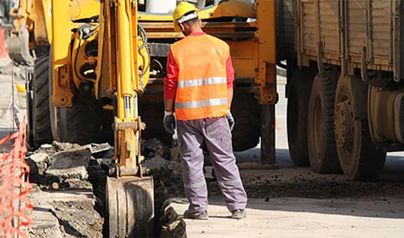
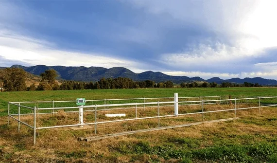
You are here News & Events Blogs Esri Australia blog Esri Australia blog AllEsri techData-driven decisionsDigital transformationDisruptive innovationGIS in Education Digital transformation WaterNSW streamlines asset monitoring with unique application WaterNSW is using ArcGIS to capture and analyse critical field data to enhance asset performance and maintain reliable service delivery to its customers. Learn more Disruptive innovation GIS tech trends - 2018 review and 2019 forecast In this annual review and forecast, Peter Gill looks back at 2018 - an awesome year in the geospatial industry - and gives us his highlights on the emerging technology capabilities and products to watch in 2019. Learn more Digital transformation An open platform one-call solution A new one-call solution maintains data security, keeps an audit trail and leverages an open platform to drive innovation in underground asset protection solutions. Learn more Data-driven decisions Scalable solutions for smarter referral services A scalable solution helps protect Australia's $340 billion worth of underground assets and field nearly two million enquiries. Learn more Digital transformation Next-gen underground asset protection The first of a three-part series detailing the journey to develop a solution for underground asset protection using an enquiry-first service that builds on spatial data discovery and sharing. Learn more Data-driven decisions How data collaboration empowers citizens Across Australia, local governments are looking to maximise communication, collaboration and data-sharing to create more liveable, sustainable and smart communities. Learn more Digital transformation How to optimise utility asset value with GIS Location-based analytics plays a key role in helping organisations optimise their network infrastructure management. Find out how a business process called reliability-centred maintenance is driving the success of utilities around the world. Learn more Disruptive innovation SmarterWX 2.0 release tips and tricks The release of SmarterWX 2.0 includes enhancements to streamline public works planning, such as Live Connect, Planiter integration and a software developers' API. In this overview of what's new Gary Johnson shares tips to help get the most out of the platform. Learn more Digital transformation Utility network modelling with ArcGIS 10.6 The new Utility Network Management extension brings advanced support for utilities to model, view, manage and analyse networks, preparing for real-world events and resulting in more efficient network management. Learn more Digital transformation 3 steps for digital transformation in utilities Esri utilities industry team manager Bill Meehan outlines the steps Australian utility companies should take to face the challenges of digital transformation. Learn more Digital transformation Esri Young Scholar Award winner: bridging gap between theory and practice Queensland University of Technology research assistant and third-year B.Sc student Alan Pearse developed IDW-Plus, an ArcGIS tool to calculate land use impact on stream health. Learn more Disruptive innovation Driving through roadblocks with GIS innovation Asset managers are using GIS technology to share data and collaborate on public works, leading to less disruption and reduced costs. Learn more Digital transformation Collaborative GIS technology streamlines city works With the launch of Smarter Planning Perth, Western Australia is at the forefront of using GIS technology to streamline processes, leading to a future of collaborative, efficient public works. Learn more Disruptive innovation 3D GIS technology: Australia's renewable energy future 3D GIS technology is helping a team from ANU map potential sites for a carbon-free renewable energy solution using a pumped hydro model that relies on wind and solar photovoltaic energy. Learn more Disruptive innovation If you're not using GIS mobile apps, you're not working efficiently The concepts of real-time and mobility are key to creating integrated systems and achieving connectivity. This has made GIS mobile apps a valuable and versatile tool for the evolving modern company. Learn more Digital transformation Geo-enable your organisation with an open platform More businesses are asking the question: 'How can we successfully geo-enable our whole organisation using an open platform, while working with an already complex mix of enterprise systems?' The answer is here. Learn more
Digital transformation WaterNSW streamlines asset monitoring with unique application WaterNSW is using ArcGIS to capture and analyse critical field data to enhance asset performance and maintain reliable service delivery to its customers. Learn more
Disruptive innovation GIS tech trends - 2018 review and 2019 forecast In this annual review and forecast, Peter Gill looks back at 2018 - an awesome year in the geospatial industry - and gives us his highlights on the emerging technology capabilities and products to watch in 2019. Learn more
Digital transformation An open platform one-call solution A new one-call solution maintains data security, keeps an audit trail and leverages an open platform to drive innovation in underground asset protection solutions. Learn more
Data-driven decisions Scalable solutions for smarter referral services A scalable solution helps protect Australia's $340 billion worth of underground assets and field nearly two million enquiries. Learn more
Digital transformation Next-gen underground asset protection The first of a three-part series detailing the journey to develop a solution for underground asset protection using an enquiry-first service that builds on spatial data discovery and sharing. Learn more
Data-driven decisions How data collaboration empowers citizens Across Australia, local governments are looking to maximise communication, collaboration and data-sharing to create more liveable, sustainable and smart communities. Learn more
Digital transformation How to optimise utility asset value with GIS Location-based analytics plays a key role in helping organisations optimise their network infrastructure management. Find out how a business process called reliability-centred maintenance is driving the success of utilities around the world. Learn more
Disruptive innovation SmarterWX 2.0 release tips and tricks The release of SmarterWX 2.0 includes enhancements to streamline public works planning, such as Live Connect, Planiter integration and a software developers' API. In this overview of what's new Gary Johnson shares tips to help get the most out of the platform. Learn more
Digital transformation Utility network modelling with ArcGIS 10.6 The new Utility Network Management extension brings advanced support for utilities to model, view, manage and analyse networks, preparing for real-world events and resulting in more efficient network management. Learn more
Digital transformation 3 steps for digital transformation in utilities Esri utilities industry team manager Bill Meehan outlines the steps Australian utility companies should take to face the challenges of digital transformation. Learn more
Digital transformation Esri Young Scholar Award winner: bridging gap between theory and practice Queensland University of Technology research assistant and third-year B.Sc student Alan Pearse developed IDW-Plus, an ArcGIS tool to calculate land use impact on stream health. Learn more
Disruptive innovation Driving through roadblocks with GIS innovation Asset managers are using GIS technology to share data and collaborate on public works, leading to less disruption and reduced costs. Learn more
Digital transformation Collaborative GIS technology streamlines city works With the launch of Smarter Planning Perth, Western Australia is at the forefront of using GIS technology to streamline processes, leading to a future of collaborative, efficient public works. Learn more
Disruptive innovation 3D GIS technology: Australia's renewable energy future 3D GIS technology is helping a team from ANU map potential sites for a carbon-free renewable energy solution using a pumped hydro model that relies on wind and solar photovoltaic energy. Learn more
Disruptive innovation If you're not using GIS mobile apps, you're not working efficiently The concepts of real-time and mobility are key to creating integrated systems and achieving connectivity. This has made GIS mobile apps a valuable and versatile tool for the evolving modern company. Learn more
Digital transformation Geo-enable your organisation with an open platform More businesses are asking the question: 'How can we successfully geo-enable our whole organisation using an open platform, while working with an already complex mix of enterprise systems?' The answer is here. Learn more