I get lots of calls and emails asking me about drones. Many people tell me they have recently purchased a drone and a camera and I would like to use it for farming applications. They ask: “How do I get started?” and “How can I make effective use of this investment?”
One of the first questions I ask in return is about the nature of the sensor on board the unmanned aerial vehicle (UAV).
This is often the key to what can be done with the drone. Many agricultural applications rely on the quality of spectral and spatial resolution of the camera on board.
Technically the UAV can be mounted with any type of sensor, such as an RGB camera, infrared camera, multispectral/hyperspectral cameras and even thermal, LIDAR and radar sensors.
The reason to use one or the other is essentially a function of the task at hand (what information is needed) and economic expectations (return on investment).
My first response is to provide preliminary answers to questions on what can be achieved with each of these sensors in a more practical sense: what are the pros and cons of the sensors and how they can help farmers make beneficial decisions.
But on second thoughts, finding a solution can often involve a lengthy discussion on sensor characteristics, bio-physical parameters the sensor is intended to measure, cost/benefit analysis and many other factors.
In my view, a better way to address the question is to identify the type of information a farmer (or a collective) wants to obtain from such a system, then stipulate what is required, from a hardware and software perspective. In other words, find a solution to the farmer’s specific requirements.
The key questions that most farmers ask can be broken down to the following topics. While they are not exhaustive, I think they are representative of the common problems that need to be solved.
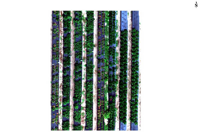
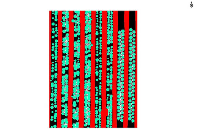
I have a huge orchard with a large number of citrus trees. I want to automatically count exactly how many trees I have; I just can’t do it manually.
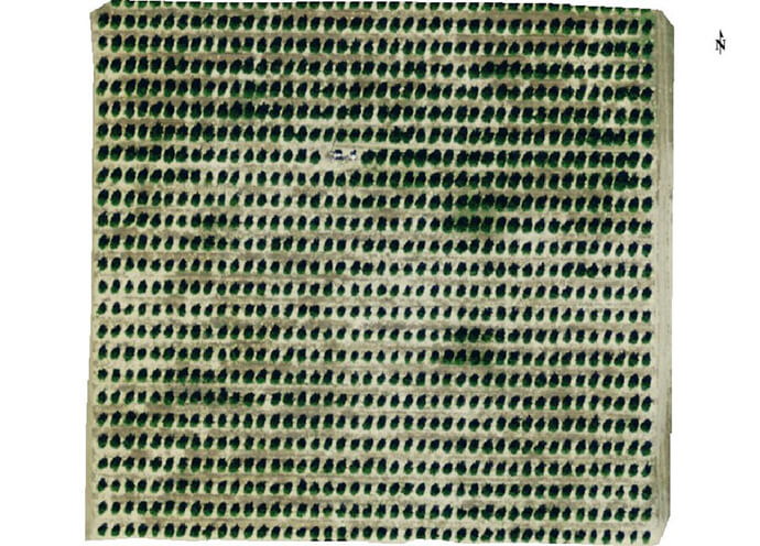
In addition to the tree count, I would also like to see the position and size of individual plants in a field, for increased accuracy of yield predictions.
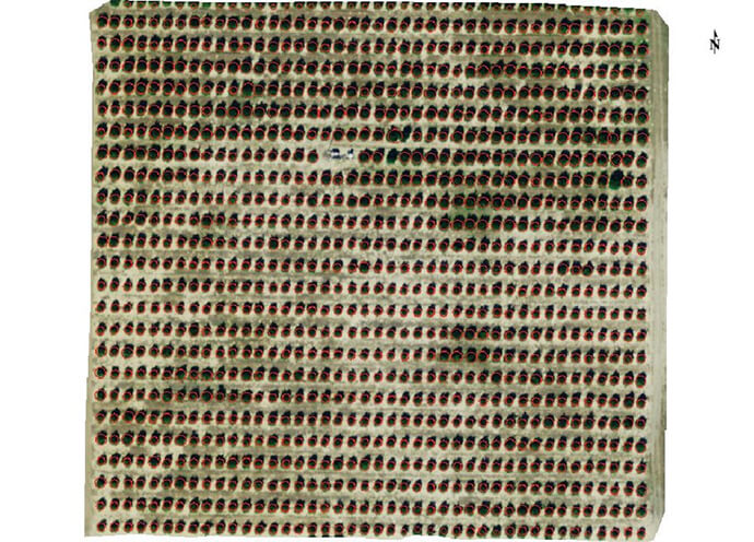
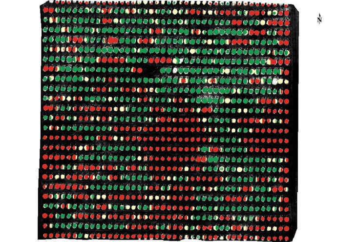
How can I see the health of individual trees in my orchard?
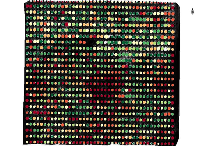
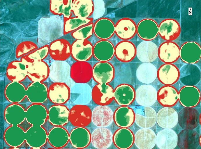
I would like to do crop scouting to help me analyse which zones of a large field may require attention.
I have a large strawberry farm where the plants lie low to the ground and overlap – can I use drone imagery for an accurate plant count and health information?
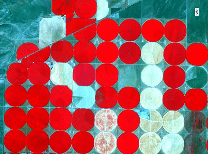
My large farm uses pivot irrigation for broad acre crops and I would like to use satellite imagery to monitor crop health. How can I see which part of the farm needs attention, be it water, fertiliser or weed infestation?
When you’ve identified the information you need to know, you can ensure your UAV is mounted with the relevant sensors to achieve the right outcome.
And once you have the imagery, you can use applications and tools that help you quickly analyse the images – for example, counting crops over large areas and monitoring health of individual plants to help make smarter decisions on crop inputs such as fertilizer or pest control. Accuracy is key to productive outputs.
If you’d like to know more getting started using drones and satellite imagery in agriculture, call 1800 870 750 or send me an email.