Since 2014, the ACT Parks and Conservation Service (ACT Parks) has been using smart mapping to manage invasive plant and animal species. Steve Taylor, Manager for the Invasive Plants Control Program, reveals how the system has evolved alongside the latest spatial tech.
Maps play an essential role in effectively managing invasive plant and animal species. They lay the groundwork for all basic monitoring systems and enable coordination of joint control work, tracing the spread of early invaders, identifying priority areas, reporting to stakeholders, and ensuring follow-up control measures are not overlooked.
In short, if you don’t map it, you can’t manage it.
Mapping can be as simple as annotated topographic maps and as sophisticated as advanced Geographic Information Systems (GIS). Before 2014, at ACT Parks, mapping of control work was haphazard. Staff with GIS skills used desktop-based systems, while many contractors, staff and volunteers relied on annotated topographic maps. The lack of a consistent approach meant work was often not recorded, paper maps lost, and transcription errors made. Even GIS shapefiles were not stored systematically, so important data was regularly overlooked.
Trialling a mobile software solution
The first attempt to address this issue coincided with the development of smartphones containing adequate GPS accuracy for offline use. ACT Parks trialled several early off-the-shelf mapping apps, however, found these lacked the ability for multiple users to simultaneously share and edit the same feature layer on a digital map.
Despite this, conducting app trials opened ACT Parks to the potential of an easy-to-use mobile mapping system with a single, shared, editable map. In 2014, the ACT Government began trialling Esri’s ArcGIS Collector (later renamed ‘ArcGIS Field Maps’) and ArcGIS Online.
Field Maps and ArcGIS Online enabled the creation of collaborative map layers and featured offline functions for those operating outside mobile range. The solution was quickly adopted as the core mapping system for public land managers across the Australian Capital Territory.

A user-driven app for ACT Parks
The first step in developing the mobile mapping system was to determine its core objective, as this would inform the data collected via Field Maps. As ACT Parks required an application that could be used by volunteers, contractors, staff and other public land management agencies, the data entry process had to be simple, quick and easy.
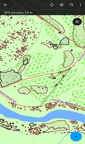
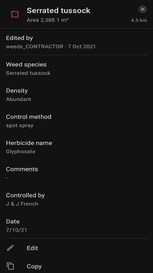
Since 2014, data has been collected annually, delivering two maps each financial year for both treated and not-treated invasive species. Control sites were added to the interactive map using polygons, and data is collected by completing a short survey. Survey fields included: weed species, DAFOR density (Dominant, Abundant, Frequent, Occasional and Rare) method for measuring species abundance), control methods in place, herbicides used and a free text field for comments. Using pick lists, domain values and later iNaturalist and Canberra Nature Map photo-point links means there is a consistent approach to data collection across the territory.
Field maps in action
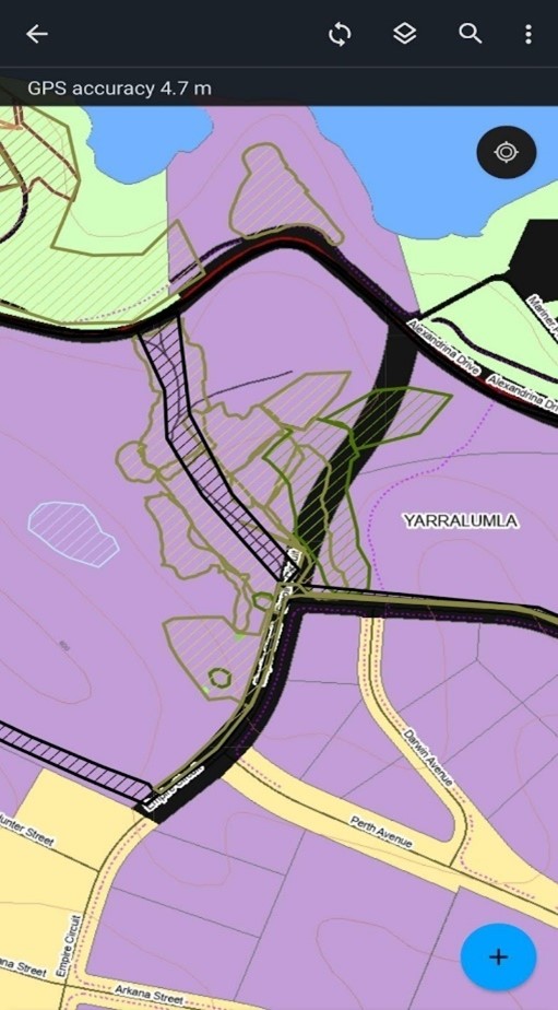
Area and density are measured using streamed polygons, allowing users to walk the area, rather than trying to accurately measure scale through their mobile device. Each streamed polygon had its own corresponding attributes page.

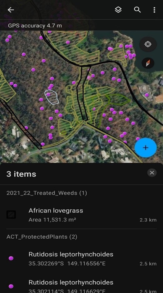
ACT Parks’ GIS team also created a detailed base map for the application featuring the names of all tracks and trails and incorporating land tenure data. When exploring the application, users can switch between the detailed parks base map and aerial imagery. The base map and aerial imagery layer are available both on and offline and are used in other areas, including ACT Parks Fire Management Unit.
Users can accumulate stored edits on their mobile device when working offline, which are later synced when in range. Online map edits are live – so updates are visible across the territory in real-time.


Keeping up with the latest tech
Early adoption of a new technology often comes with risk – but in this instance, persistence has paid dividends for ACT Parks. Across public land, all control work undertaken by staff and contractors is recorded each financial year on a shared map.
Other key benefits of adopting this system include:
- Coordination of control work across agencies
- Targeted control work in areas of high conservation value
- Tracking spread and control of early invaders to inform eradication and containment measures
- Use of invasion pressure gauges to indicate progress with control work and threat levels
- The ability to collate and analyse survey results and make data publicly available via the ACT Parks Operations Dashboard
The existing time series of control data from 2009 onwards has also been made available to the University of Canberra and CSIRO for research into control work thresholds. This data also informs funding briefs by demonstrating what ACT Parks can achieve when enabled with the latest GIS technology.
A framework for the future
Enabling consistent data collection has been essential to ACT Parks management of invasive plant species and research into control work thresholds. Having a real-time digital map layer serves as a single source of truth for land managers, contractors and volunteers as it ensures all control work is targeted and coordinated. By securing ACT Government land managers continued funding, adaptive species management can become a reality.
For more information on using ArcGIS Field Maps to manage invasive species, send an enquiry to speak with one of our specialists.

