Geographic Information System (GIS) technology is advanced crime analytics software that enables police, investigators and law enforcement to map and analyse crime data, enhance citizen engagement and improve field operations.

Integrated solutions for crime analysis
Leverage modern crime mapping software and spatial analysis tools to generate actionable insights, improve operations and make smarter, data-driven decisions.


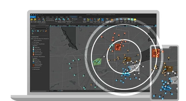
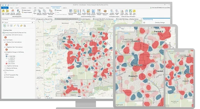
Analyse crime patterns
Leverage ArcGIS crime mapping solutions to support tactical, strategic, and investigative analysis, and make it easy to share and collaborate with web maps and apps.
Analyse crime data, identify crime types and hot spots, and help plan crime prevention initiatives.
Share dynamic information
Translate analysis into operationally useful information products. Create and share dynamic apps for self-service analysis and situational awareness in the field, and generate compelling crime reports with interactive maps.
Make data-driven decisions
Provide the right tools for all members of your agency. Everyone will be able to take advantage of maps and apps to inform decision-making.
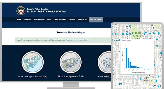
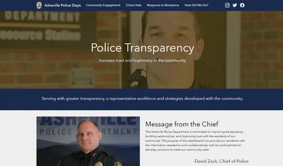
Open and transparent policing
Engage the community with useful maps, achieve transparent policing with open data and analysis, and work with citizens to reduce and prevent crime and public safety risks.


Create an open data portal
An ArcGIS Open Data portal provides a quick and easy way to start sharing data with the public. Decide which datasets you want to share – such as traffic stop data or public records – and enable them to update automatically on your public-facing website with easy-to-use tools.
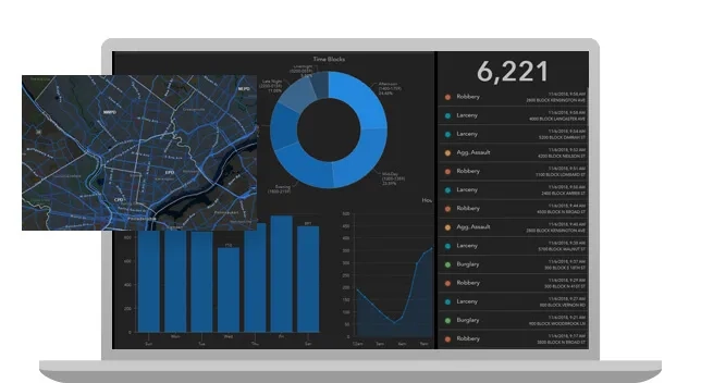
Enable open analysis
With public-facing dashboards, deliver open analysis tools that integrate maps with charts and widgets that encourage slicing, dicing, filtering, and querying of datasets. Encourage problem solving and understanding of policing strategies.
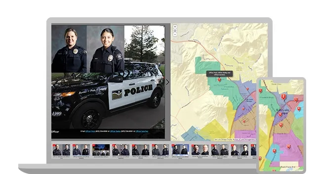
Connect with your citizens
Use ArcGIS StoryMaps to add context to data, communicate outreach efforts, enlist the public’s help, and brief members of the community on upcoming events or policing programs that may affect them.
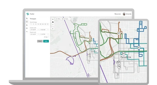
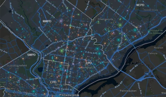
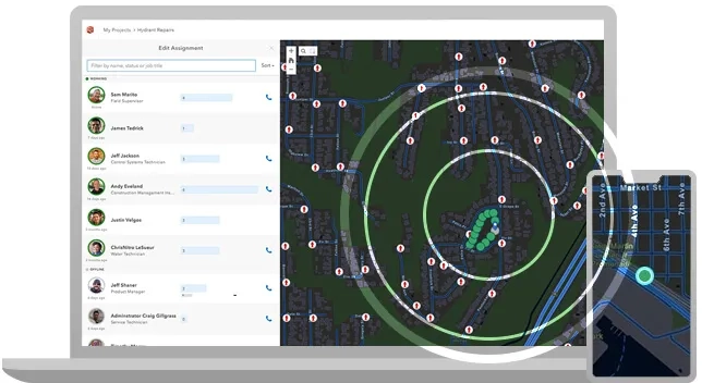
Field mobility for police operations
Explore mobile applications that enable operational awareness and support real-time location tracking, routing, and intelligence collection.
Enhance officer safety and coordination of efforts by command staff via live operational dashboards and support all in-the-field activities in connected or disconnected environments. Easy-to-use apps can be deployed in a secure environment behind your organisation’s firewall.


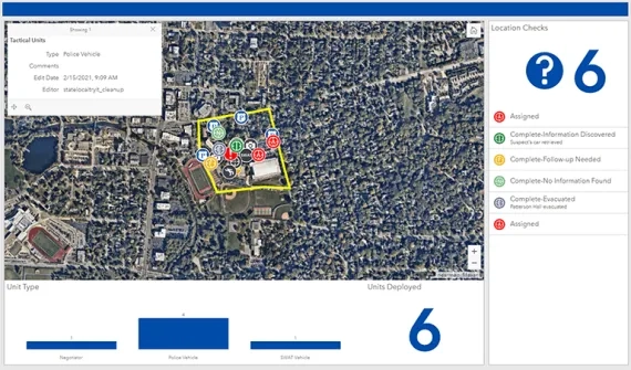
Build a comprehensive plan
Operational planning starts with an understanding of location and knowing when and where to deploy your resources. Leverage ArcGIS tools to enable officers in the field to work together to analyse, plan, and coordinate resources for the most effective response.
Bring spatial awareness to the street
Help officers gain greater situational awareness by putting geospatial intelligence at their fingertips. Share incident data, crime hot spots, enforcement zones, and any other data via up-to-date smart maps. Use your agency’s authoritative data and GPS location data to enable smart navigation and routing, even in disconnected environments. Capture intelligence in the field that immediately feeds into systems of record and can be shared with other officers and command staff in real time to inform decision-making.
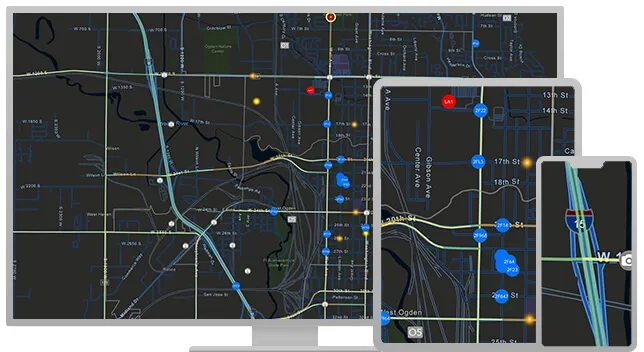
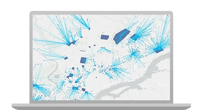
Share operations information in real time
Create dynamic dashboards that give command staff and line supervisors a real-time operational view of officer activities, physical assets, and events. Share updates with both internal and external stakeholders via secure web maps, and control access so personnel only see the information they need.