
ArcGIS Maps SDK enables developers to incorporate advanced mapping and geospatial capabilities into their applications across multiple devices.
Build interactive and visually stunning mapping applications and deliver immersive mapping experiences to your users.
Manage web-based interfaces for accessing GIS data.
Get started with ArcGIS Server Services REST APIs

Enable automation and scripting of complex geospatial workflows.
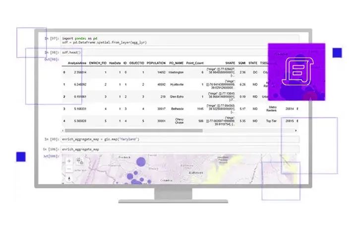
Discover ArcGIS API for Python
Build interactive mapping applications.
Install and set up ArcGIS Maps SDK
Share APIs with public for collaborative development.
Build web apps with open source mapping APIs
Discover Leaflet, a lightweight open-source plug-in