
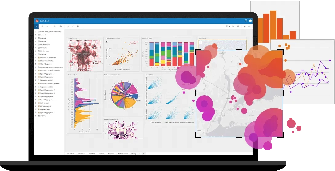
Explore data and perform spatial, statistical, predictive, and link analyses with this user type and enable analysts to fuse location analytics with open data science and business intelligence workflows.
Run the user type finder to determine which user type meets your requirements.
Capabilities

Perform exploratory, statistical, link and spatial analyses

Create maps and charts from spatial and tabular data

Directly connect to multiple data types and sources
Create, share, and run repeatable analysis models

Access authoritative data and expand your analysis
Included app
![]()
Combine location analytics with open data science and business intelligence workflows to unlock new insights.
Compare user types
| Insights Analyst | GIS Professional | Creator | |
|---|---|---|---|
| Perform exploratory, statistical, link, and spatial analyses in a drag-and-drop interface | ✓ | ||
| Create maps, charts, and tables from spatial and tabular data using ArcGIS Insights | ✓ | ||
| Directly connect to Python and R kernels | ✓ | ||
| Create, share, and run analysis models | ✓ | ✓ | |
| Analyse data to understand trends | ✓ | ✓ | ✓ |
| Combine 3D, CAD, imagery, and other data types on a single map | ✓ | ||
| Access authoritative data to accelerate your work and expand analysis | ✓ | ✓ | ✓ |
| Included ArcGIS Online credits | 1000 | 500 | 500 |