Austroads partners with Esri Australia to enhance geospatial capabilities, leveraging telematics data for smarter, more efficient road and transport management across Australia and New Zealand.
Austroads is advancing its geospatial capabilities to unlock smarter, data-driven solutions for road and transport management across Australia and New Zealand.
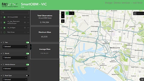
Key to this initiative is the telematics data collected by Transport Certification Australia (TCA), a business unit of Austroads. Through its Telematics Analytics Platform (TAP), TCA gathers and processes data from vehicles via a network of providers who deliver services to transport operators under the National Telematics Framework. This information is aggregated, de-identified, and presented via interactive geospatial dashboards, delivering valuable insights for a wide range of stakeholders.
Austroads is now elevating these capabilities through a partnership with Esri Australia, the country’s leading provider of GIS solutions and technology. Esri Australia specialises in GIS solutions that enable organisations to manage, analyse and visualise spatial data, across a wide range of sectors such as urban planning, environmental management, and infrastructure development. With Esri’s cutting-edge GIS technology, this partnership will optimise TAP’s geospatial performance, driving operational efficiency, improving decision making and facilitating deeper stakeholder engagement through more actionable insights.
“This collaboration has the potential to revolutionise data-driven decision making across Australian transport agencies, reinforcing our commitment to innovative solutions that improve the efficiency, productivity, and safety of our road networks,” said Matt Brunsdon, Austroads’ Chief Data & Technology Officer.
Shannon Smith from Esri Australia, added, “What excites us about this partnership is how it brings together diverse data sets to reveal trends that will directly drive smarter, more informed decisions in transport management. Our GIS solutions are all about delivering insights faster and more accurately, and with Austroads, we can take that capability to the next level.”
“This will allow us to deliver faster, more reliable geospatial insights through TAP”, said Matt. He explained that the telematics data TCA provides is used by transport agencies for a range of research and decision-making purposes, including the prioritisation of maintenance and capital investments. Local governments are also using this information to make better-informed heavy vehicle access decisions and respond to community concerns. These decisions are contributing to improved freight outcomes which are productive, safe and sustainable.
“These advanced geospatial capabilities will offer our stakeholders enhanced clarity on the use of road networks and contribute to further improvements in lifecycle management practices for road and bridge infrastructure, as well as informed asset investment decisions,” highlighted Matt.
A key outcome of the partnership will be the creation of a centralised geospatial platform, designed to empower stakeholders with interactive data-driven visualisations that reveal trends, patterns and insights in road and transit activity.
“Our goal is to provide intuitive, visual tools that empower better decision-making, streamline planning, and help create safer, more sustainable roads for everyone. Working with Austroads on this important initiative will have a meaningful impact on how transport management evolves,” Shannon said.
“With Esri’s expertise, we’re equipping transport agencies with tools to gain deeper insights and drive smarter, more effective decisions,” Matt added. “This initiative will directly contribute to better infrastructure planning, enhanced safety measures, and more sustainable transport management, creating tangible benefits for the entire community.”
If you would like more details or have any questions, please contact the communications team.