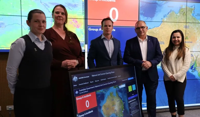
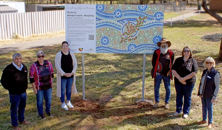
You are here News & Events News News Search news Search by year All2026202520242023202220212020201920182017201620152014201320122011 Tags - Any -#Cross River Rail3DAbout GISABSAECAFAC22AgileAgribusinessAgricultureAnalyticsApplication developmentAppsAppStudioArcGISArcGIS 10.5ArcGIS 10.6ArcGIS dashboardsArcGIS EnterpriseArcGIS Enterprise upgradeArcGIS HubArcGIS IndoorsArcGIS OnlineArcGIS ProArtificial intelligenceAsset managementAugmented realityAustralian Bureau of StatisticsAustralian bushfireAustralian GIS Hall of FameAutodeskBankingBIBig DataBig Data AnalyticsBIMBorder PatrolBrian BoulmayBusinessBusiness IntelligenceCadastreCalifornia CoastlineCitizen engagementClimate ChangeCloudCloud computingCloud GIScollaborationCollectorCommercialCommercial propertyCommunityConstructionContentCoronavirusCouncilCOVID-19COVID-19 vaccineCrisisCrowdsourcingDataData analyticsData transformationData visualisationData-driven decisionsDBYDDeep learningDefence and intelligenceDekhoDepartment of DefenceDesignDial Before you DigDigital transformationDigital twinDisability Servicesdisaster management Disaster resilienceDisruptive appsDNRMEdrone mapping DronesEarth observationsEducationeLearningElectionElectorateElectricElectricityEmergency managementEmergency responseEmergency servicesEnergyEnergy QueenslandEnergy, oil, gas and renewablesEngineeringEnterprise advantage programEnterprise GISENVIEnvironmental managementEnvironmental scienceEsriEsri AustraliaEsri Petroleum ConferenceEsri UCEsri Utility Network ModelEsri Young Scholar AwardEsri Young Scholars AwardEventsFederal governmentField data collectionFinancial institutionsFinancial servicesflood Food securityForestryForresterGasGDA2020GDA94Geo hubGeoAIGeoAnalyticsGeographic datumGeographic Information SystemsGeoscience AustraliaGeospatial AnalyticsGeospatial excellence awardGISGIS DayGIS for schoolsGIS Hall of Fame AwardsGIS managerGIS server softwareGIS ServicesGIS technologyGIS TrainingGIS web servicesGovernmentHealthHealth and human servicesHigher educationHomeland SecurityIcon WaterIDLImageryImpact AwardsIndoor navigationInfrastructureInnovationInsights for ArcGISInsuranceInsurance and BankingInteractive mapsInternet of ThingsInternshipInteroperabilityIoTJack DangermondJavaScriptLand AdministrationLand managementLaura DangermondLaw enforcementLive dataLive sensorsLocal governmentLocate22Location intelligenceLocation-based analyticsLogisticsMachine learningManaged servicesMapping and chartingMapsMarine scienceMaritimeMediaMicrosoft AzureMiningMining explorationMobileMobile applicationsMobile GISNational developmentNational SecurityNot for profitOH&SOilOpen dataOpen platformOperational awarenessOz MineralsOzriPartnershipPetroleumPlanningPlantationPortsPredictive analysisProductsPublic safetyPublic sectorPublic worksQueensland GlobeRaster dataReal-time analyticsRecoveryRemote sensingResilient communitiesResourcesRetailROISaaSSafe communitiesSAG AwardsSAPSAR ImagerySARscapeSatellite imagerySensorsServices overviewSituational awarenessSmart citiesSmart communitiessmart governmentSmart transportSmarterWXSolar eclipseSpatial data infrastructure solutionsSpeculative designStartupsState governmentStateStatStory mapsSupply chain managementSurvey123SustainabilitySustainable developmenttechnical debtTelcoTelecommunicationsTrainingTransformationTransportTransport analyticsTransport and InfrastructureTransportationTrimbleUIUnearthed ChallengeUnited NationsUniversitiesUnmanned Aerial VehiclesUrban analyticsUrban planningUser experienceUser interfaceUser researchUtilitiesUtility networkUXUXGVaccine distributionvegetation managementVirtual realityWaterWaterfallWeb GISWGS84White paperWHO ICEYE and Esri Australia partner to deliver unprecedented hazard intelligence ICEYE and Esri Australia partner to deliver real-time flood and bushfire intelligence as ready-to-use map layers within ArcGIS. This integration empowers organisations to act faster and with confidence during natural disasters. Learn more Sphere and Esri Australia partner to automate drone-to-cloud workflows Sphere and Esri Australia have entered a strategic partnership to integrate Site Scan for ArcGIS® with Sphere’s HubX and HubT systems, establishing a fully automated workflow, moving drone data seamlessly from capture to processing to delivery across industries in Australia. Learn more See Victoria in 3D Discover how Victoria’s Department of Transportation and Planning is using 3D web apps and spatial technology to streamline city planning, improve efficiency, and make better decisions. Learn more News Innovating efficient and green construction with GIS Discover how ACCIONA leverages ArcGIS online to transform engineering projects, cutting cost, boosting collaboration, and accelerating the shift to a low-carbon future. Learn more News Austroads and Esri Australia partner for smarter transport solutions Austroads partners with Esri Australia to enhance geospatial capabilities, leveraging telematics data for smarter, more efficient road and transport management across Australia and New Zealand. Learn more News Cutting-edge GIS applications celebrated gloablly Visionary GIS applications created by two innovative Australian companies were recognised at the 44th Esri User conference, highlighting their contribution to the engineering, design, construction and rail freight sectors. Learn more News Making the City of Sydney even cooler Increasing tree canopy and green cover to reduce the impacts of rising urban temperatures, with spatial analytics. Learn more News Spatial digital twin: Building the NSW smart state The NSW Spatial Digital Twin will provide transformative opportunities across the state’s entire development and infrastructure lifecycle. Learn more National Situation Room keeping Australians safe from crisis Learn more GIS ambassador recognised for contribution to STEM industries Learn more Celebrating innovation in GIS application Learn more Award-winning Queensland innovation showcased on world stage Learn more Student storyteller recognised on the world stage Learn more Re-awakening Indigenous place names in West Wyalong Learn more NextGen digital damage prevention Learn more AIHW wins global tech award for mapping vital mental health data Learn more Mapping croc sightings across north Queensland Learn more Critical technology infrastructure for COVID-19 vaccine distribution Learn more SA interactive map shares groundwater contamination data Learn more DBYD set to transform the telecom industry Learn more Load More
ICEYE and Esri Australia partner to deliver unprecedented hazard intelligence ICEYE and Esri Australia partner to deliver real-time flood and bushfire intelligence as ready-to-use map layers within ArcGIS. This integration empowers organisations to act faster and with confidence during natural disasters. Learn more
Sphere and Esri Australia partner to automate drone-to-cloud workflows Sphere and Esri Australia have entered a strategic partnership to integrate Site Scan for ArcGIS® with Sphere’s HubX and HubT systems, establishing a fully automated workflow, moving drone data seamlessly from capture to processing to delivery across industries in Australia. Learn more
See Victoria in 3D Discover how Victoria’s Department of Transportation and Planning is using 3D web apps and spatial technology to streamline city planning, improve efficiency, and make better decisions. Learn more
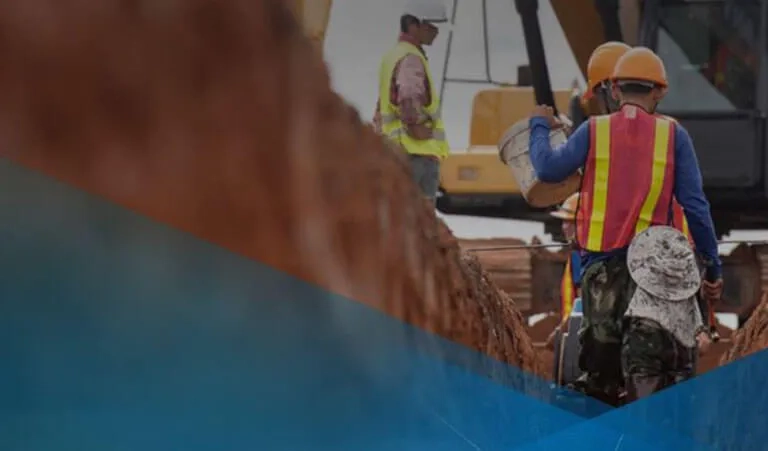
News Innovating efficient and green construction with GIS Discover how ACCIONA leverages ArcGIS online to transform engineering projects, cutting cost, boosting collaboration, and accelerating the shift to a low-carbon future. Learn more
News Austroads and Esri Australia partner for smarter transport solutions Austroads partners with Esri Australia to enhance geospatial capabilities, leveraging telematics data for smarter, more efficient road and transport management across Australia and New Zealand. Learn more
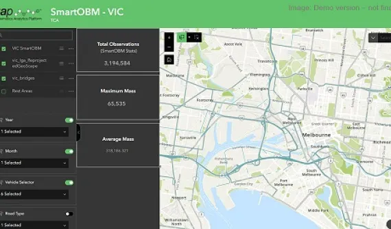
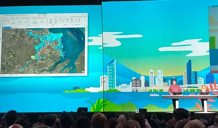
News Cutting-edge GIS applications celebrated gloablly Visionary GIS applications created by two innovative Australian companies were recognised at the 44th Esri User conference, highlighting their contribution to the engineering, design, construction and rail freight sectors. Learn more
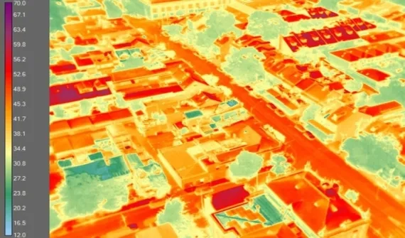
News Making the City of Sydney even cooler Increasing tree canopy and green cover to reduce the impacts of rising urban temperatures, with spatial analytics. Learn more
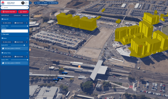
News Spatial digital twin: Building the NSW smart state The NSW Spatial Digital Twin will provide transformative opportunities across the state’s entire development and infrastructure lifecycle. Learn more