Without a spatial digital twin, there can be no smart cities, no smart regions and no smart states.
One of the largest spatial digital twins in the world, developed by the NSW Government, is continuing to evolve and contribute to a smarter, more sustainable future to enhance the lives of communities across the state.
The NSW Spatial Digital Twin (SDT), led by the Department of Customer Service’s (DCS) Spatial Services, is a cross-sector, collaborative digital workbench available to government, industry, academia and community, enabling the development of smart cities and driving improvements for the planning, design, and operation of assets and services.
With most of Western Sydney and the entire CBD of regional city Bathurst mapped and live, it’s already one of the largest spatial digital twins in the world.
At the heart of the NSW SDT is a shared data management and delivery platform based on the Esri ArcGIS Enterprise Portal, which provides access to NSW Government spatial data by deploying Spatial Services’ FSD (Foundation Spatial Data) 2D, 3D and 4D data sets and federating data catalogues across key NSW Government portal environments, like the SEED (Sharing and Enabling Environmental Data) Portal.
A foundation for a smarter future
Critically, the NSW SDT provides a foundation to accelerate the deployment and uptake of smart and connected technologies across the state.
Infrastructure NSW has identified the NSW SDT as an enabler of Smart Places and part of the future digital form of government. According to DCS Spatial Services, without a spatial digital twin, there can be no smart cities, no smart regions and no smart state.
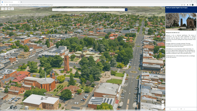
The Bathurst Spatial Digital Twin is a case in point.
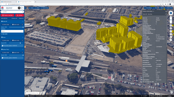
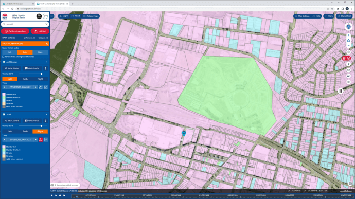
Bathurst was the first regional city to be included in the NSW Spatial Digital Twin as part of the Live NSW program, with the digital representation of the city enabling the visualisation of location-based information in 4D for four million square metres of the CBD.
This gives the council, planners and the community the ability to interact with data in a user-friendly place-based platform, and enables the deployment of ‘smart infrastructure,’ including Internet of Things (IoT) sensors, allowing access to real-time data that can be used, for example, to identify electric vehicle charging station locations.
The Bathurst SDT enables visualisation of past, present and future built and natural environments to assist the council, industry and the community to collaboratively realise Bathurst’s best potential as a smart and sustainable city.
Realising transformative opportunities
To date, the program has produced digital twin data for more than 19 local government areas across Greater Sydney and regional NSW.
As more data is integrated, the SDT will provide transformative opportunities for the NSW Government and local councils to realise benefits across the entire development and infrastructure lifecycle, and will deliver:
The ability to plan, build and operate development and infrastructure projects before anything is created physically.
Greater confidence and clarity in planning and delivery that will improve project performance and empower builders, infrastructure operators and policy makers.
Innovative approaches for public/private collaborations.
A wealth of data for analytics, resource planning and service delivery.
Optimised community engagement for infrastructure projects.
Reduced costs through automated compliance and approval processes.
Improved decision-making with data insights
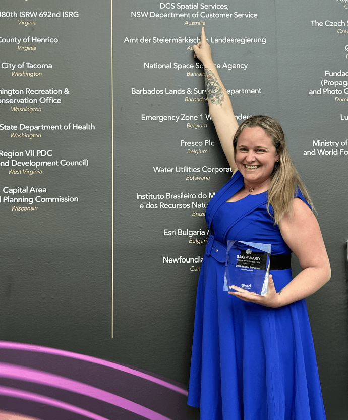
At the global user conference held in July 2023, Esri was proud to award DCS Spatial Services with a Special Achievement in GIS (SAG) award.
Speaking about the program, DCS Spatial Services Surveyor-General and Executive Director, Narelle Underwood, said the NSW SDT was enabling greater collaboration, improved planning and, ultimately, decision-making driven by data insights.
“DCS Spatial Services has created a more collaborative environment that shares and visualises location information updated in near real-time, with 4D models of the state to support improved decision making,” Mrs Underwood said.
“Thanks to its ability to connect different data types and systems, the NSW Spatial Digital Twin program is enabling more efficient planning, prioritisation and delivery of infrastructure, and ultimately improved community engagement.
“We believe this model sets a strong foundation to facilitate delivery of information and datasets from local, state and federal agencies to the community into the future.”
The NSW SDT is a leading example of the new approach to digital transformation and using data to build a smarter, more sustainable future. The technology is a vital enabler of change, assisting decision makers to explore new lines of investigation, and showcasing the power of collaboration, innovation, and data-driven decision-making.
This article was first published in the December 2023 edition of Position Magazine.
If you would like more details or to have any questions answered by the media team, contact Martin Volz, Senior PR and Communications Advisor.