Esri tech has been supporting the world's most progressive leaders for more than 50 years. Explore the pioneering solutions transforming governments, businesses and communities.
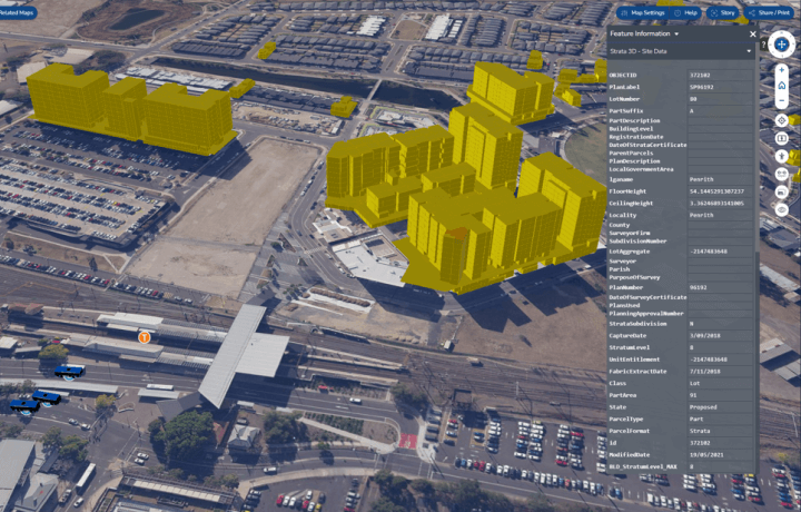
Building the NSW smart state
Spatial digital twin to provide transformative opportunities across the state's entire development and infrastructure lifecycle.

Big mine thinking Vol. 1
A quick guide to the top geo-smart applications supporting successful mineral exploration.