Leverage urban analytics to reveal a clear picture of community issues, real-time incidents, correlations and trends. Future-proof your city’s strategy by breaking down data silos and implementing collaborative, timely information-sharing workflows for data-driven decision-making.

Call 1800 870 750 or email a specialist to learn about the role GIS can play in building smarter communities.
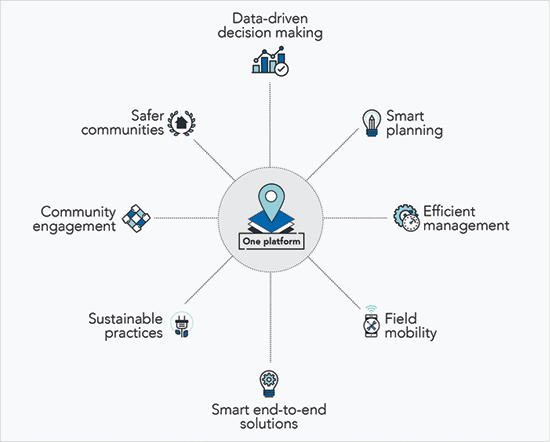
One platform for smart cities
The Esri Geographic Information System (GIS) platform provides local governments with the tools to develop smarter cities and deliver better services to the community.
As a collaborative platform, it enables government agencies to share spatial data to break through traditional data silos and build a more transparent organisation.
The Esri platform can be scaled to provide the tools for enterprise-wide data-driven decision making that improves management efficiency. Its mobility capabilities allow staff to access data any time, on any device, from anywhere to ensure enterprise data is always accurate and up-to-date.
With empowered collaboration and timely information sharing, your city can deliver smarter end-to-end solutions that create a more inclusive, sustainable and prosperous place to live.