You are here News & Events News News Search news Search by year All20242023202220212020201920182017201620152014201320122011 Tags - Any -#Cross River Rail3DAbout GISABSAECAFAC22AgileAgribusinessAgricultureAnalyticsApplication developmentAppsAppStudioArcGISArcGIS 10.5ArcGIS 10.6ArcGIS dashboardsArcGIS EnterpriseArcGIS HubArcGIS IndoorsArcGIS OnlineArcGIS ProArtificial intelligenceAsset managementAugmented realityAustralian Bureau of StatisticsAustralian bushfireAustralian GIS Hall of FameAutodeskBankingBIBig DataBig Data AnalyticsBIMBorder PatrolBrian BoulmayBusinessBusiness IntelligenceCadastreCalifornia CoastlineCitizen engagementClimate ChangeCloudCloud computingCloud GIScollaborationCollectorCommercialCommercial propertyCommunityConstructionContentCoronavirusCouncilCOVID-19COVID-19 vaccineCrisisCrowdsourcingDataData analyticsData transformationData visualisationData-driven decisionsDBYDDeep learningDefence and intelligenceDekhoDepartment of DefenceDesignDial Before you DigDigital transformationDigital twinDisability Servicesdisaster management Disaster resilienceDisruptive appsDNRMEdrone mapping DronesEarth observationsEducationeLearningElectionElectorateElectricElectricityEmergency managementEmergency responseEmergency servicesEnergyEnergy QueenslandEnergy, oil, gas and renewablesEngineeringEnterprise advantage programEnterprise GISENVIEnvironmental managementEnvironmental scienceEsriEsri AustraliaEsri Petroleum ConferenceEsri UCEsri Utility Network ModelEsri Young Scholar AwardEsri Young Scholars AwardEventsFederal governmentField data collectionFinancial institutionsFinancial servicesflood Food securityForestryForresterGasGDA2020GDA94Geo hubGeoAIGeoAnalyticsGeographic datumGeographic Information SystemsGeoscience AustraliaGeospatial AnalyticsGeospatial excellence awardGISGIS DayGIS for schoolsGIS Hall of Fame AwardsGIS managerGIS server softwareGIS ServicesGIS technologyGIS TrainingGIS web servicesGovernmentHealthHealth and human servicesHigher educationHomeland SecurityIcon WaterIDLImageryImpact AwardsIndoor navigationInfrastructureInnovationInsights for ArcGISInsuranceInsurance and BankingInteractive mapsInternet of ThingsInternshipInteroperabilityIoTJack DangermondJavaScriptLand AdministrationLand managementLaura DangermondLaw enforcementLive dataLive sensorsLocal governmentLocate22Location intelligenceLocation-based analyticsLogisticsMachine learningManaged servicesMapping and chartingMapsMarine scienceMaritimeMediaMicrosoft AzureMiningMining explorationMobileMobile applicationsMobile GISNational developmentNational SecurityNot for profitOH&SOilOpen dataOpen platformOperational awarenessOz MineralsOzriPartnershipPetroleumPlanningPlantationPortsPredictive analysisProductsPublic safetyPublic sectorPublic worksQueensland GlobeRaster dataReal-time analyticsRecoveryRemote sensingResilient communitiesResourcesRetailROISaaSSafe communitiesSAG AwardsSAPSAR ImagerySARscapeSatellite imagerySensorsServices overviewSituational awarenessSmart citiesSmart communitiessmart governmentSmart transportSmarterWXSolar eclipseSpatial data infrastructure solutionsSpeculative designStartupsState governmentStateStatStory mapsSupply chain managementSurvey123SustainabilitySustainable developmenttechnical debtTelcoTelecommunicationsTrainingTransformationTransportTransport analyticsTransport and InfrastructureTransportationTrimbleUIUnearthed ChallengeUnited NationsUniversitiesUnmanned Aerial VehiclesUrban analyticsUrban planningUser experienceUser interfaceUser researchUtilitiesUtility networkUXUXGVaccine distributionvegetation managementVirtual realityWaterWaterfallWeb GISWhite paperWHO Esri supports SAP HANA platform A global announcement by SAP and Esri enhances performance and scalability by integrating enterprise and geospatial data into core business processes. Learn more Esri founders' donation preserves coastal habitat Jack and Laura Dangermond's record private donation to The Nature Conservancy has permanently protected nearly 25,000 acres of ecologically and historically important coastal habitat. Learn more Students fight traffic congestion with ArcGIS Year 12 geography students surveyed parent drivers and mapped pick up congestion hot spots, as part of Esri Australia's $100 million GIS for Schools program. Learn more Mount Agung Real-time Monitoring Map keeps public informed As Mount Agung continues to erupt, the real-time monitoring map informs the public and assists with disaster response planning. Learn more News Yes or No? ABS Maps Marriage Law Survey Results Integrating the data from 12.7 million survey responses the ABS displayed the results in a simple map, presenting states, territories, and federal electoral divisions' Yes/No responses and participation rates. Learn more Esri and Autodesk partnership: GIS and BIM A new partnership will seamlessly integrate BIM design tools and GIS mapping technology to enable more sustainable and resilient infrastructure. Learn more Smarter Planning Perth wins Spatial Excellence Award Cutting-edge spatial technology public works platform takes out Spatial Enablement Award. Learn more News Australia's most high-tech response to natural disaster Ergon Energy used a world-first web-GIS incident management system to coordinate recovery efforts during Tropical Cyclone Debbie. Learn more Crowdsourcing bushfire apps could save lives Learn more iWORCS coordinates capital works across NSW Learn more MH370 search unlocks insights with advanced mapping of deep oceans Learn more Real-time security centres help monitor major events Learn more Esri cited in Gartner LI software report Learn more Adelaide poised to be Australia's smartest city Learn more Perth set for smart infrastructure future Learn more Innovation key to smart cities says US expert A single, innovative technology can help Australia cut crime rates, improve healthcare and transform environmental management, a visiting 2016 US presidential candidate and global authority on smart cities has declared. Learn more Esri partners with Waze to give governments open data A partnership has been announced between Waze - the popular free crowdsourced traffic and navigation app - and Esri, designed to help governments of any size develop intelligent transportation systems. Learn more Esri earns top ranking in latest Forrester research report In a new report by influential research and advisory firm Forrester, Esri has been recognised for setting a global standard in GIS technology, with consistent and constant innovation. Learn more Australian utility sets global technology benchmark Learn more Smart mapping stamps out climate change sour grapes One of the world's largest wine makers has armed itself with cutting-edge smart mapping technology to help fight the effects of climate change and safeguard the production of its celebrated wines. Learn more Load More
Esri supports SAP HANA platform A global announcement by SAP and Esri enhances performance and scalability by integrating enterprise and geospatial data into core business processes. Learn more
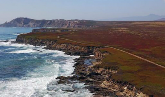
Esri founders' donation preserves coastal habitat Jack and Laura Dangermond's record private donation to The Nature Conservancy has permanently protected nearly 25,000 acres of ecologically and historically important coastal habitat. Learn more
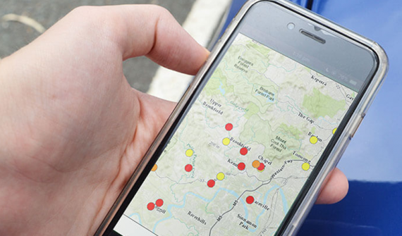
Students fight traffic congestion with ArcGIS Year 12 geography students surveyed parent drivers and mapped pick up congestion hot spots, as part of Esri Australia's $100 million GIS for Schools program. Learn more
Mount Agung Real-time Monitoring Map keeps public informed As Mount Agung continues to erupt, the real-time monitoring map informs the public and assists with disaster response planning. Learn more
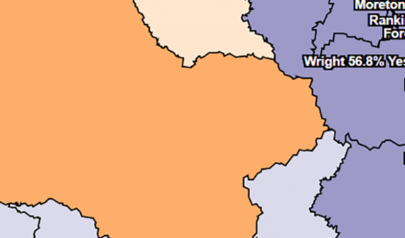
News Yes or No? ABS Maps Marriage Law Survey Results Integrating the data from 12.7 million survey responses the ABS displayed the results in a simple map, presenting states, territories, and federal electoral divisions' Yes/No responses and participation rates. Learn more
Esri and Autodesk partnership: GIS and BIM A new partnership will seamlessly integrate BIM design tools and GIS mapping technology to enable more sustainable and resilient infrastructure. Learn more
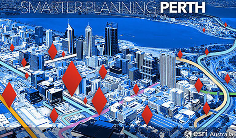
Smarter Planning Perth wins Spatial Excellence Award Cutting-edge spatial technology public works platform takes out Spatial Enablement Award. Learn more
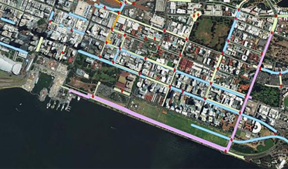
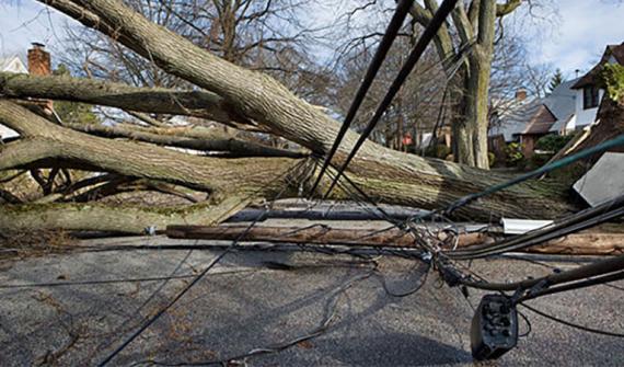
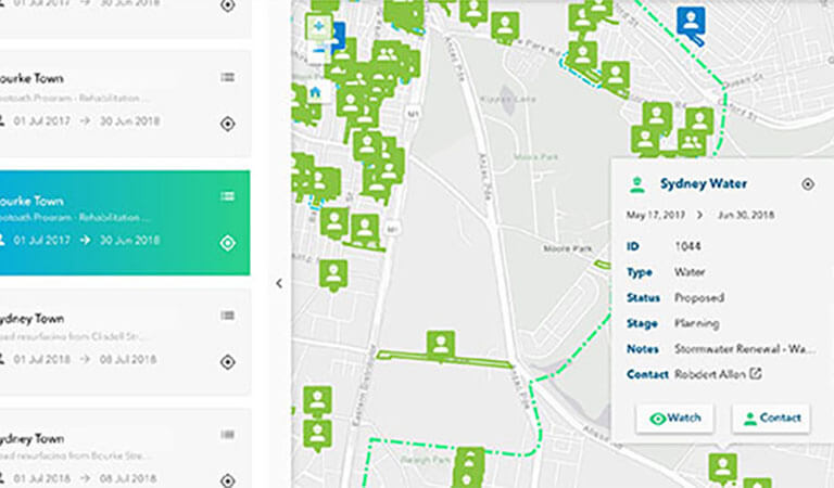
News Australia's most high-tech response to natural disaster Ergon Energy used a world-first web-GIS incident management system to coordinate recovery efforts during Tropical Cyclone Debbie. Learn more
Innovation key to smart cities says US expert A single, innovative technology can help Australia cut crime rates, improve healthcare and transform environmental management, a visiting 2016 US presidential candidate and global authority on smart cities has declared. Learn more
Esri partners with Waze to give governments open data A partnership has been announced between Waze - the popular free crowdsourced traffic and navigation app - and Esri, designed to help governments of any size develop intelligent transportation systems. Learn more
Esri earns top ranking in latest Forrester research report In a new report by influential research and advisory firm Forrester, Esri has been recognised for setting a global standard in GIS technology, with consistent and constant innovation. Learn more
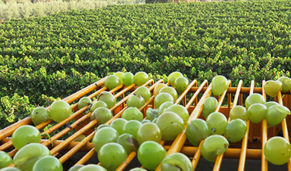
Smart mapping stamps out climate change sour grapes One of the world's largest wine makers has armed itself with cutting-edge smart mapping technology to help fight the effects of climate change and safeguard the production of its celebrated wines. Learn more