Geospatial heavyweight and global leader in spatial analytics, Esri, has announced the acquisition of location data extraction technology from ClearTerra, a leader in geospatial and activity-based intelligence tools.
This acquisition will provide ArcGIS platform users the ability to easily discover and extract geographic data from unstructured textual data like emails, briefings, and reports, instantly generating intelligent map-based information.
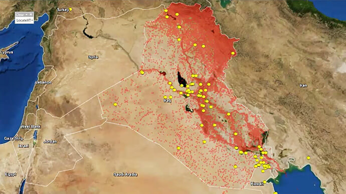
This capability will make mapping this elusive information easier across many industries. Defence, intelligence, and public safety organisations tend to have massive volumes of unstructured data, as do other fields such as petroleum, utilities, and maritime, where locating information on the earth is not as easy as searching for a street address. Esri’s acquisition of ClearTerra technology brings workflow-enhancing software technologies into the ArcGIS platform.
“We have been close partners with Esri for a number of years,” said Jeff Wilson, former vice president of sales for ClearTerra, now an executive for defence and intelligence with Esri.
“Esri has the platform and resources to provide a solid path going forward for our technology, allowing us to expand this capability to the global market” he said
ClearTerra LocateXT technology allows analysts to rapidly scan through documents without having to spend hours reading, copying, pasting, and running spreadsheet formulas, placing the results instantly into geospatial features. Additionally, ClearTerra FindFZ technology provides enhanced search capabilities for the ArcGIS platform, incorporating the powerful techniques found in internet search engines, including a tolerance for misspelled words, as well as wildcard and Boolean logic searches.
“We are excited to bring ClearTerra technology into the Esri stack,” said David Eastman, Esri Australia’s national security industry specialist.
“The unstructured data tools are powerful not only for those who have made use of this technology for a number of years, such as in the military, but also have useful applications for so many more Esri users.”
“ClearTerra supports the notion of GEOINT as a Platform through automatically extracting and exposing geospatial content in any machine readable files which reduces the workload on the analyst” he said.
ClearTerra has been an active member of the Esri partner program, providing their software to ArcGIS users via desktop, server, and the cloud. Support and maintenance for the software will continue via Esri with no interruption of service and is readily available for licensing.
For more information on ClearTerra and how its technology can further enhance your ArcGIS workflow, enquire here.
If you would like to connect with our public relations team, submit a media enquiry.