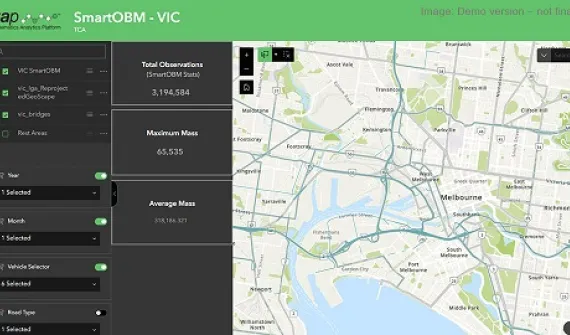
GIS for Transport and Infrastructure
Australia’s leading transport and logistics professionals leverage GIS as an important tool for managing, planning, evaluating, and maintaining the nation’s transportation systems and infrastructure.
GIS technology delivers insight that far surpasses the capabilities of traditional analysis in the transport sector. To be able to overlay information geographically – and literally map out potential opportunities – provides a perspective on the present situation and a window into the future that few other tools can.
From modelling future travel demand and analysing the annual capital improvement plans, to identifying noise regulation violations around airports – discover how GIS is transforming the transport, infrastructure and logistics sectors in the below case studies.
Hanson and HeidlebergCement
GIS is helping Hanson and HeidlebergCement save hundreds of thousands of dollars and shortening project delivery periods from 18 months to as little as just three months.
VicRoads
GIS empowered VicRoads to deliver a safer driver experience across its entire 53,000 kilometre road network.
Thiess John Holland
GIS delivered an 80% time saving in the collation and location of information to Thiess John Holland staff working on Melbourne’s EastLink project.
Perth Airport
Perth Airport is flying high after becoming Australia’s first airport to introduce an enterprise-wide GIS.